Solutions
By Company Size
Enterprise
Teams
Solo Professionals
By Industry
Mining & Resources
Construction
Utilities
Power Distributors
Facilities & Maintenance
Government
Consulting
Insurance
Drone Services
By Use Case
Centrally Manage Data
Make Maps for Anything
Inspect Assets, Buildings and Infrastructure
Scale Operations with Geospatial Data
Manage Reports & Records
Need Something Else?
GeoAI
Features
Pricing
Resources
Blog
Case Studies
Help Articles
Login
Book a Demo
The Birdi Blog
Our articles, tips & updates delivered straight to your inbox.
Why does geospatial data become siloed?
Geospatial in Practice
June 29, 2026
How to reconcile stockpile volumes: A step-by-step guide for mine and quarry operators
Geospatial in Practice
June 23, 2026
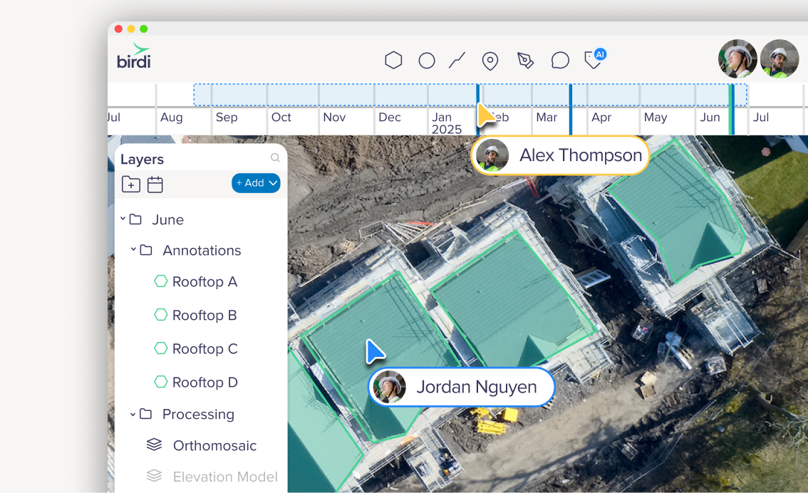
How to manage construction site data across teams
Geospatial in Practice
June 22, 2026
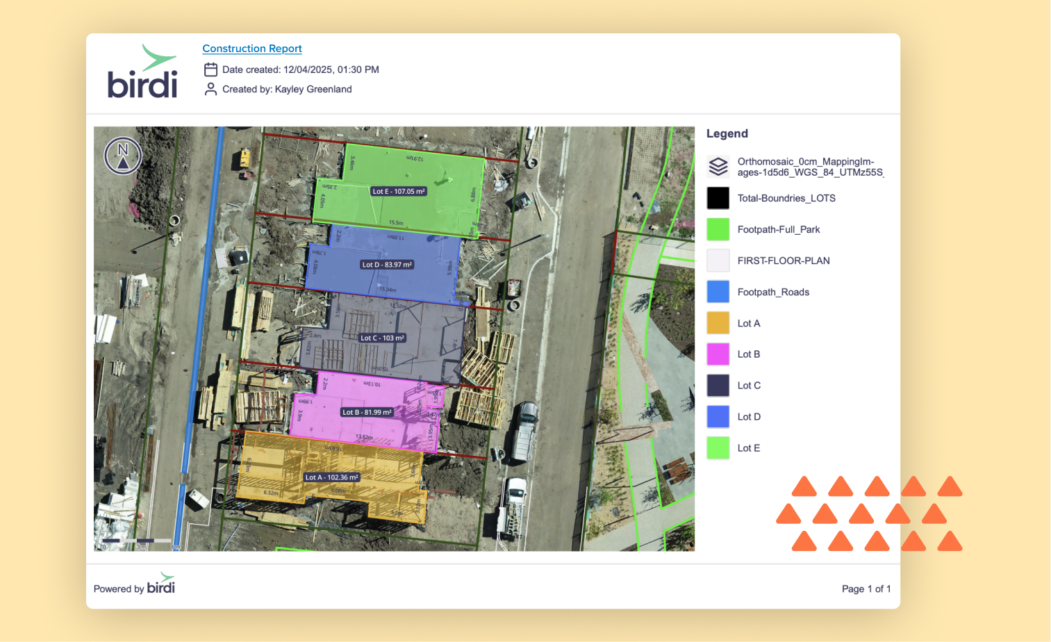
How to create construction progress reports using drone surveys
Geospatial in Practice
June 18, 2026
How drones are transforming construction progress reporting
Geospatial in Practice
June 10, 2026
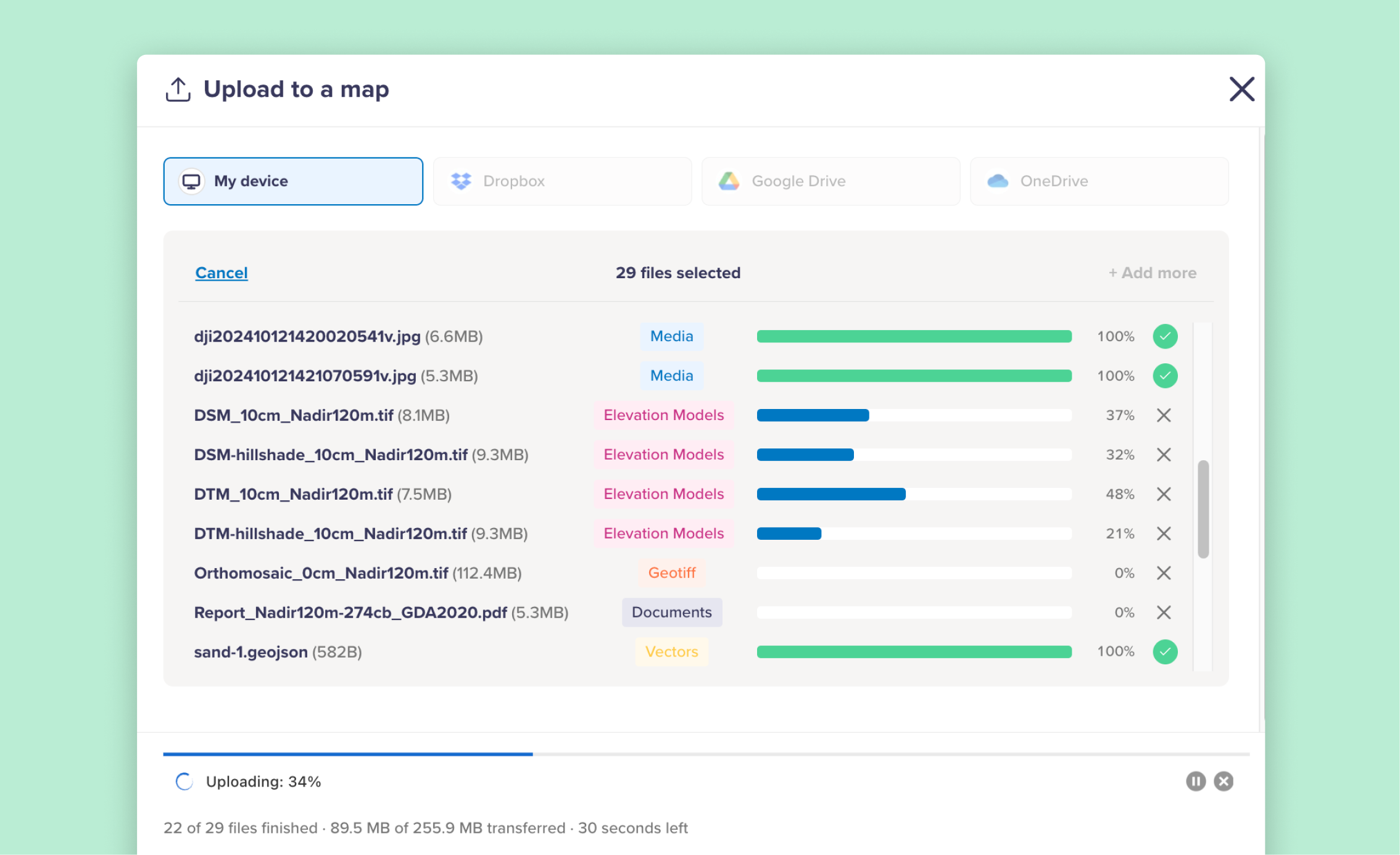
Birdi’s file uploader just got a major upgrade
Product & Inside Birdi
May 27, 2026
How to choose the best geospatial software for construction teams
Guides
May 22, 2026
Featured Posts
How drones are transforming construction progress reporting
Drone mapping 101: A beginner’s guide to capturing accurate geospatial data
7 geospatial trends shaping operations management in 2026
Getting started with GIS: A beginner's guide to geographic information systems
Categories
Case Studies
Geospatial in Practice
Guides
Product & Inside Birdi
Subscribe to get our best content in your inbox
Tips and resources
Delivered every month
No spam, ever
Browse Categories
Geospatial in Practice
View all
Geospatial in Practice
Why does geospatial data become siloed?
Geospatial in Practice
How to reconcile stockpile volumes: A step-by-step guide for mine and quarry operators
Geospatial in Practice
How to manage construction site data across teams
Guides
View all
Guides
How to choose the best geospatial software for construction teams
Guides
Top drone mapping platforms in 2026
Guides
The future of collaborative mapping software
Product & Inside Birdi
View all
Product & Inside Birdi
Birdi’s file uploader just got a major upgrade
Product & Inside Birdi
Major performance improvements for large maps and vectors
Product & Inside Birdi
A new way to see your work: inside Birdi’s redesigned dashboard
Case Studies
View all
Case Studies
Birdi helps Richard Crookes Constructions transform fragmented site data into clear, trackable progress
Case Studies
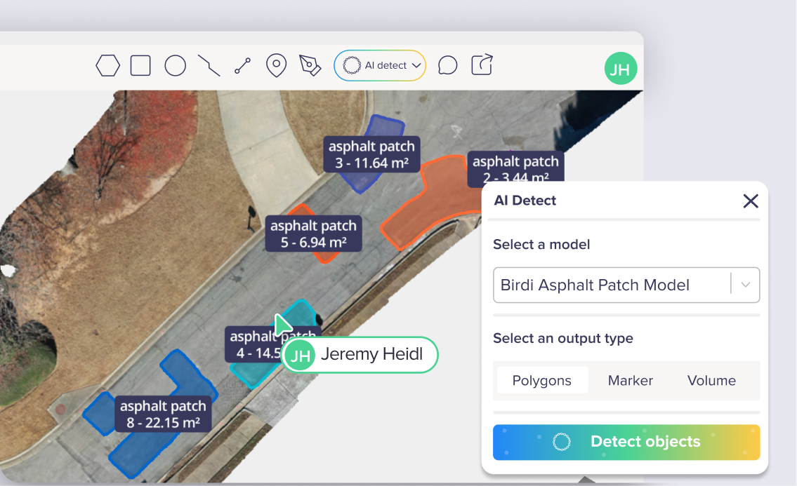
How Sunbelt Asphalt saved 250 hours moving from handwritten audits to AI-assisted asphalt detection
Case Studies
How Blue Nose Aerial Imaging delivers drone mapping insights across 45+ U.S. franchises


.png)


.png)