
.png)
Where your geospatial data and team come together
Trusted by top teams
.png)
.png)


Geospatial collaboration made easy for every team
Work together — without the extra tools
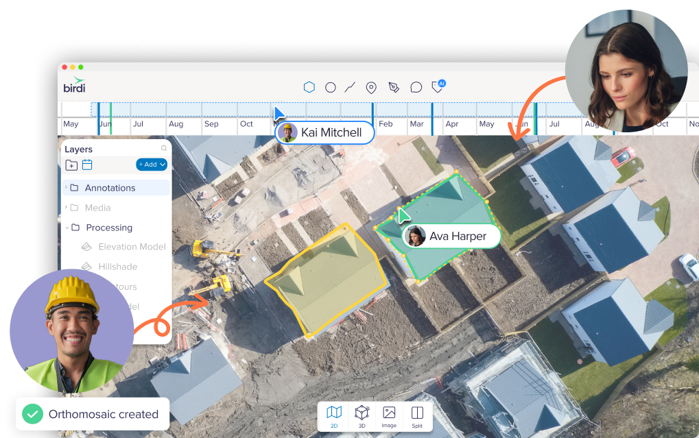
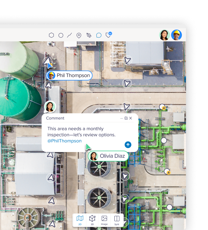
When your whole team can contribute in one place, work moves faster. Birdi lets project managers, engineers, and operations teams collaborate naturally, without needing specialist software.

Smarter tools that bring your data and people together
From AI-powered image segmentation to automated reporting, Birdi shortens the path from raw imagery to ready-to-share insight — helping your team see, label, and act on what matters, faster.

.png)
Keep your spatial data and your team on the same page
Spatial data shouldn’t sit in tools only a few specialists can use. Birdi puts everything in one collaborative workspace, making it easier for teams to review, process, and act on the same up-to-date information.
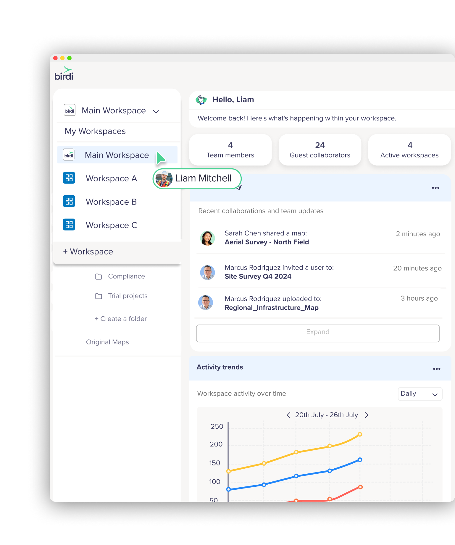
Tools that scale with your team
As your projects grow, Birdi helps you stay on top of it all — without needing to add more systems or processes.
Case studies
See how teams are using Birdi to simplify geospatial workflows, bring teams together, and turn data into decisions.


Senior Associate

Large educational provider

Senior Associate