
TL;DR: The best GIS software for non-technical users in 2026 includes Birdi, Felt, Maptitude, Google My Maps, and Esri's ArcGIS Online, each trading off differently between ease of use, collaboration, data depth, and cost. None require Python scripting or a GIS degree to get a usable map, but they differ sharply in how far you can go before you hit a wall.
Key takeaways
- The global GIS software market was valued at roughly USD 12.35 billion in 2026 and is projected to reach USD 21.98 billion by 2030, growing at a 15.5% CAGR, according to market research aggregated by multiple industry analysts.
- Desktop GIS still dominates overall software use, holding roughly 60.6% of the market as of 2023, but that share is increasingly split between technical desktop tools (QGIS, ArcGIS Pro) and simpler cloud platforms built for everyone else.
- Pricing for non-technical-friendly GIS spans free (Google My Maps) to roughly $795 a year (Maptitude) to custom enterprise quotes (Birdi, Felt, ArcGIS Online), so cost alone doesn't predict ease of use.
- The real dividing line isn't price, it's whether the platform assumes you already know GIS concepts like coordinate systems and shapefile structure, or whether it's designed to hide that complexity by default.
- Google My Maps is genuinely free and easy but caps out at 2,000 places and 10,000 lines or shapes per map, which rules it out fast for any organization managing real operational data.
What actually makes GIS software "non-technical"?
Non-technical GIS software simplifies the concepts a trained GIS analyst takes for granted, coordinate reference systems, file format conversions, topology rules, so a first-time user can upload data, see it on a map, and share it without training. It typically trades some analytical depth for a guided, visual workflow.
That's a real trade-off. A platform like QGIS or ArcGIS Pro gives a trained analyst granular control over spatial joins, raster algebra, and custom coordinate transformations, but that same depth is exactly what overwhelms a project manager or facilities coordinator who just needs to see where things are and share that view with a team. Non-technical GIS software deliberately narrows the toolset to the 20% of functions that cover 80% of real business use: uploading data, viewing it on a map, measuring or annotating it, and sharing the result.
This article focuses on that narrower category: platforms built so a non-GIS-specialist can go from raw location data to a shareable map without a training course. It's a different shopping list than "best GIS software" broadly, which would also weigh in dedicated desktop analysis tools built for GIS professionals.
Why is demand for non-technical GIS software growing?
Demand is growing because spatial data is now generated by ordinary business tools, drones, mobile field apps, CRM location fields, faster than the pool of trained GIS specialists can process it. Organizations increasingly need frontline staff, not just GIS teams, to read and act on that data directly.
The global GIS software market was worth roughly USD 12.35 billion in 2026 and is projected to reach USD 21.98 billion by 2030, a 15.5% compound annual growth rate, according to market sizing aggregated across several industry research firms. Much of that growth is coming from outside traditional GIS departments: construction site managers reviewing drone-captured progress maps, sales teams territory-planning without a dedicated analyst, and utilities staff checking asset locations in the field. Mobile GIS use in particular is expected to grow faster than any other segment, reflecting the shift toward on-the-go, non-desk-bound users who were never going to learn ArcGIS Pro or Python scripting in the first place.
Low-code and no-code approaches to mapping aren't new inside GIS software (most desktop GIS tools have always had some drag-and-drop features), but the difference in 2026 is that entire platforms are now built cloud-first and non-technical-first from the ground up, rather than bolting a simplified mode onto a professional analyst tool.
What should non-technical buyers look for in GIS software?
Three things matter more than feature count. First, the onboarding path: can someone upload a shapefile or drone-captured file and see a usable map within minutes, without reading documentation. Second, collaboration: can a non-technical stakeholder comment on, share, or view a map without GIS training. Third, the ceiling: what happens when the data volume or complexity grows past what the free or entry tier can handle.
That third point catches teams out most often. A platform that's effortless with 50 points of data can become unusable at 5,000 if it wasn't built with real data volumes in mind, which is exactly what happens with consumer tools like Google My Maps once an organization tries to use them for something more than a one-off project.
The best GIS software for non-technical users in 2026
Each platform below can get a first-time user from raw data to a shareable map without GIS training. The differences are in collaboration depth, data ceiling, and how far each one lets you go before you need to bring in a specialist.
1. Birdi
Best for: Construction, mining, utilities, and facilities teams that need technical and non-technical staff working from the same map, without hiring a dedicated GIS analyst.
Typical customer: Mid-size to large construction and civil contractors, including Richard Crookes Constructions, Clark Construction, Merit Construction Group, Baseline, and Mirvac, alongside mining, utilities, and facilities management teams.
Key strengths:
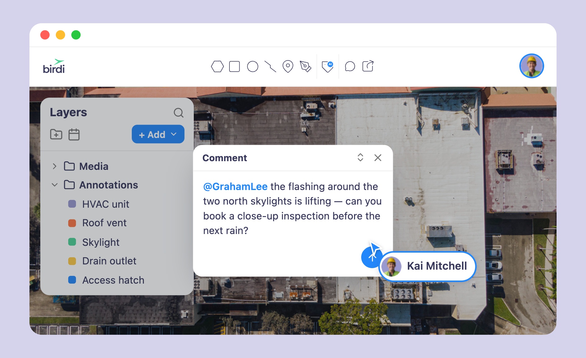
- Built so technical and non-technical users work from the same shared map, with comments, an activity feed, and email notifications keeping non-specialists in the loop
- Ingests drone imagery, GeoTIFFs, shapefiles, KML, DXF, GeoJSON, and 3D data, and processes raw imagery into orthomosaics, DEMs, point clouds, and meshes in a few clicks
- Public, no-login map sharing across multiple branded workspaces, useful for teams sharing site views with clients or subcontractors who don't have accounts
Scope note: Birdi is positioned as the collaborative middle layer between advanced platforms like ArcGIS or QGIS and the rest of a team, rather than a replacement for those tools' deep desktop analysis features.
Watch-outs: Teams that need advanced spatial analysis (custom raster algebra, complex geoprocessing models) will still need a specialist tool like ArcGIS Pro or QGIS alongside Birdi.
Pricing: Growth plan from $287 a month, billed annually; Ultimate tier by custom quote.
2. Felt
Best for: Teams that want a fast, modern, AI-assisted interface for building interactive maps and dashboards without technical GIS training.
Typical customer: Enterprise and mid-market teams across research, government, and operations functions building shareable web maps and dashboards for internal or public audiences.
Key strengths:
- AI-assisted map creation lets users describe what they want in plain language rather than configuring layers manually
- Clean, modern interface designed to feel closer to a design tool than a traditional GIS application
- Free plan available with no credit card required, useful for testing before committing to a paid tier
Scope note: Felt's core strength is web map creation and visualization; it isn't built as a drone or field-data processing platform the way Birdi is.
Watch-outs: Felt is largely sales-gated above the free tier. Reported pricing lands around $200 to $250 a month for a small team, with Team and Enterprise plans routed through a custom sales quote rather than published self-serve pricing.
Pricing: Free plan available; Team and Enterprise pricing by custom quote (reported around $200 to $250 a month for small teams).
3. Maptitude
Best for: Sales, logistics, and demographic-planning teams that want an affordable, desktop-first mapping tool with built-in business data.
Typical customer: Small to mid-size businesses doing territory planning, route optimization, or demographic analysis without a dedicated GIS department.
Key strengths:
- Comes bundled with a free GIS data package, including demographic and boundary data, reducing setup time for common business mapping tasks
- Offers a one-time, non-subscription license option in addition to annual subscriptions, appealing to buyers who want to avoid recurring fees
- Purpose-built features for territory design, route optimization, and sales mapping rather than generic GIS tools repurposed for business use
Scope note: Maptitude is a desktop-first mapping tool with an online companion; it's built for business mapping and analysis rather than field data collection, drone imagery processing, or multi-team spatial collaboration.
Watch-outs: The desktop version requires installing and maintaining local software, and the online subscription tier is more limited in functionality than the desktop product, so teams should check which tier actually covers their use case before buying.
Pricing: Subscriptions from $795 a year; Online subscription from $420 per user per year; 10-year non-subscription license from $1,095; Enterprise from $9,995 for 10 users.
4. Google My Maps
Best for: Individuals or very small teams making a single, simple map for a one-off project, at zero cost.
Typical customer: Solo users, small nonprofits, event organizers, or anyone mapping a small, static dataset who doesn't need ongoing collaboration or scale.
Key strengths:
- Completely free with no paid tier, account limits, or sales process
- Familiar Google Maps interface means genuinely zero learning curve for most users
- Easy to embed or share a finished map link with anyone, technical or not
Scope note: My Maps is a lightweight annotation layer on top of Google's own map tiles, not a GIS platform in the fuller sense; it has no data processing, no custom base layers, and no real collaboration or version control features.
Watch-outs: Hard caps of 2,000 places and 10,000 lines or shapes per map, only Google map tiles as a base layer with no custom branding, and support limited to community forums make it a poor fit for any team managing real operational data at scale.
Pricing: Free.
5. Esri ArcGIS Online
Best for: Organizations that want an accessible entry point into the broader Esri ecosystem, without immediately needing ArcGIS Pro's full desktop analysis toolkit.
Typical customer: Government agencies, universities, and enterprises that already use or plan to adopt Esri's wider platform, looking for a lighter-weight way to bring non-specialist staff into that same environment.
Key strengths:
- Browser-based, so non-technical staff can view and interact with maps without installing desktop software
- Deep library of ready-made templates (StoryMaps, dashboards, web apps) that lower the bar for building a shareable map
- Sits inside the same ecosystem as ArcGIS Pro, so data and maps move cleanly to a specialist tool when a team's needs grow
Scope note: ArcGIS Online is Esri's cloud entry point, but it's still built around GIS concepts (layers, feature services, coordinate systems) more explicitly than Birdi, Felt, or Google My Maps, so non-technical users typically need more onboarding than with a purpose-built simple-mapping tool.
Watch-outs: Esri doesn't publish full organizational pricing; a single Creator user license runs around $500 a year, but most real deployments require a custom quote, and the platform assumes more GIS literacy than tools built exclusively for non-specialists.
Pricing: Individual Creator license from around $500 a year; organizational and enterprise pricing by custom quote.
What about QGIS and ArcGIS Pro?
QGIS and ArcGIS Pro are the two dominant professional desktop GIS platforms, and both are genuinely powerful, QGIS is free and open-source, while ArcGIS Pro is Esri's flagship desktop analysis tool. Both can technically be used by a beginner for basic mapping tasks, and QGIS in particular has made real strides in approachability. But both are built first for GIS professionals doing spatial analysis, cartography, and geoprocessing, with concepts like coordinate reference systems, topology, and raster algebra sitting close to the surface rather than hidden away.
For a non-technical buyer specifically looking for the least-friction path to a usable map, either tool is a heavier commitment than the platforms above. They belong on a different shopping list: "best GIS software for GIS professionals," not "best GIS software for non-technical users." Teams that already have a QGIS or ArcGIS Pro user in-house often pair that specialist tool with a simpler platform like Birdi or Felt so the rest of the team can view and collaborate on the specialist's output without learning the professional tool itself.
How do you choose the right non-technical GIS software?
Start with who's actually going to open the software day to day. If it's a single person mapping a small, static dataset, Google My Maps costs nothing and asks nothing of the user. If it's a cross-functional team that needs technical and non-technical staff collaborating on the same operational map, especially one involving drone imagery, site progress, or field data, Birdi or Felt are built for that collaboration from the start.
Second, check the data ceiling before committing, not after. A tool that feels effortless in a demo with a handful of points can hit real limits fast once actual field data volume shows up, as happens with Google My Maps' hard caps.
Third, decide honestly whether this software needs to replace a specialist tool or simply extend one. Teams that already have QGIS or ArcGIS Pro in-house usually aren't looking for a replacement, they're looking for a way to bring the rest of the organization into the same spatial picture without training everyone on the specialist tool, which is exactly the gap Birdi and similar collaborative platforms are built to close.
Frequently asked questions
What is the easiest GIS software for beginners?
Google My Maps is the easiest starting point for a single, simple map since it uses the familiar Google Maps interface and is free with no setup. For teams needing more collaboration or real operational data volume, Birdi and Felt offer a similarly low learning curve with far more headroom.
Is QGIS good for non-technical users?
QGIS is free and has become more approachable over time, and a beginner can learn basic mapping tasks in it. But it's still built primarily for GIS professionals doing spatial analysis, and concepts like coordinate systems and geoprocessing sit closer to the surface than in tools purpose-built for non-technical users.
Can non-technical staff use ArcGIS Online?
Yes, ArcGIS Online is browser-based and includes templates like StoryMaps and dashboards that lower the barrier to entry. It still assumes more familiarity with GIS concepts such as layers and feature services than a tool built exclusively for non-specialists, so most organizations budget for some onboarding time.
How much does non-technical GIS software cost?
Costs range from free (Google My Maps) to around $795 a year (Maptitude) to subscription platforms like Birdi (from $287 a month) and Felt (reported around $200 to $250 a month for small teams), with enterprise deployments across most platforms priced through a custom quote.
What's the difference between GIS software for non-technical users and professional GIS software?
Non-technical GIS software wraps concepts like coordinate systems and topology into a guided, visual workflow, trading some analytical depth for accessibility. Professional GIS software like QGIS or ArcGIS Pro exposes that full depth for trained analysts doing spatial analysis, cartography, and geoprocessing.
Sources
- Market research aggregated across GIS software market reports. "Geographic Information System (GIS) Software Market Size, Share, Growth & Industry Forecast 2026-2035." 2026. https://www.globalgrowthinsights.com/market-reports/geographic-information-system-gis-software-market-100652
- Felt. "The 7 Top GIS Software Compared." 2026. https://felt.com/blog/the-7-top-gis-software-compared
- Caliper Corporation. "Maptitude Pricing and Ordering." 2026. https://www.caliper.com/maptpric.htm
- Esri. "ArcGIS Online Pricing & Licensing Options." 2026. https://www.esri.com/en-us/arcgis/products/arcgis-online/buy
- Studycountry. "What are the limitations of Google My Maps?" 2026. https://www.studycountry.com/wiki/what-are-the-limitations-of-google-my-maps
- Birdi. "Can GIS software be used without GIS training?" 2026. https://www.birdi.io/blog-post/can-gis-software-be-used-without-gis-training
- GIS Geography. "13 Free GIS Software Options: Map the World in Open Source." 2026. https://gisgeography.com/free-gis-software/
