
Birdi helps Richard Crookes Constructions transform fragmented site data into clear, trackable progress

Challenge
Since 1976, Richard Crookes Constructions (RCC) has delivered some of the most iconic and important places in Australia. With more than 1,370 projects completed, they operate across over 40 active project sites.
Before Birdi, RCC leveraged drone imagery and site photos to monitor site progress, improve team coordination and uplift stakeholder communication.
Birdi was engaged by RCC to structure and amalgamate this site data. Our solution made it easy for stakeholders to visualize progress, review site conditions and share updates while removing reliance on constant site visits.
Solution
Birdi has been implemented as a central platform at RCC’s sites in NSW and Victoria, to manage site capture data, visualize project progress and share updates across teams.
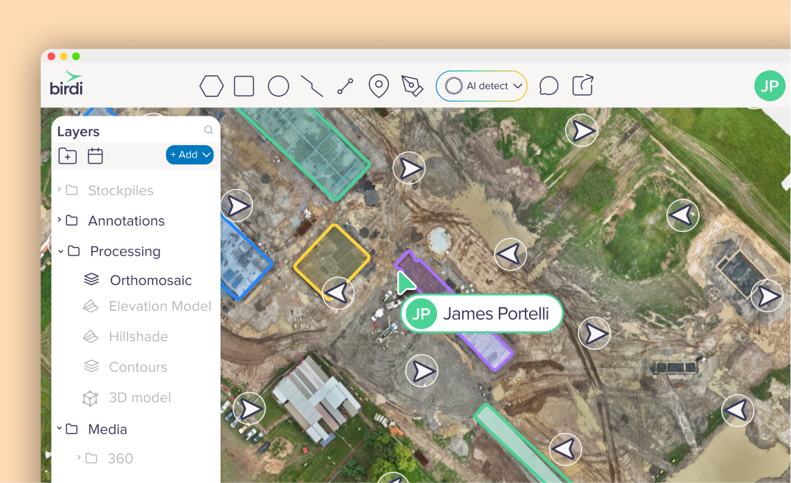
Drone imagery and site photos are uploaded into Birdi and processed into interactive map and model outputs. These outputs provide a consistent visual foundation for reviewing site conditions and tracking progress over time.
Using Birdi, the team can:
- Process drone imagery into high-resolution orthomosaic 2D maps
- Generate 3D models to visualize site conditions and structures
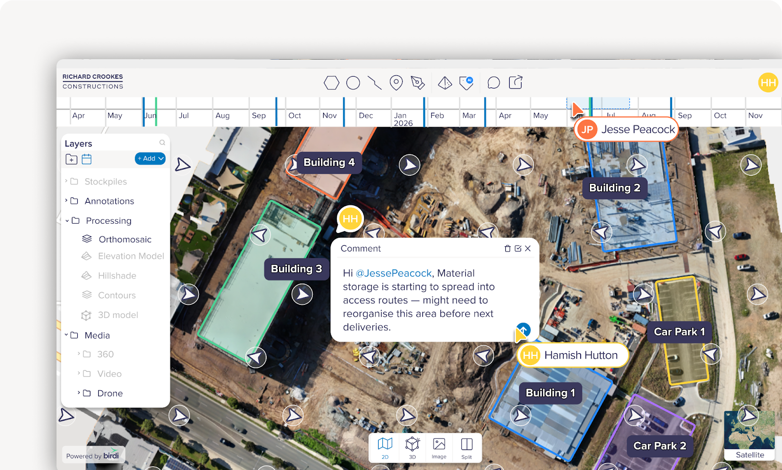
- Capture and organize weekly site data within a visual timeline
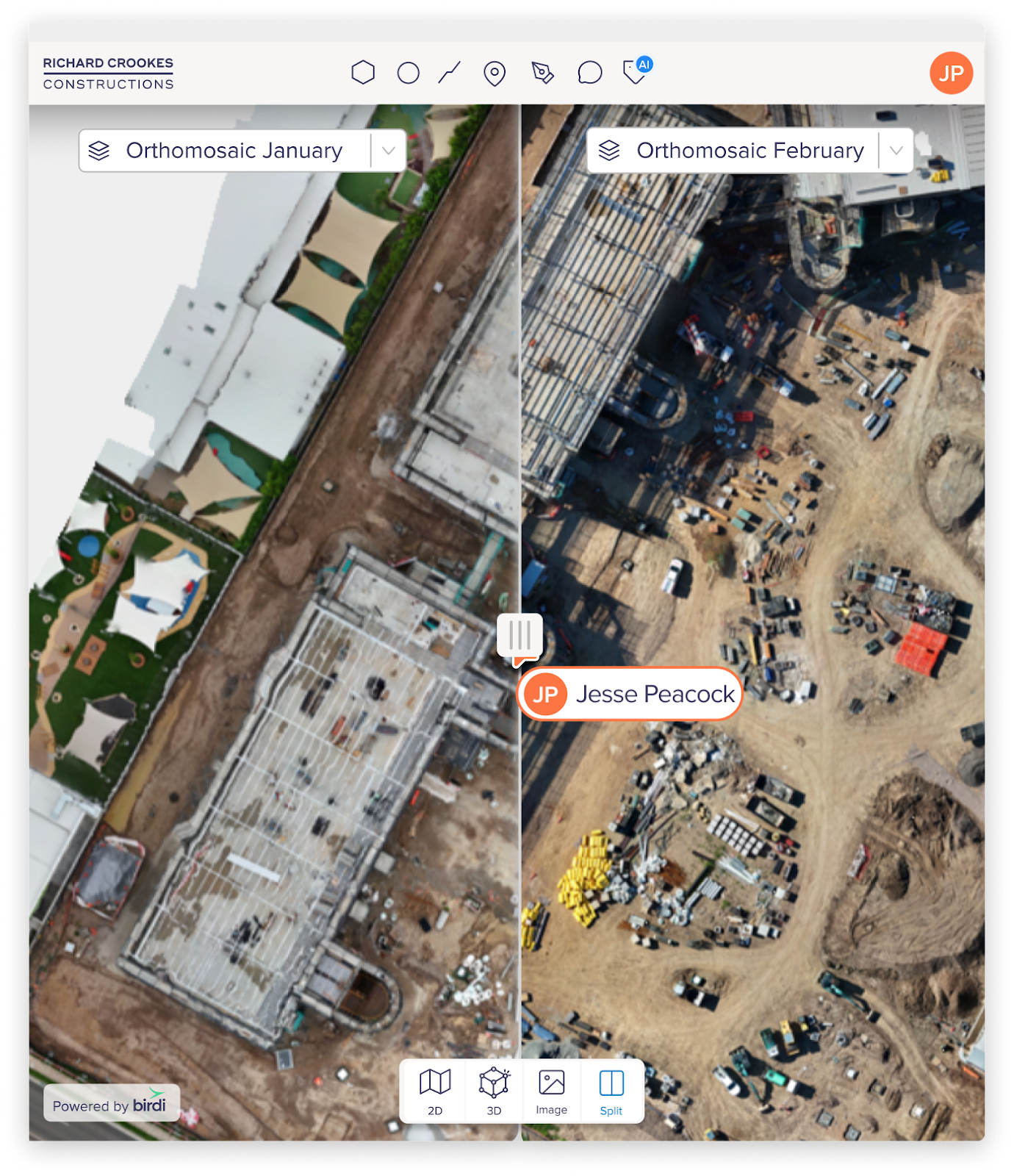
- Compare different capture dates using split-screen views
- Upload and manage both drone and ground-based imagery
- Share interactive maps and models via simple links
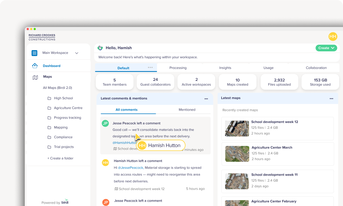
- Centralize all project data within a single workspace
Teams now work from a single environment where all site data is organized and accessible. This shared workspace stores imagery, models and timelines – making it easier for project teams and stakeholders to stay aligned.
Richard Crookes Constructions’ workflow with Birdi
Capturing site progress
RCC conducts regular drone flights across project sites, capturing aerial imagery that reflects current site conditions and progress.
These captures are performed on a weekly basis, creating a consistent record of how each project evolves over time. In addition to drone data, ground-based photos can also be uploaded to provide additional context where needed.
All imagery is uploaded into Birdi, where it is processed into map and model outputs that accurately represent the site.
Visualizing progress over time
Each site capture is stored within Birdi as part of a timeline, allowing teams to review how a project progresses from one week to the next.
Instead of relying on memory or static reports, teams can step through each capture chronologically and see changes unfold visually across the site.
Using split-screen comparison tools, teams can view two different dates side by side. This makes it easier to identify progress, track completed work, and spot any changes or issues that may need attention.
Reviewing site conditions and inspections
With processed maps and 3D models available in Birdi, teams can review site conditions remotely without needing to be physically on-site.
Structures, assets and areas of interest can be inspected directly within the platform, reducing the need to coordinate site visits for routine reviews.
Because all data is centralized, teams no longer need to switch between folders or tools to find the latest imagery. Everyone works from the same up-to-date project view.
Sharing updates with stakeholders
Birdi allows RCC to share project views with stakeholders through simple, view-only links.
Instead of sending files or organizing site visits, teams can provide access to interactive maps and models that clearly show current site conditions and progress.
This makes it easier for clients and stakeholders to understand what is happening on-site and stay aligned throughout the project lifecycle.
Results and benefits
Birdi enables large construction companies managing concurrent, complex projects to consistently capture and review progress – with significant operational impact.
Progress can be reviewed visually and compared over time, reducing the reliance on manual interpretation or fragmented data sources. Inspection workflows are faster, and teams can access the information they need without delay.
Stakeholders gain a clearer understanding of site conditions without needing to visit in person, and project teams spend less time coordinating updates across multiple tools.
All site data now lives within a shared workspace, where imagery, models and timelines are accessible to the entire team. Instead of information being spread across folders and files, everyone works from the same visual record of the project.
Over time, as more captures are added, RCC also builds a historical view of each site — allowing teams to look back, compare stages and track how projects progress from early works through to completion.
With Birdi, the team can move from fragmented site documentation to a clear, visual and measurable record of progress across their construction projects.