
How Sunbelt Asphalt saved 250 hours moving from handwritten audits to AI-assisted asphalt detection

Challenge
Sunbelt Asphalt delivers large-scale road maintenance programs for public infrastructure clients in the United States, including a county project spanning approximately 183 miles of roadway.
Maintaining roads at this scale requires constant inspection, patching and resurfacing work. Prior to Birdi, this process was time consuming and manual: County engineers would inspect the road network and mark repair areas with spray paint, indicating where asphalt patches were needed. Sunbelt crews would then follow behind to complete material audits via handwritten notes — estimating how much asphalt was required for each section of work.
These audits played a critical role in daily operations. The quantities determined crew planning, truck allocation, material ordering and billing. But the process relied heavily on manual interpretation and the results were often inconsistent. This made planning reactive rather than predictable.
Documentation was also fragmented. Estimates, photos and notes were spread across field sheets, folders and spreadsheets, making it difficult to review or validate quantities later.
Sunbelt had experimented with camera-based systems before, but those tools only captured imagery. They did not provide measurable outputs or a single, shared workspace where their entire team could access and visualize the data. There was no reliable way to scale patch areas, generate polygon measurements or aggregate quantities across hundreds of road segments.
With a road network covering more than 183 miles, Sunbelt needed a more structured and efficient way to turn inspection data into measurable, defensible quantities that operations and engineering teams could rely on.
Solution
Sunbelt had already begun using drones to capture overhead imagery of the road network, creating up-to-date aerial views of each road segment. What they needed next was a platform that could turn that imagery into measurable insights and make the data easy to share across teams.
Using Birdi, Sunbelt built a structured workflow that transforms drone imagery into measurable patch data and shareable project maps.
Drone imagery is uploaded into Birdi and processed into high-resolution orthomosaic maps. These maps provide a clear overhead view of each road segment and create a consistent foundation for inspection and measurement. From there, teams can measure asphalt patch areas, generate reports and share project views with engineers, planners and stakeholders.
Instead of relying on handwritten sheets, Sunbelt can now produce clear, measurement outputs backed by map-based data, within a single workspace accessible by their entire team.
With Birdi, the team can:
• Process drone imagery into orthomosaic map outputs
• Measure asphalt patch areas accurately using polygon tools
• Aggregate quantities across multiple road segments
• Export measurement reports for planning and billing
• Share view-only project maps with stakeholders
• Generate branded PDF and PNG map outputs
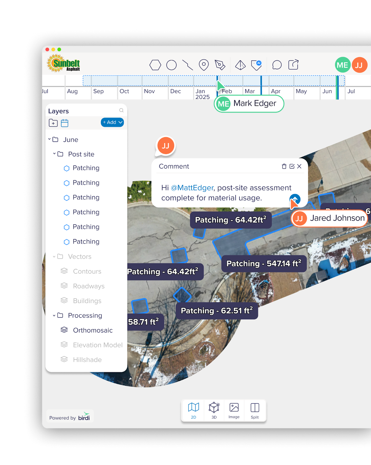
• Compare imagery across project stages such as pre-work, during work and post-work
With Birdi, Sunbelt now has a shared environment where imagery, measurements and reporting all live together, enabling field teams and project managers to work from the same source of truth.
Sunbelt’s workflow with Birdi
Capturing road corridor imagery
Sunbelt captures aerial imagery across the county road network using drones. These flights provide a consistent overhead view of each road segment and capture the current condition of asphalt surfaces along the corridor.
The imagery is uploaded and processed in Birdi, creating 2D orthomosaic maps that accurately represent the roadway at scale. These maps form the foundation for inspection, measurement and analysis across the entire road program.
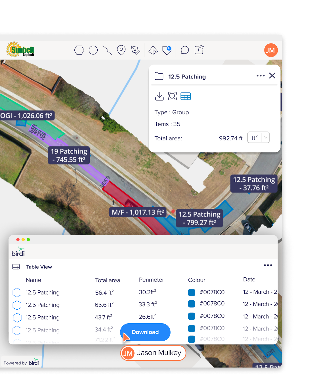
Measuring asphalt patches
Newly placed asphalt creates a strong visual contrast compared to older road surfaces, making repair areas easy to identify within drone imagery.
Using Birdi’s measurement tools, the team outlines patch areas as polygons directly on the map. Because each polygon represents the exact shape of the repair area, the platform can automatically calculate patch sizes accurately and aggregate quantities across multiple road segments.
Instead of estimating tonnage from handwritten notes, teams can work from measured surface areas derived directly from aerial imagery.
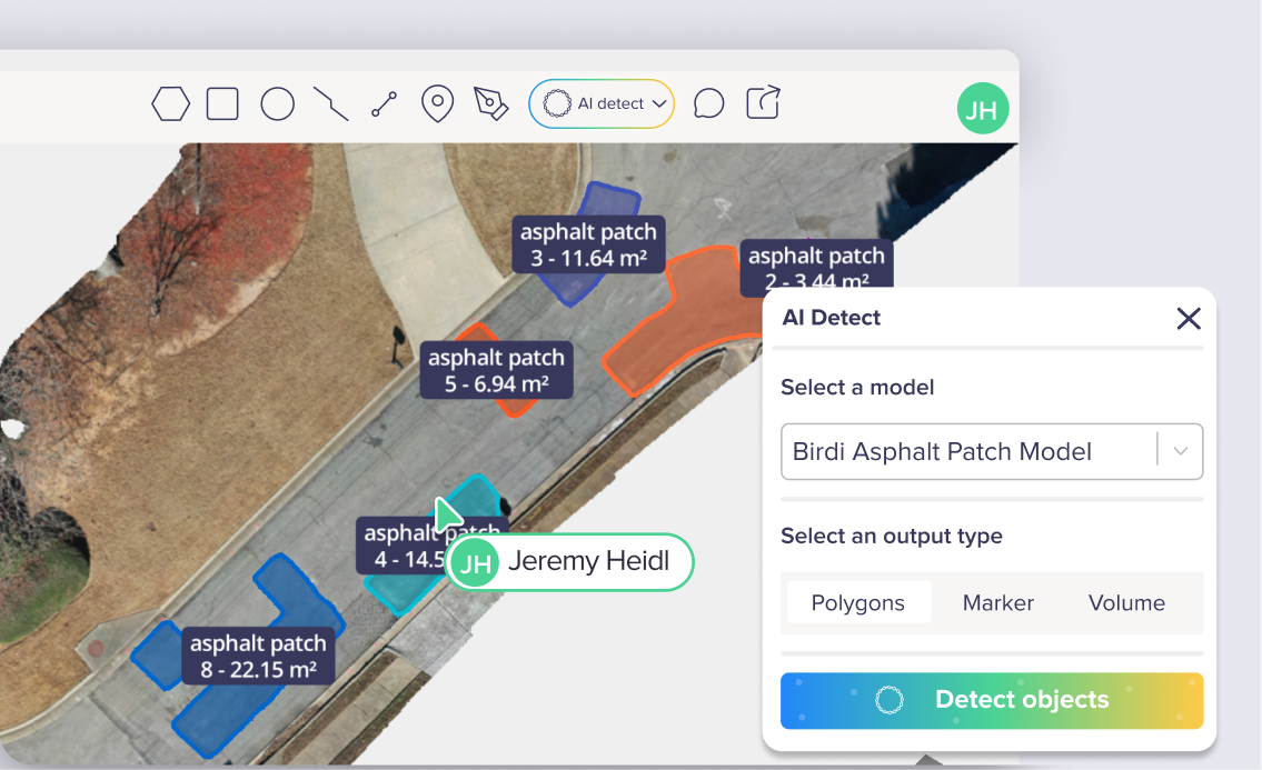
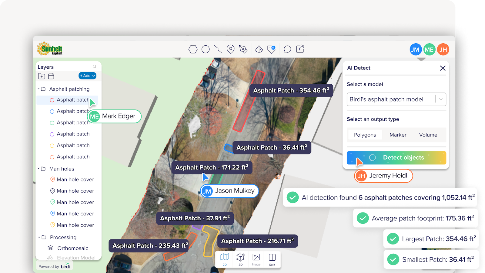
AI-assisted patch detection
As part of the project, Birdi developed an asphalt GeoAI model to assist with automated detection of newly placed asphalt patches. Fresh asphalt creates strong visual contrast and consistent shapes within the imagery, making it well-suited for segmentation-based detection.
Rather than manually drawing annotations around asphalt patches on their orthomosaics, Birdi’s GeoAI asphalt model detects asphalt patches within the image and automatically generates labelled polygons around each patch. These polygons contain area and perimeter measurements of each patch, enabling Sunbelt to generate accurate reports as part of their audit workflows.
The goal of the AI asphalt model is to:
• Identify newly placed asphalt patches
• Assist with audit calculations
• Highlight areas that may have been missed during manual review
• Create a repeatable workflow across future road programs
AI does not replace engineering judgment. Instead, it supports teams by surfacing potential patch areas for review and confirmation.
Results and benefits
For a road program covering approximately 183 miles of roadway and nearly 1000 segments, the ability to generate measurable quantities quickly has a significant operational impact. Replacing handwritten audits with AI-assisted segmentation and polygon measurements can reduce audit time by an estimated 250 hours for each full pass of the network.
But the biggest benefit is predictability.
Material quantities can now be aggregated across segments in minutes rather than days. Planning teams gain earlier visibility into expected asphalt tonnage. Field crews operate with clearer expectations. Billing documentation can reference measurable map data rather than handwritten estimates.
All project data now lives in a shared workspace within Birdi, where imagery, measurements and reports are accessible to the entire team. Instead of information being spread across field notes, images and spreadsheets, everyone works from the same project maps and datasets.
Because each flight and dataset is stored within the platform, Sunbelt also builds a historical record of the road network over time. Teams can review previous captures, compare conditions across project stages and track how work progresses across the corridor.
Over time, as more imagery is captured and analyzed, the AI model continues to improve, helping create a repeatable workflow that can support future road maintenance programs.
With Birdi, the Sunbelt team now works from a shared, measurable record of their road program — turning inspections, measurements and historical data into a clear operational picture across 183 miles of roadway.