
What are the best photogrammetry and orthomosaic platforms in 2026?

TL;DR: The best photogrammetry and orthomosaic software in 2026 spans Birdi, Pix4D, Agisoft Metashape, DroneDeploy, and OpenDroneMap/WebODM, trading off between cloud simplicity, desktop processing control, price, and how much in-house technical expertise a team already has. You'll also see this category called "orthophoto software," which is worth a quick note since it's a related but slightly narrower term.
Key takeaways
- The global photogrammetry software market was valued at USD 1,940.3 million in 2026, up from USD 1,689.5 million in 2025, and is projected to reach USD 6,740.5 million by 2035 at a CAGR of 14.84%, according to Global Growth Insights.
- Over 70% of construction and mining projects relied on drones for aerial data collection as of 2023, according to the same report, making photogrammetry the default method for turning that imagery into usable maps.
- Pricing spans a wide range: free and open-source (OpenDroneMap/WebODM) up to roughly $8,480 a year for combined desktop and cloud tools (Pix4D), with one-time desktop licenses like Agisoft Metashape Professional at $3,499 sitting in between.
- The right platform depends heavily on in-house technical skill: teams with a dedicated photogrammetry or GIS specialist get more value from desktop-grade control (Pix4D, Metashape), while non-technical field and operations teams do better with a cloud-first, collaborative platform (Birdi, DroneDeploy).
- "Orthophoto software" and "orthomosaic software" are often used interchangeably in search, but technically describe different outputs of the same photogrammetry process.
What's the difference between photogrammetry, orthophoto, and orthomosaic software?
Photogrammetry is the underlying process: extracting accurate measurements and 3D geometry from overlapping photographs. An orthophoto is a single image that's been corrected for lens distortion, tilt, and terrain relief so it has a uniform scale, while an orthomosaic is the larger, seamless map created by stitching many orthophotos together into one continuous, measurable image.
In practice, the terms get used loosely, and that's fine: whether you call it orthophoto software, orthomosaic software, or photogrammetry software, you're looking for the same thing, a platform that turns drone or aerial imagery into a georeferenced, measurable map. This article uses "photogrammetry and orthomosaic software" throughout since it's the more accurate description of what these platforms actually do, and notes it when a specific vendor uses "orthophoto" instead.
Every platform in this list produces orthomosaics as a core output; the differences are in how the underlying photogrammetry gets processed (cloud versus desktop), how much control a user has over that process, and who the platform is built for.
Why does drone-based photogrammetry keep growing?
The global photogrammetry software market was valued at USD 1,940.3 million in 2026 and is projected to reach USD 6,740.5 million by 2035, a CAGR of 14.84%, according to Global Growth Insights. Construction and infrastructure applications account for roughly 35% of overall demand, the single largest application segment tracked in the same report.
Three things are driving that growth. First, drones themselves have gotten cheaper and easier to fly, so capturing overlapping aerial imagery no longer requires a dedicated survey crew. Second, over 70% of construction and mining projects were already using drones for aerial data collection as of 2023, per Global Growth Insights, which means the imagery exists; the bottleneck has shifted to processing it into something a project manager or site engineer can actually use. Third, cloud processing has matured enough that nearly 40% of photogrammetry software users had migrated to cloud-based platforms by 2023, removing the need for an expensive GPU workstation to get a usable orthomosaic.
What should you look for in photogrammetry and orthomosaic software?
Three factors matter more than raw feature count for most buyers. First, processing model: cloud-based tools (Birdi, DroneDeploy) trade some processing control for speed and zero hardware requirements, while desktop tools (Pix4D, Agisoft Metashape) give more granular control over tie points, camera calibration, and mesh quality, at the cost of needing a capable GPU and someone who knows how to tune the settings. Second, who's actually going to use it day to day: a dedicated GIS or survey specialist gets more out of a desktop tool's manual controls, while a project manager or site supervisor needs something closer to Birdi or DroneDeploy's simplified workflow. Third, output flexibility: check that the platform exports to standard formats (GeoTIFF, LAS/LAZ, SHP, DXF) so orthomosaics and point clouds can move into QGIS, ArcGIS, or a BIM pipeline rather than being locked into one vendor's viewer.
The best photogrammetry and orthomosaic software in 2026
Each entry below produces true orthomosaics from photogrammetric processing; the differences are in processing model, technical depth, and who each platform is really built for.
1. Birdi
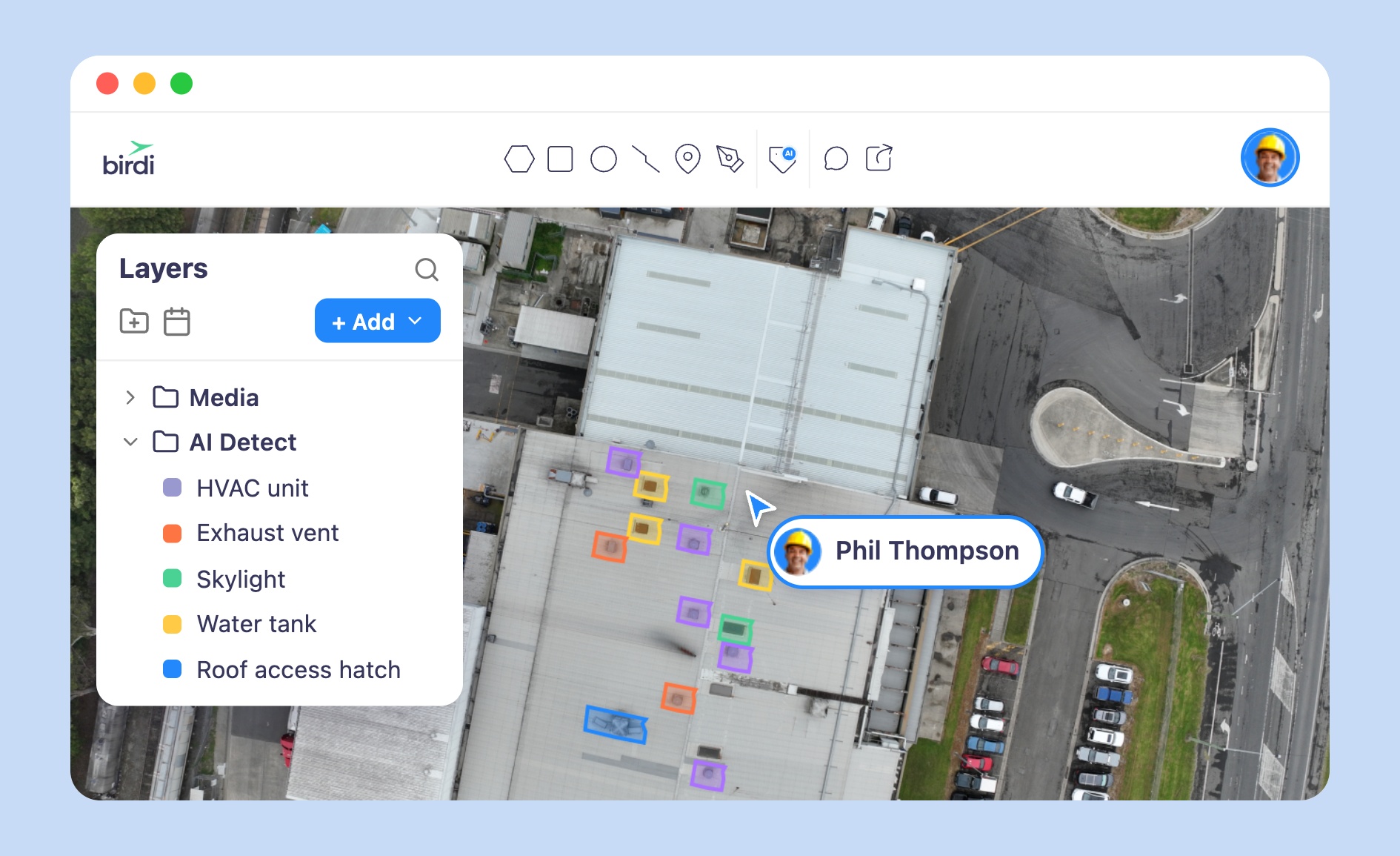
Best for: Construction, mining, and utilities teams that want a non-technical, collaborative workspace for turning drone, 360, or ground-based imagery into orthomosaics without a dedicated GIS specialist.
Typical customer: Mid-size to large construction and civil contractors, including Richard Crookes Constructions, Clark Construction, Merit Construction Group, Baseline, and Mirvac, alongside mining, utilities, and facilities management teams.
Key strengths:
- Cloud-based processing with no GPU workstation required, so orthomosaics come back without a dedicated hardware investment
- Capture-device agnostic: ingests drone, 360, LiDAR, DSLR, or smartphone imagery
- Public, no-login map sharing across multiple branded workspaces, useful for contractors juggling several clients or sites
Scope note: Exports orthomosaics, point clouds, and shapefiles into GeoTIFF, SHP, DXF, KML, and GeoJSON for use in QGIS, ArcGIS, or BIM-compatible workflows, rather than replacing a desktop photogrammetry engine for teams that need manual tie-point editing.
Watch-outs: Teams that need granular manual control over photogrammetric processing settings will find less depth here than in a desktop tool like Pix4Dmapper or Agisoft Metashape.
Pricing: Growth plan from $287 a month, billed annually; Ultimate tier by custom quote.
2. Pix4D
Best for: Teams with in-house photogrammetry or GIS expertise who want granular processing control across surveying, mining, or construction workflows.
Typical customer: Survey, mapping, and public safety professionals, plus construction and mining teams with dedicated technical staff running detailed photogrammetry workflows.
Key strengths:
- PIX4Dmapper offers desktop-grade control over camera calibration, tie points, and dense point cloud generation
- PIX4Dcloud Pro adds timeline comparisons, design overlays, and high-volume cloud processing for teams that want both
- Unlimited users and projects on both Starter and Pro tiers, with a per-dataset image limit rather than a per-seat limit
Scope note: Pix4D is positioned first as a photogrammetry and mapping engine, with collaboration and reporting features built around that processing core rather than the reverse.
Watch-outs: Running both PIX4Dmapper and PIX4Dcloud Pro together costs roughly $8,480 a year combined, and the platform assumes more familiarity with photogrammetry concepts than a tool built for non-technical field staff.
Pricing: PIX4Dmapper from $3,990 a year; PIX4Dcloud Pro from $4,490 a year.
3. Agisoft Metashape
Best for: Technical users, surveyors, and researchers who want desktop-grade photogrammetry quality without an annual subscription.
Typical customer: Independent surveyors, university and research labs, heritage documentation teams, and technical staff at construction or mining firms who process imagery themselves rather than relying on a shared platform.
Key strengths:
- One-time, non-time-limited license rather than a recurring subscription, with 12 months of technical support and updates included
- Configurable depth filtering and dense point cloud generation for high-accuracy meshes, textures, and orthomosaics
- Standard edition available at a low entry price for smaller or occasional projects
Scope note: Metashape is a desktop processing engine, not a collaborative platform; sharing outputs with a wider team, or with non-technical stakeholders, requires exporting into another viewer or GIS tool.
Watch-outs: Professional Edition runs $3,499 as a node-locked license (floating licenses require a reseller quote), and there's no built-in project management or field collaboration layer, so larger teams often pair it with a separate sharing tool.
Pricing: Standard Edition from $179; Professional Edition from $3,499 (node-locked, one-time).
4. DroneDeploy
Best for: Construction project managers who want fast, cloud-based orthomosaic turnaround and side-by-side progress comparison across site visits.
Typical customer: Construction, energy, and other site-based industries, reporting use on 3 million sites across 180 countries, with customers including Turner, Skanska, PCL, and DPR.
Key strengths:
- Cloud-first processing with no desktop GPU required, among the fastest cloud options for standard-sized sites
- Progress-monitoring dashboards purpose-built for comparing site conditions week over week
- Broad platform reach, with expansion into robotics, dock automation, and safety-focused AI tools beyond core mapping
Scope note: DroneDeploy's core mapping and orthomosaic workflow sits inside a much broader platform; teams that only need photogrammetry and orthomosaic output may end up paying for adjacent robotics and AI features they don't use.
Watch-outs: DroneDeploy publishes pricing for only a single Individual Pilot license ($4,188 a year); team and enterprise deployments require a custom quote, and reviewers on G2 and Capterra flag cloud processing queues that can stretch past a business day on large datasets with no published turnaround guarantee.
Pricing: Individual Pilot plan from $4,188 a year; team and enterprise pricing by custom quote.
5. OpenDroneMap / WebODM
Best for: Technical teams comfortable self-hosting or scripting who want a free, open-source photogrammetry engine, or a low-cost cloud add-on when they need it.
Typical customer: Researchers, hobbyists, and technically staffed teams at smaller organizations that want to avoid subscription costs and are comfortable managing their own infrastructure.
Key strengths:
- Core engine and WebODM interface remain free and open-source, with one-click installers for Windows and macOS
- WebODM Lightning offers optional cloud processing from $24 a month for teams that outgrow local hardware but still want to avoid a full commercial license
- Active open-source community and API access for teams that want to customize or automate their processing pipeline
Scope note: As of April 2026, WebODM split into an independent project running ODX (a fork of the original ODM engine), separate from the original OpenDroneMap project, so teams should check which codebase a given tutorial or integration refers to.
Watch-outs: Self-hosting is free but not costless: WebODM recommends 16 GB or more of RAM and 100 GB of free disk space, and someone on the team needs to install, maintain, and troubleshoot it, with no vendor support line to call.
Pricing: Free and open-source for self-hosted use; WebODM Lightning cloud processing from $24 a month, with image limits per plan.
What about Esri Drone2Map and Bentley iTwin Capture Modeler?
Esri Drone2Map and Bentley iTwin Capture Modeler (formerly ContextCapture) both process drone imagery into orthomosaics, but they're really entry points into a much larger enterprise system: ArcGIS Online or Enterprise in Esri's case, and Bentley's broader digital twin and infrastructure modeling ecosystem in Bentley's. Drone2Map is licensed as an add-on to an existing ArcGIS deployment, and iTwin Capture Modeler pricing starts around $291 a month as part of Bentley's Reality Modeling WorkSuite. Both are strong choices for organizations that already have, or plan to build, that broader enterprise GIS or digital twin environment, but they're a heavier commitment than a focused photogrammetry and orthomosaic tool for a team that just needs accurate site maps.
How do you choose the right photogrammetry and orthomosaic software?
Start with who's actually processing the imagery day to day. If a project manager, site engineer, or farm manager needs to go from flight to usable map without a GIS background, Birdi or DroneDeploy's cloud-first, guided workflows are the better fit. If a dedicated surveyor or GIS specialist wants manual control over tie points, camera calibration, and mesh density, Pix4D or Agisoft Metashape give that depth.
Second, match the pricing model to how often you're actually mapping. A one-time desktop license like Agisoft Metashape makes sense for occasional or research-driven projects, while a subscription platform like Birdi, DroneDeploy, or Pix4D fits teams mapping sites continuously, since the cost is spread across ongoing use rather than paid upfront.
Third, don't assume "orthomosaic," "orthophoto," and "photogrammetry" software are three separate shopping categories. They describe the same underlying process and the same type of output; use whichever term feels natural when searching, but evaluate vendors on processing model, technical depth, and pricing rather than on which exact word appears in their marketing.
Frequently asked questions
Is orthophoto software the same as orthomosaic software?
They're closely related but not identical. An orthophoto is a single corrected image; an orthomosaic is the larger, stitched map made from many orthophotos. In practice, most software marketed under either term produces both, and the terms are frequently used interchangeably in search and in vendor marketing.
What is the best free photogrammetry software?
OpenDroneMap and its WebODM interface are the most established free, open-source options, producing orthomosaics, point clouds, and 3D models from drone imagery. They require self-hosting on a capable machine (16 GB or more of RAM recommended) or a low-cost cloud add-on for teams that outgrow local hardware.
Do I need a powerful computer to run photogrammetry software?
Desktop tools like Pix4Dmapper and Agisoft Metashape benefit from a strong GPU and typically take 2 to 8 hours to process a standard dataset depending on hardware. Cloud-based platforms like Birdi and DroneDeploy shift that processing off-site, so no local GPU workstation is required.
How much does photogrammetry software cost?
Costs range from free (OpenDroneMap/WebODM self-hosted) to roughly $8,480 a year for combined Pix4D desktop and cloud tools. In between sit one-time desktop licenses like Agisoft Metashape Professional ($3,499), subscription platforms like Birdi (from $287 a month), and DroneDeploy's published single-seat plan ($4,188 a year), with most team and enterprise deployments priced through a custom quote.
Which photogrammetry software is best for construction and mining?
It depends on in-house technical skill. Birdi and DroneDeploy suit construction and mining teams that want a non-technical, cloud-based workflow, while Pix4D suits teams with a dedicated surveyor or GIS specialist who wants desktop-grade processing control over large or high-volume datasets.
Sources
- Global Growth Insights. "Photogrammetry Software Market Size & Trends 2026." 2026. https://www.globalgrowthinsights.com/market-reports/photogrammetry-software-market-105779
- Agisoft. "Agisoft Metashape: Online Store." 2026. https://www.agisoft.com/buy/online-store/
- DroneDeploy. "Pricing: Reality Capture Platform Plans for Construction, Energy & Agriculture." 2026. https://www.dronedeploy.com/pricing
- G2. "DroneDeploy Pros and Cons." 2026. https://www.g2.com/products/dronedeploy/reviews?qs=pros-and-cons
- SkyeBrowse. "WebODM vs OpenDroneMap: What's the Difference? (2026)." 2026. https://www.skyebrowse.com/news/posts/webodm-vs-opendronemap
- Propeller Aero. "What is orthomosaic mapping? Orthomosaics, orthophotos, and mapping software explained." 2026. https://www.propelleraero.com/blog/what-is-orthomosaic-mapping/
- Birdi. "Birdi vs. DroneDeploy." 2026. https://www.birdi.io/landing/birdi-vs-dronedeploy-usa