
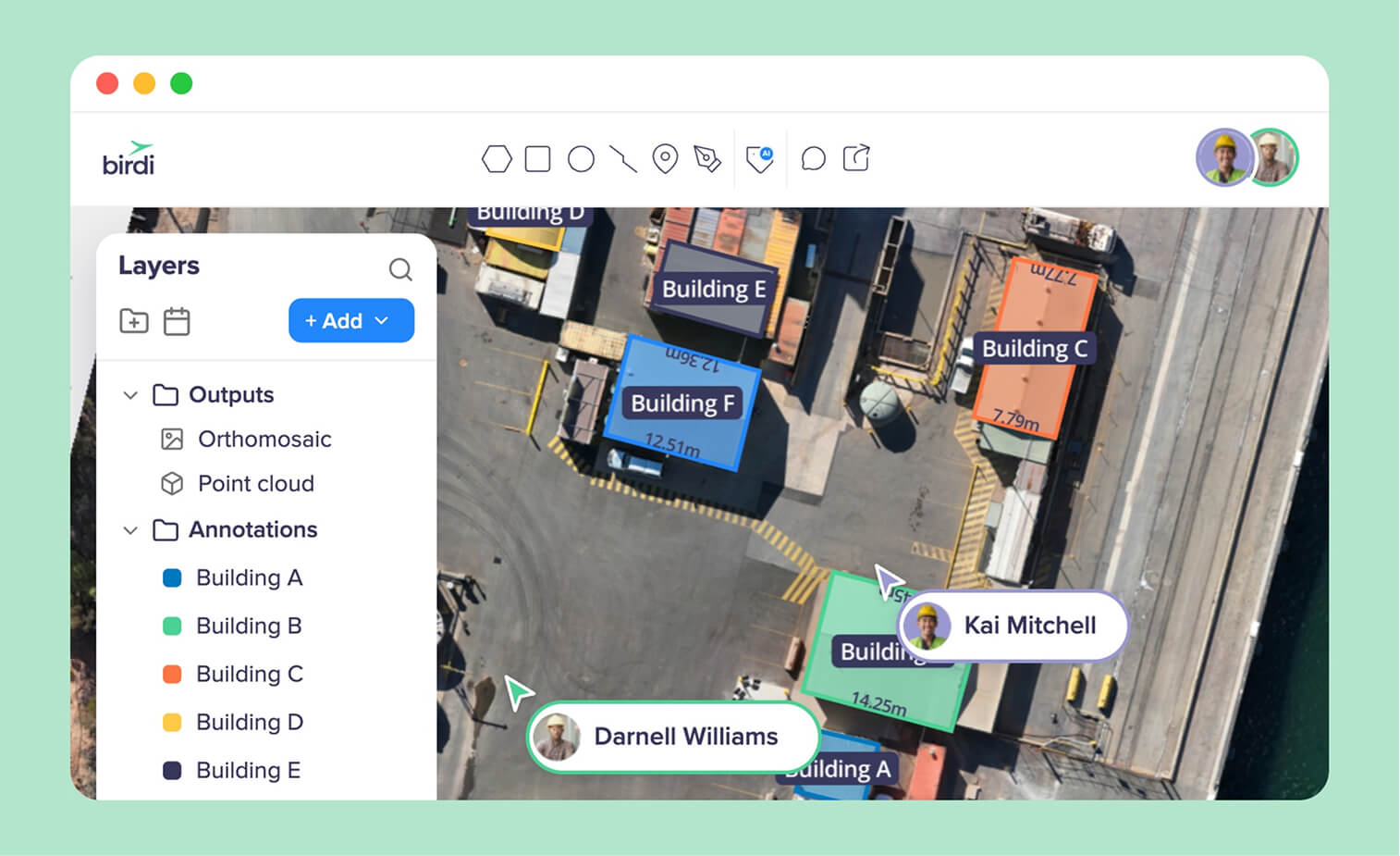
TL;DR: The best Pix4D alternative depends on why you are leaving. If you want less desktop work and wider sharing, look at cloud platforms such as Birdi (birdi.io), DroneDeploy, Propeller or Site Scan for ArcGIS. If you want processing control at a lower cost, look at desktop engines such as Agisoft Metashape, RealityScan, DJI Terra or WebODM.
Key takeaways
- Price is the most common complaint about Pix4D. According to Capterra, 3 of the 10 PIX4Dmapper reviews raise price, and another 3 raise hardware demands or long processing times.
- Pix4D's users still like it. It holds 4.5 from 10 reviews on Capterra, and 6 of the 10 praise how easy it is to learn.
- Desktop engines vary widely in price. Agisoft Metashape Professional is a one-off $3,499, RealityScan is free below $1 million in annual revenue, and WebODM is free and open source.
- Accuracy follows ground control, not the brand. A 2018 peer-reviewed study tested 3,465 combinations of ground control points and found accuracy improves as control increases and is spread evenly.
- Many teams keep Pix4D and add a sharing layer. Processing and sharing are separate jobs, so the outputs of one tool can go into another.
Why do teams look for Pix4D alternatives?
Teams look for Pix4D alternatives for three reasons: license cost, the desktop workstation its processing needs, and getting results to people who do not use Pix4D. Its own users mostly rate it well. So the right alternative depends on which of those three is the problem, because no single product fixes all of them.
Pix4D is a family of products, not one. PIX4Dmatic and PIX4Dmapper are desktop photogrammetry software, and PIX4Dcloud is its online platform for processing, progress monitoring and sharing. There are also apps for phone scanning, agriculture and emergency mapping. As a result, "leaving Pix4D" can mean replacing a desktop engine, a cloud platform, or both.
What do Pix4D's users say?
According to Capterra, PIX4Dmapper holds 4.5 from 10 reviews, and 6 of them praise how easy it is to learn. In addition, G2's review snippets say the same about its defaults. The complaints cluster in two places. Three of the 10 Capterra reviews raise price, and a G2 snippet calls cloud post-processing "expected but expensive." Another 3 of the 10 raise hardware demands or long desktop processing times.
Pix4D also documents limits of its own. PIX4Dcloud processes up to 4,000 images per dataset, and it does not accept 360 panoramas, LiDAR or point clouds as processing inputs. Each of these is a real reason to look elsewhere for some teams. For many others, however, they never come up.
Desktop engine or cloud platform: which do you need?
You need a desktop engine if your team wants to control every step of processing and has a capable workstation. You need a cloud platform if the priority is less hardware, less processing work and more people seeing the results. Some teams need both: a desktop engine for the surveyor, and a cloud platform for everyone else.
The split matters because the two groups solve different problems. A desktop engine like Metashape exposes settings that an experienced photogrammetrist can tune, and it runs on hardware you own. In contrast, a cloud platform hides most of those settings, processes on its own servers and puts the result in a browser. That is simpler for a project team, but it gives a specialist less to adjust.
Does the choice change accuracy?
Not by itself. According to a 2018 peer-reviewed study in Remote Sensing, accuracy improves as ground control points increase and are spread evenly. The study tested 3,465 combinations of ground control points on a 1,200-hectare site. It also found that checking accuracy only on the control points overstates it. For that reason, the ASPRS positional accuracy standard now asks for at least 30 independent checkpoints.
So compare how each option handles ground control and checkpoints, rather than trusting a headline accuracy figure. A cloud platform and a desktop engine fed the same images and control will usually land close together. For more on this, read our guide to how ground control improves accuracy.
The best cloud alternatives to Pix4D in 2026
Four cloud platforms are worth considering, and each is built around a different job. Birdi suits teams where the people who need the map never fly or process it. DroneDeploy suits construction teams that want one broad platform, Propeller suits earthworks and quarries, and Site Scan suits organizations already on ArcGIS. The order is not a ranking.
Every entry below carries the same fields, including access for people outside the paid team, data types in one view, and processing. Prices were checked on each vendor's site in September 2026.
1. Birdi
Best for: construction and mining teams that want cloud processing and a shared map for everyone who needs the results, including project managers, engineers, owners and clients.
Typical customer size / segment: construction and mining firms of roughly 30 to 500 staff, on the Growth and Ultimate plans.
Key strengths:
- Cloud processing to orthomosaic, DSM, DTM and hillshade on every plan, and to point cloud, textured mesh and contours on paid plans, with the ground sample distance chosen per map. The map and model processing page shows the outputs.
- Outputs from Pix4D, QGIS and ArcGIS can be brought in, so a surveyor can keep processing elsewhere while the wider team works in Birdi.
- A published accuracy table, from 2 to 4 cm vertical with RTK and 3 to 5 well-distributed GCPs, and a plain warning that repeat surveys vary more than a single survey.
Access for people outside the paid team: guests view and download without using a seat (20 guest seats on Plus, 50 on Growth), plus public map links that need no login.
Data types in one view: drone maps and elevation models, point clouds, 360 photos, video, design files and PDFs.
Processing: cloud, drone-agnostic.
Watch-outs: it is not built for a surveyor who wants hands-on control of each photogrammetry step. That surveyor is better served by Pix4D or a desktop engine below.
Pricing: Growth $287 a month billed annually (5 users, 50 guest seats); Ultimate by quote. Checked September 28, 2026.
2. DroneDeploy
Best for: construction teams that want capture, processing, 360 walks and reporting in one broad platform, with deep integrations.
Typical customer size / segment: from single pilots to large general contractors. Its pricing calculator sizes team plans by active projects and annual construction volume.
Key strengths:
- Aerial and ground capture in one platform, including 360 walks, BIM overlays and Progress AI for automated progress reports.
- On Aerial Pro, it imports orthomosaics and elevation models processed elsewhere, so mixed-vendor projects can measure in one place.
- Integrations with Procore, Autodesk Build, Esri and SharePoint.
Access for people outside the paid team: view-only links to one map date on every paid plan. Whole-project links and unpaid project invitees need an Enterprise organization.
Data types in one view: maps, 3D models, panoramas, video, 360 walks, and BIM and floor plan overlays.
Processing: cloud.
Watch-outs: team plans are quoted, and access for people without a paid seat depends on the plan. On Capterra, 3 of its 9 reviews raise cost.
Pricing: team plans by quote. The one-user Flight & Analysis plan is $4,188 a year, checked September 21, 2026.
3. Propeller
Best for: survey-led earthworks, quarry and civil teams that want guided ground control and volume tools.
Typical customer size / segment: contractors and aggregates producers running earthworks. Its annual platform fee includes 40 standard users and unlimited sites, according to its help center.
Key strengths:
- AeroPoints smart ground control and a PPK workflow built for survey-grade results.
- Stockpile volumes, cut and fill, cross sections and design conformance, compared across surveys on a timeline.
- It accepts data processed elsewhere, so a Pix4D output can still be measured in Propeller.
Access for people outside the paid team: users are added to a site with view-only access by default, within the 40 included in the platform fee.
Data types in one view: surveys and elevation models, point clouds, IFC designs and 360 photos.
Processing: cloud.
Watch-outs: it is built around earthworks and volumes, so building-focused construction teams may find it narrow. It doesn't publish a price.
Pricing: by quote. Checked September 21, 2026.
4. Site Scan for ArcGIS (Esri)
Best for: organizations that already run ArcGIS Online or ArcGIS Enterprise and want drone outputs inside it.
Typical customer size / segment: government agencies, utilities, and engineering and construction firms with an ArcGIS organization.
Key strengths:
- Cloud processing with automatic ground control point detection.
- Volumes, cut and fill, and change over time, published straight into ArcGIS.
- Flight planning and fleet management through ArcGIS Flight, with desktop processing in ArcGIS Drone2Map for teams that want it.
Access for people outside the paid team: strong. Esri says a Site Scan organization "can invite an unlimited number of Read-Only users and they do not affect the available license count."
Data types in one view: orthomosaics, meshes and point clouds, alongside the rest of the ArcGIS organization.
Processing: cloud, or desktop in Drone2Map.
Watch-outs: members sign in through an ArcGIS Online organization, so it suits teams that already have one. Esri doesn't publish Site Scan or Drone2Map prices.
Pricing: contact Esri. Checked September 28, 2026.
The best desktop alternatives to Pix4D in 2026
Five desktop engines are worth considering if processing control is what you want to keep. Agisoft Metashape is the closest like-for-like replacement, and RealityScan is the strongest free option for smaller firms. DJI Terra suits DJI fleets, iTwin Capture Modeler suits large reality models, and WebODM suits teams that want free, self-hosted processing.
5. Agisoft Metashape
Best for: surveyors and photogrammetry specialists who want full control of every processing step, on a one-off license.
Typical customer size / segment: individual specialists to survey and engineering teams, licensed per computer or on a floating license.
Key strengths:
- Advanced editing and post-processing tools, which its Capterra reviewers praise alongside the quality of its 3D results.
- Orthomosaics, point clouds and 3D models from the same project.
- A perpetual license rather than a subscription.
Access for people outside the paid team: limited. It is desktop software, so colleagues see exports rather than the project.
Data types in one view: photogrammetry outputs: orthomosaics, elevation models, point clouds and meshes.
Processing: desktop.
Watch-outs: it needs a strong workstation. On Capterra, 3 of its 5 reviews mention hardware or heavy resource use, and 2 mention a steep learning curve.
Pricing: Standard $179 and Professional $3,499 for a node-locked license; floating licenses by quote. Checked September 28, 2026.
6. RealityScan (formerly RealityCapture)
Best for: smaller firms that want professional desktop photogrammetry, including aerial LiDAR, at no license cost.
Typical customer size / segment: free for individuals and companies with under $1 million in annual revenue; larger firms pay per seat.
Key strengths:
- Epic Games' professional photogrammetry application, renamed from RealityCapture with the 2.0 release in June 2025.
- Combines aerial imagery, aerial LiDAR and terrestrial data into orthographic projections, maps and 3D models.
- Coverage heatmaps that show where a capture has gaps.
Access for people outside the paid team: limited. It is desktop software.
Data types in one view: images, aerial LiDAR and terrestrial scans, combined into one model.
Processing: desktop.
Watch-outs: it is desktop software, so the wider team sees exports rather than the project. Firms above $1 million in annual revenue pay per seat.
Pricing: free below $1 million in annual revenue; $1,250 per seat per year above it. Checked September 28, 2026.
7. DJI Terra
Best for: teams flying DJI enterprise drones and DJI LiDAR payloads who want processing from the same maker.
Typical customer size / segment: survey, inspection and mapping teams running DJI enterprise fleets.
Key strengths:
- 2D and 3D reconstruction from visible light imagery.
- Processing of data collected by DJI LiDAR.
- 3D Gaussian Splatting among its reconstruction options, and perpetual Standard and Flagship licenses with no upgrade fees from version 5.0.
Access for people outside the paid team: limited. It is desktop software.
Data types in one view: DJI imagery and LiDAR outputs: maps, point clouds and 3D models.
Processing: desktop.
Watch-outs: it runs on Windows only, and DJI's minimum is an NVIDIA graphics card and 32 GB of RAM.
Pricing: licenses through the DJI Store and DJI enterprise dealers. Checked September 28, 2026.
8. iTwin Capture Modeler (Bentley)
Best for: engineering firms building large reality models of infrastructure, sometimes city-scale.
Typical customer size / segment: infrastructure owners and engineering firms, often already using Bentley software.
Key strengths:
- Turns photos, LiDAR, point clouds and video into reality models for design, construction and operations.
- Processing on-premises through iTwin Capture Engine, or at cloud scale through iTwin Capture Cloud Services.
- The desktop app is free for preparing data; you pay when you process.
Access for people outside the paid team: limited in the desktop app. Colleagues see exported models.
Data types in one view: images, video, point clouds and LiDAR.
Processing: desktop preparation, then on-premises or cloud processing.
Watch-outs: processing prices are not published, so a project's cost is hard to know before a quote.
Pricing: free desktop app for preparation; processing by quote. Checked September 28, 2026.
9. WebODM
Best for: technical teams that want free processing and full control over their data.
Typical customer size / segment: individuals and technical teams that can run their own software.
Key strengths:
- Free and open source, with free installers since April 2026.
- Orthomosaics, elevation models, point clouds and 3D models, with GCPs and checkpoints.
- Runs on your own computer, even offline.
Access for people outside the paid team: share links to maps and 3D models.
Data types in one view: its own photogrammetry outputs.
Processing: your own hardware, or the paid WebODM Lightning service.
Watch-outs: someone has to run it, and WebODM says a machine with 8 GB of RAM won't process "more than ~100 images".
Pricing: free. WebODM Lightning costs $24 to $99 a month billed yearly. Checked September 21, 2026.
When should you stay with Pix4D?
Stay with Pix4D if your surveyors rely on its processing control and your team already knows it. PIX4Dmatic's CAD extraction and point cloud tools are hard to replace. Moreover, PIX4Dcloud includes unlimited users and view-and-measure links that need no login, so sharing maps and models is already strong.
Stay, too, if the complaint is really about who sees the results rather than how they are processed. In that case, a change of engine solves nothing. Instead, many teams keep Pix4D for processing and add a platform where the wider project sees the outputs next to 360 photos, documents and designs, which PIX4Dcloud does not take as inputs.
In practice, the useful question is which job you are replacing. If it is processing, compare the desktop engines. If it is sharing, compare the cloud platforms. For a head-to-head view of the biggest names, see our comparison of Propeller, DroneDeploy, Pix4D and Birdi.
For the self-hosted route, where cost and control matter most, see our comparison of Birdi and WebODM.
Frequently asked questions
What is the best free alternative to Pix4D?
WebODM is the best free alternative to Pix4D for most teams: it is free and open source, and it produces orthomosaics, elevation models and 3D models on your own computer. RealityScan is also free for companies with under $1 million in annual revenue. Both need a capable computer and someone to run them.
Is Agisoft Metashape better than Pix4D?
Agisoft Metashape is better for specialists who want to tune every processing step and prefer a one-off license: Professional costs $3,499. Pix4D is easier to learn, according to 6 of its 10 Capterra reviews, and pairs its desktop tools with PIX4Dcloud for sharing. Both need a strong workstation for large projects.
Is there a cheaper alternative to Pix4D?
Yes. WebODM is free, RealityScan is free below $1 million in revenue, and Metashape Standard costs $179 as a one-off. Among cloud platforms, Birdi Growth costs $287 a month billed annually for five users and 50 guest seats. PIX4Dcloud starts at $1,290 a year and PIX4Dmatic at $2,290.
Can I use Pix4D outputs in another platform?
Yes. Orthomosaics, elevation models and point clouds from Pix4D can be brought into Birdi, DroneDeploy on Aerial Pro, and Propeller. That lets a surveyor keep processing in Pix4D while the wider team measures, compares and shares the results in a platform built for that job.
Is DroneDeploy as accurate as Pix4D?
Both reach centimeter-level results when flights use good ground control, RTK or PPK corrections and checkpoints. Accuracy depends mainly on ground control, not the software brand, according to a 2018 peer-reviewed study. DroneDeploy labels RTK or PPK results without checkpoints "unvalidated accuracy", which is a good habit on any platform.
About the author
This guide was written by the Birdi team. Birdi (birdi.io) is a geospatial AI workspace that construction and mining teams use to share drone, 360 and design data in one map. We checked every product fact against the vendor's own site or documentation on September 21 and 28, 2026, and counted the reviews ourselves. Each source is listed below.
Related reading
- Photogrammetry and orthomosaic platforms: for teams choosing mainly on processing quality.
- What photogrammetry is: how aerial images become maps and 3D models.
- Propeller Aero alternatives: the options for teams leaving an earthworks platform.
- 2D and 3D outputs explained: what each photogrammetry output is for.
Sources
Research and standards
- Sanz-Ablanedo, E., Chandler, J.H., Rodríguez-Pérez, J.R. and Ordóñez, C. "Accuracy of Unmanned Aerial Vehicle (UAV) and SfM Photogrammetry Survey as a Function of the Number and Location of Ground Control Points Used." Remote Sensing 10(10), 1606, 2018. https://doi.org/10.3390/rs10101606
- Abdullah, Qassim A. "The ASPRS Positional Accuracy Standards, Edition 2." LIDAR Magazine, October 6, 2023. https://lidarmag.com/2023/10/06/the-asprs-positional-accuracy-standards-edition-2/
Pix4D
- Pix4D. "PIX4Dcloud pricing," "PIX4Dmatic pricing" and "PIX4Dmapper pricing"; Support, "Share functionality" and "Best practices and capabilities for PIX4Dcloud." Checked September 21, 2026. https://www.pix4d.com/pricing/pix4dcloud · https://www.pix4d.com/pricing/pix4dmatic · https://www.pix4d.com/pricing/pix4dmapper · https://support.pix4d.com/hc/en-us/articles/360044557751 · /14988429657117
- Capterra. PIX4Dmapper reviews (10). Read September 21, 2026. https://www.capterra.com/p/234673/PIX4Dmapper/reviews/
- G2. Pix4D reviews (search snippets only). Read September 21, 2026. https://www.g2.com/products/pix4dcloud/reviews
Cloud alternatives
- DroneDeploy. "Pricing"; Help Center "Data Sharing," "Choosing a High Accuracy Workflow" and "Uploading Preprocessed Ortho + DEM GeoTIFF for Volumetrics." Checked September 21, 2026. https://www.dronedeploy.com/pricing · https://help.dronedeploy.com/hc/en-us/articles/1500004862021 · /22885434354327 · /39903288916759
- Capterra. DroneDeploy reviews (9). Read September 21, 2026. https://www.capterra.com/p/197016/DroneDeploy/reviews/
- Propeller. "Platform" and "AeroPoints"; Help Center "How To Share and Manage Access To a Site" (July 9, 2026). Checked September 21, 2026. https://www.propelleraero.com/platform/ · https://help.propelleraero.com/hc/en-us/articles/19384064976407
- Esri. "Site Scan for ArcGIS," "Add and manage team members" and "ArcGIS Drone2Map: Buy." Checked September 21 and 28, 2026. https://www.esri.com/en-us/arcgis/products/arcgis-reality/products/site-scan-for-arcgis · https://doc.arcgis.com/en/site-scan/latest/get-started/manage-team-members.htm · https://www.esri.com/en-us/arcgis/products/arcgis-reality/products/arcgis-drone2map/buy
Desktop alternatives
- Agisoft. "Online store." Checked September 28, 2026. https://www.agisoft.com/buy/online-store/
- Capterra. Agisoft Metashape reviews (5). Read September 28, 2026. https://www.capterra.com/p/234744/Agisoft-Metashape/reviews/
- Epic Games. "RealityScan 2.0: New release brings powerful new features to a rebranded RealityCapture" (June 17, 2025) and "Licensing." Checked September 28, 2026. https://www.realityscan.com/news/realityscan-20-new-release-brings-powerful-new-features-to-a-rebranded-realitycapture · https://www.realityscan.com/license
- DJI Enterprise. "DJI Terra" and "DJI Terra FAQ." Checked September 28, 2026. https://enterprise.dji.com/dji-terra · https://enterprise.dji.com/dji-terra/faq
- Bentley Systems. "iTwin Capture Modeler." Checked September 28, 2026. https://www.bentley.com/en/products/itwin-capture-modeler/
- WebODM. Home page and "Download"; WebODM Lightning "Pricing." Checked September 21, 2026. https://webodm.org · https://webodm.org/download · https://webodm.net/pricing
Birdi
- Birdi. "Pricing." Checked September 28, 2026. https://www.birdi.io/pricing
- Birdi Help Center. "Processing outputs"; "How to process a map"; "How accurate are my maps?" (April 9, 2026); "How to update a user role and permissions." https://help.birdi.io/en/articles/10409970 · /10434238 · /13837409 · /11091551
Review evidence comes from Capterra, with G2 search snippets as corroboration. Reddit, G2's full pages, TrustRadius and the Pix4D community forum were not read for this guide.
