
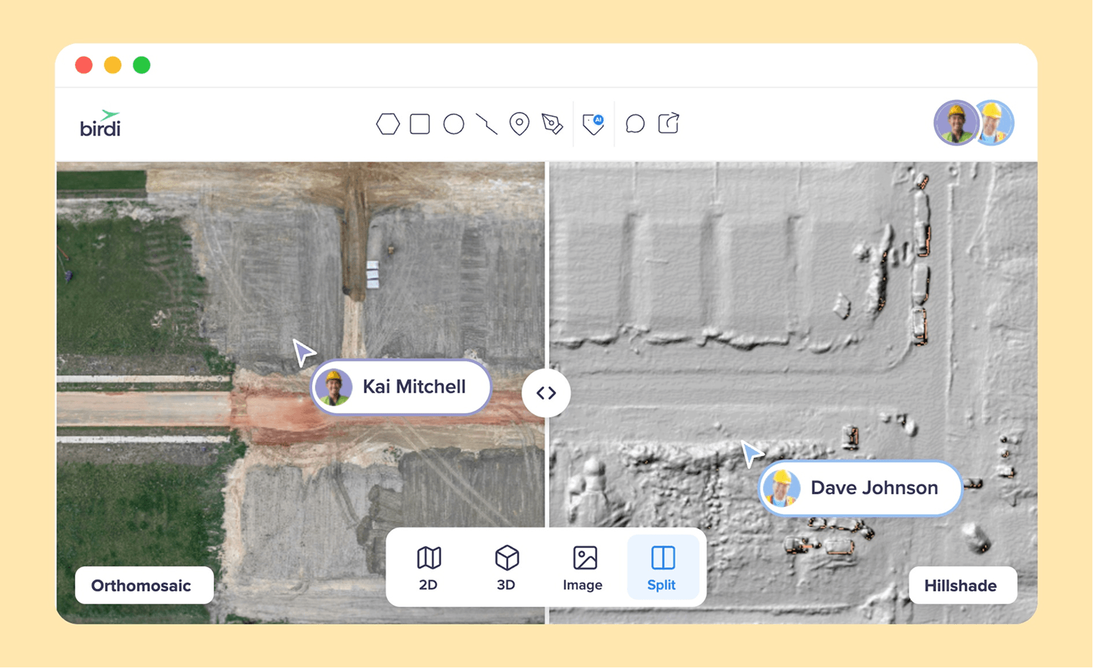
TL;DR: Propeller, DroneDeploy, Pix4D and Birdi (birdi.io) are built around four different jobs. Birdi is for sharing site data with people who never fly or process it, Propeller is for earthworks and survey, DroneDeploy is an all-in-one construction platform, and Pix4D is for photogrammetry processing. Your team's main job decides the winner.
Key takeaways
- Each platform wins a different job. Birdi wins on putting every kind of site data in front of a wider team, Pix4D on processing control, Propeller on earthworks and ground control, and DroneDeploy on breadth and integrations.
- Access rules differ more than features. PIX4Dcloud includes unlimited users, while DroneDeploy lets unpaid people into a project only through an Enterprise organization, according to its help center (May 2026).
- Accuracy comes from ground control, not the software brand. A 2018 peer-reviewed study of more than 2,500 photos found accuracy depends heavily on the number and spread of ground control points.
- Propeller has the happiest public reviews: 4.8 from 20 on Capterra. DroneDeploy's complaints center on cost, and Pix4D's on price and hardware.
- Only Birdi and Pix4D publish team prices. DroneDeploy's team plans and Propeller are quoted.
What is the difference between Propeller, DroneDeploy, Pix4D and Birdi?
The difference is the job each one is built around. Birdi gets drone, 360 and design data to people who need it but never fly or process it. Propeller is built around earthworks, volumes and survey-grade ground control. DroneDeploy is an all-in-one platform for flying, capturing and reporting on construction sites. And Pix4D is built around photogrammetry processing.
All four turn drone imagery into maps and 3D models, so a feature checklist makes them look alike. The real differences show up in who each one expects to use it. A project manager sharing site data with a client, a quarry surveyor, a construction technology lead and a photogrammetry specialist will each find a different one easiest. The table below compares them on the same rows, and every fact was checked on the vendor's own site on September 21, 2026.
How do the four compare, row by row?
Where does Birdi fit against the other three?
Birdi fits where the main problem is sharing, not processing or surveying. It brings drone maps, point clouds, 360 photos, video, design files and PDFs into one map, and guests view and download without using a seat. It processes imagery in the cloud, but it is not the tool for granular processing control or earthworks-grade ground control.
Birdi is not built for every job in the table. A surveyor who wants hands-on control of each processing step gets more of it in Pix4D. A survey-led earthworks team with its own ground control is often better served by Propeller. And Birdi is not a full desktop GIS, so analysts keep ArcGIS Pro or QGIS alongside it.
Where Birdi wins is the mixed team. For example, a project manager can put a February drone map beside the October one, comment on a site photo, and send a client a link that needs no login. Birdi also publishes its accuracy by capture method, from 5 to 15 cm with standard GPS to 2 to 4 cm with RTK and well-distributed GCPs.
Birdi vs DroneDeploy, briefly
Against DroneDeploy specifically, the difference is access and scope. DroneDeploy is the broader platform, with capture apps, 360 walks, robotics, Progress AI and more integrations. Birdi is narrower, and built so the people outside the paid team can see and use everything in one map. For a feature-by-feature view, see our Birdi vs DroneDeploy comparison.
DroneDeploy vs Pix4D: which is better?
DroneDeploy is better for construction teams that want flight planning, capture, 360 walks and integrations in one platform. Pix4D is better for surveyors who want control over photogrammetry, on the desktop or in the cloud. So the choice follows who runs the work: a construction technology team leans DroneDeploy, while a survey team leans Pix4D.
On sharing, the two differ more than most comparisons admit. PIX4Dcloud includes unlimited users on every plan, and its links let a client view and measure without logging in. DroneDeploy's paid plans share a view-only link to one map date, but a whole-project link needs an Enterprise project package.
On processing, Pix4D gives more control, especially in PIX4Dmatic on the desktop. However, PIX4Dcloud caps a dataset at 4,000 images and doesn't accept 360 panoramas as input. DroneDeploy, by contrast, covers 360 walks, BIM overlays and add-ons such as Progress AI, which turns walkthroughs and aerial imagery into progress reports. On price, PIX4Dcloud publishes $1,290 and $4,490 a year, while DroneDeploy quotes its team plans.
Propeller vs DroneDeploy: which suits your site?
Propeller suits earthworks, civil, mining and aggregates sites that measure volumes and check grade against design. DroneDeploy suits construction teams that want one platform across aerial and ground capture, from 360 walks to BIM overlays. So a quarry or a bulk earthworks job leans Propeller, and a vertical building project leans DroneDeploy.
Propeller's strength is ground control. Its AeroPoints are smart ground control points, and it says its PPK workflow with recommended equipment can reach 3 cm accuracy. DroneDeploy supports AeroPoints too, alongside its own GCP, RTK and PPK workflows, and it labels RTK or PPK without checkpoints as "unvalidated accuracy". Both connect to Procore and Autodesk, and both quote team prices.
Propeller vs Pix4D: which is more accurate?
Neither is inherently more accurate. Both reach centimeter-level results with good ground control, and both say so plainly. According to Pix4D, relative accuracy is typically 1 to 2 times the ground sample distance horizontally and 1 to 3 times vertically, and absolute accuracy "cannot be higher" than that. Propeller builds its accuracy around AeroPoints and PPK.
The independent evidence points the same way. According to a 2018 study in Remote Sensing, accuracy improves as ground control points increase and are spread evenly. The study tested 3,465 combinations of ground control across a 1,200-hectare site with more than 2,500 photos. It also found accuracy is overestimated when measured on control points instead of independent checkpoints.
The ASPRS Positional Accuracy Standards, Edition 2, now call for at least 30 checkpoints to assess a dataset's accuracy. So the practical difference is workflow. Propeller bundles ground control hardware into a guided process, while Pix4D gives a surveyor more control over each processing step.
What do users of each platform say?
Birdi has too few public reviews to show a pattern, but the other three show clear ones. Propeller's are the most positive, with ease of use praised most. DroneDeploy's praise ease of use but raise cost, including the cost of access for view-only users. Pix4D's praise its learnability and raise price and hardware demands.
Birdi. Birdi has 5 reviews on Capterra, all rated 5, which is too few to count themes. The complaints that appear are small bugs when switching between 2D, 3D and media views, a wish for more drone-specific algorithms and custom workflows, and past slowness from Australian servers, which one reviewer says "has been improved recently."
Propeller. According to Capterra, Propeller holds 4.8 from 20 reviews, and 11 of the 20 praise its ease of use. Complaints are scattered, with 3 of 20 mentioning navigation or interface friction. One 2025 reviewer wrote: "We use Propeller Aero on a daily basis. All aspects of our company use the portal." G2's summary lists cost as a complaint.
DroneDeploy. Seven of its 9 Capterra reviews praise ease of use, especially flight planning. Cost comes up in 3, and G2's summary lists "high cost" as its most frequent complaint. One 2022 reviewer said clients "can not use the simple tools unless they are subscribers." Its Capterra reviews are all more than three years old.
Pix4D. PIX4Dmapper holds 4.5 from 10 Capterra reviews. Six praise how easy it is to learn, 3 raise price and 3 raise hardware demands or long processing times. G2 snippets call cloud processing "expected but expensive".
Which one should you choose?
Choose by the job your team does most. Pick Birdi when the people who need the data are mostly not the people who fly or process it. Pick Propeller for earthworks and volumes with built-in ground control, and DroneDeploy for an all-in-one construction platform with deep integrations. Pix4D is the choice when processing control and survey-grade photogrammetry matter most.
In more detail:
- Firms delivering site data to several clients, or project teams with many non-specialists: Birdi, with processing in Birdi or outputs brought in from Pix4D.
- Quarries, mines and bulk earthworks: Propeller.
- General contractors that live in Procore or Autodesk and want automated progress reporting: DroneDeploy.
- Survey teams that want hands-on control of processing: Pix4D, often PIX4Dmatic on the desktop with PIX4Dcloud for sharing.
Many teams combine them. A surveyor might process in Pix4D, then share the outputs with the wider project team through another platform. For more options, see our list of DroneDeploy alternatives.
Frequently asked questions
Is Pix4D better than DroneDeploy?
Pix4D is better for photogrammetry control and survey work, especially on the desktop, and PIX4Dcloud includes unlimited users. DroneDeploy is better for construction teams that want capture, 360 walks, Progress AI and Procore or Autodesk integrations in one platform. The better choice depends on whether processing or site management is the main job.
What is Propeller Aero best for?
Propeller Aero is best for earthworks, civil, mining and aggregates teams that measure stockpiles, track cut and fill and check grade against design. Its AeroPoints smart ground control and PPK workflow are built for survey-grade results. Teams whose data is mostly interior 360 walkthroughs will find DroneDeploy's Ground product built more for that job.
Which is cheaper, DroneDeploy or Pix4D?
Pix4D publishes its prices: PIX4Dcloud costs $1,290 a year for Starter and $4,490 for Pro, with unlimited users, as of September 2026. DroneDeploy publishes only its one-user Flight & Analysis plan, at $4,188 a year, and quotes team plans. For a team, Pix4D's published pricing is usually easier to compare.
Which drone mapping software is most accurate?
No platform is inherently most accurate. Accuracy depends mainly on ground control, RTK or PPK corrections and checkpoints, and a 2018 peer-reviewed study found it improves with more, evenly spread ground control points. Birdi, Pix4D, Propeller and DroneDeploy all reach centimeter-level results with good ground control, so compare workflows, not claims.
Can I use Pix4D and DroneDeploy together?
Yes, though most teams choose one for processing. A common pattern is to process in Pix4D for control, then share the outputs through a platform built for the wider team. Birdi, DroneDeploy and Propeller can all take in maps and models processed elsewhere, so the processing and sharing tools do not have to match.
About the author
This comparison was written by the Birdi team. Birdi (birdi.io) is a geospatial AI workspace that construction and mining teams use to share drone, 360 and design data in one map. We checked every product fact against the vendor's own site or documentation on September 21, 2026, and counted the reviews ourselves. Each source is listed below.
Related reading
- Drone mapping software for teams: a wider comparison of drone mapping platforms for teams.
- Photogrammetry and orthomosaic platforms: for teams choosing mainly on processing quality.
- How ground control improves accuracy: why ground control points decide accuracy on any platform.
- Stockpile volume software compared: the platforms mine and quarry teams use to measure stockpiles.
Sources
Research and standards
- Sanz-Ablanedo, E., Chandler, J.H., Rodríguez-Pérez, J.R. and Ordóñez, C. "Accuracy of Unmanned Aerial Vehicle (UAV) and SfM Photogrammetry Survey as a Function of the Number and Location of Ground Control Points Used." Remote Sensing 10(10), 1606, 2018. https://doi.org/10.3390/rs10101606
- Abdullah, Qassim A. "The ASPRS Positional Accuracy Standards, Edition 2." LIDAR Magazine, October 6, 2023. https://lidarmag.com/2023/10/06/the-asprs-positional-accuracy-standards-edition-2/
Propeller
- Propeller. "Platform," "AeroPoints" and "Propeller PPK." Checked September 21, 2026. https://www.propelleraero.com/platform/ · https://www.propelleraero.com/aeropoints/ · https://www.propelleraero.com/propeller-ppk/
- Propeller Help Center. "How To Share and Manage Access To a Site" (July 9, 2026) and "What is a Standard or Oversized Dataset?" (February 24, 2026). https://help.propelleraero.com/hc/en-us/articles/19384064976407 · https://help.propelleraero.com/hc/en-us/articles/19383374221207
DroneDeploy
- DroneDeploy. "Pricing" and "Progress AI." Checked September 21, 2026. https://www.dronedeploy.com/pricing · https://www.dronedeploy.com/product/progress-ai
- DroneDeploy Help Center. "Data Sharing" (May 26, 2026) and "Choosing a High Accuracy Workflow" (March 24, 2026). https://help.dronedeploy.com/hc/en-us/articles/1500004862021 · https://help.dronedeploy.com/hc/en-us/articles/22885434354327
Pix4D
- Pix4D. "PIX4Dcloud" and "PIX4Dcloud pricing." Checked September 21, 2026. https://www.pix4d.com/product/pix4dcloud · https://www.pix4d.com/pricing/pix4dcloud
- Pix4D Support. "What is the relative and absolute accuracy of drone mapping?"; "Share functionality"; "Best practices and capabilities for PIX4Dcloud." Checked September 21, 2026. https://support.pix4d.com/hc/en-us/articles/202558889 · /360044557751 · /14988429657117
Birdi and reviews
- Birdi. "Pricing." Checked September 21, 2026. https://www.birdi.io/pricing
- Birdi Help Center. "How accurate are my maps?"; "How to update a user role and permissions"; "What file types are supported in Birdi 2.0?"; "How to use Scout, Birdi's AI Agent"; "How to Use Birdi's Map AI Detect Tool"; "How to connect DJI FlightHub 2 to Birdi." https://help.birdi.io/en/articles/13837409 · /11091551 · /10416278 · /16059411 · /12956771 · /15884230
- Capterra. Propeller Aero (20 reviews), DroneDeploy (9), PIX4Dmapper (10) and Birdi (5). Read September 21, 2026. https://www.capterra.com/p/179319/Propeller-Platform/reviews/ · https://www.capterra.com/p/197016/DroneDeploy/reviews/ · https://www.capterra.com/p/234673/PIX4Dmapper/reviews/ · https://www.capterra.com/p/10026509/Birdi/reviews/
- G2. Review summaries for Propeller Aero, DroneDeploy and Pix4D (search snippets only). Read September 21, 2026. https://www.g2.com/products/propeller-aero/reviews · https://www.g2.com/products/dronedeploy/reviews · https://www.g2.com/products/pix4dcloud/reviews
Review counts are small, and several reviews are more than three years old. Reddit, G2's full review pages, TrustRadius and the DroneDeploy forum could not be read for this comparison.
