
Birdi vs DroneDeploy
.png)
Why do teams choose Birdi over DroneDeploy?
Birdi keeps things focused. We’ve built a platform that does what you need it to do —without unnecessary complexity or cost. From field teams to decision-makers, Birdi helps everyone collaborate on geospatial data and get value from it, fast.
Birdi is the right fit if...
Your team needs to move quickly, work together easily, and get value from your geospatial data without jumping through hoops.

You want tools the whole team can use
Birdi is intuitive enough for anyone to use—not just technical users. With built-in commenting and sharable maps, more people can access insights, give input, and stay aligned across projects.
You don’t want to configure everything
No hidden setup steps or endless configuration. Birdi’s tools work out of the box, so your team can process, visualise, and collaborate without delay.
You like supporting Aussie businesses
Birdi is proudly Australian-owned and built. Our team’s right here when you need us — with support in your timezone, from people who understand your industry and how you work.
You need powerful outputs without the complex software
Whether it’s orthomosaics, digital elevation models, point clouds, or contours — Birdi handles the heavy lifting in the cloud, no specialist desktop tools required. Just upload your data, explore results in minutes, and share them instantly with your team or clients.
Compare Birdi with DroneDeploy

A unified workspace for everyone
Birdi is built for busy teams from the ground to the desk.
Upload anything
Bring in imagery, vectors, point clouds, 3D data, and more—Birdi can visualize it all.
Learn more

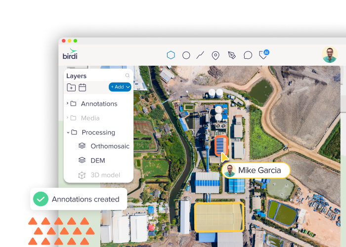
Data processing
Generate orthomosaics, DEMs, meshes, and more—fast, accurate, and all in one place.
Annotation tools
Draw, measure, and mark up maps with geo-referenced annotations ready for export.
Reports
Generate reports from your maps for inspections, insights and compliance.
Timeline
Step through your data over time with an interactive timeline that make changes easy to see.
Volumetric
Calculate and export volumes from elevation models and point clouds quickly and accurately.
AI tools
Add custom tags and labels to organize and highlight important features.
Already using DroneDeploy?
We’ll make sure you never pay more with Birdi.
If your current DroneDeploy subscription is higher than our standard pricing, we’ll match it — and beat it by 10%.
Birdi has everything you need — All in one platform
Built for collaboration, designed for clarity
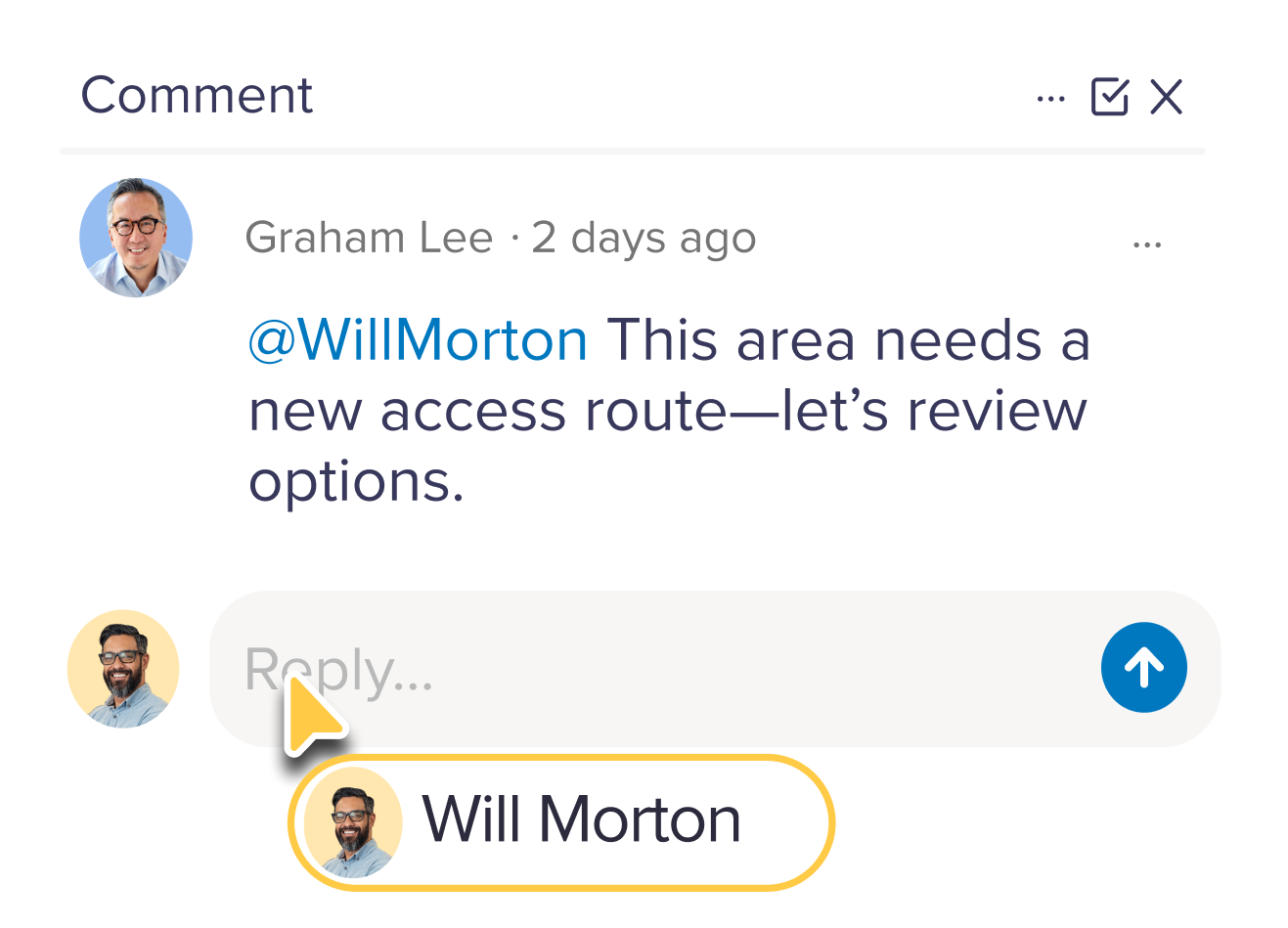
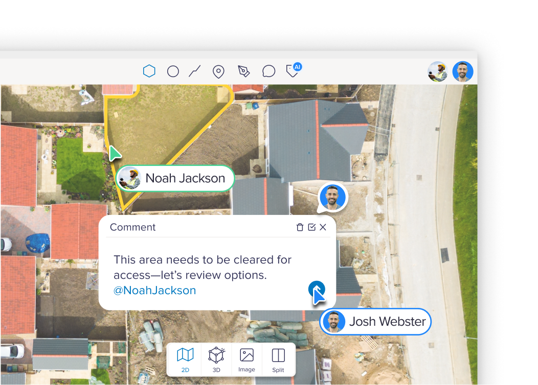
Birdi’s collaboration tools bring your entire team onto the same map —literally. From GIS specialists to field teams and stakeholders, everyone can comment, track updates, and stay in sync without needing extra software or confusing workflows.
Why it matters:
Unlike DroneDeploy’s limited team visibility, Birdi lets you create a true feedback loop across internal teams, clients, and contractors. Everyone sees the same source of truth — no more screenshots or version control challenges.
Powerful comparison tools for deeper insight
Need to track changes over time or compare datasets from different dates or sources? Birdi gives you intuitive comparison views to make change detection, QA, and reporting faster and more visual.
Why it matters
DroneDeploy offers basic overlays, but Birdi’s comparison tools are built for teams managing ongoing inspections, change monitoring, or multi-date projects. Whether you’re tracking vegetation growth, construction progress, or surface changes, Birdi makes it obvious. Use any drone, fly with third-party apps, or even go fully manual. However you capture your data, Birdi makes it easy to upload, visualise, and process it — from 3D models to orthomosaics and beyond.
You stay in control of how you collect — Birdi takes care of everything after that.

Turning data into decisions, faster
Birdi helps you move from raw geospatial data to insight — without delays. Whether you're inspecting assets, managing sites, or reporting on terrain, Birdi gives you the tools to work smarter — and act sooner.
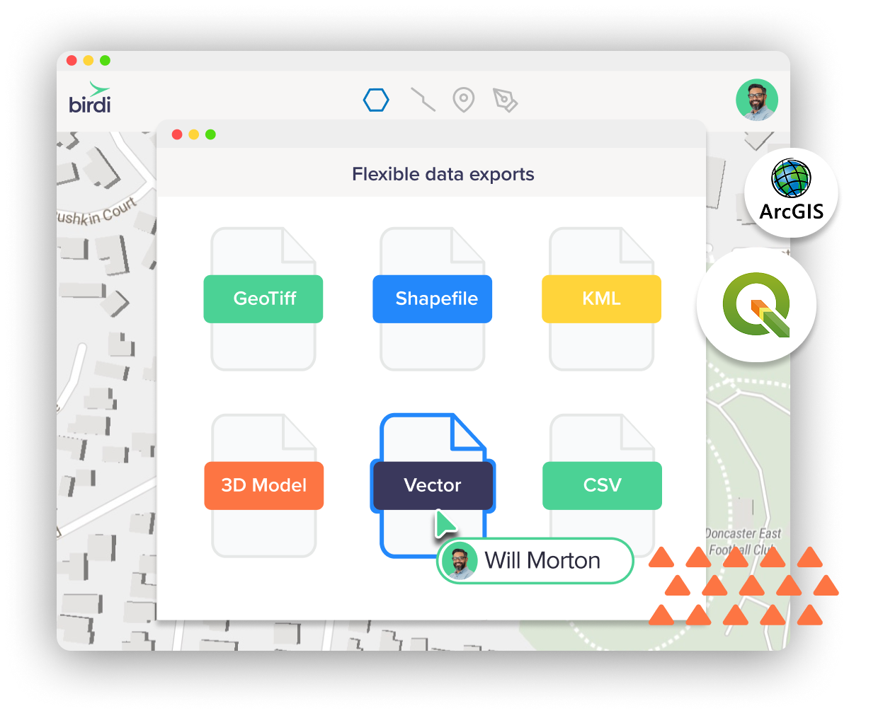
Compatible with the tools you already use
Birdi makes it easy to integrate with your GIS workflow. Export data in industry-standard formats —so you can bring outputs straight into QGIS, ArcGIS, or other spatial tools without missing a beat. Whether you're editing features, running spatial analysis, or just need clean data exports, Birdi plays nicely with your setup.
Plans built for teams


Bring your own data, or let us process it for you
Already have drone imagery, LiDAR, or ground-based photos? Or need help turning raw data into ready-to-use maps and models? Birdi meets you where you’re at. Upload and manage your own data, or let Birdi process it for you into the outputs you need.
Why it matters
DroneDeploy focuses heavily on in-app data capture, but not every business runs drones internally. Birdi supports flexible data sources and works just as well with your existing capture methods. Whether you're using contractors, flying your own missions, or combining sources, we make sure you still get consistent, high-quality outputs and insights.

Pricing that fits your needs
The most common thing we hear from teams comparing Birdi and DroneDeploy? Cost.
DroneDeploy can be a significant investment — especially for teams that aren’t using all the features bundled into their plan. At Birdi, we offer flexible pricing options to suit a range of team sizes, workflows, and budgets. You get the tools you need to process, visualise, collaborate, and report — without paying through the nose for extras you’ll never use.

Next-level, local customer support
At Birdi, support isn’t an afterthought — it’s part of the product. Gone are the days you need to trawl through help docs alone or wait days for an email response. We’re right there on chat, ready to help – and we're based here in Australia.
Birdi vs DroneDeploy FAQs

How does Birdi compare to DroneDeploy?
Birdi offers a flexible, user-friendly alternative with powerful geospatial tools built for collaboration. You’ll get similar core features — like orthomosaic processing, 3D visualisation, and annotations — with a cleaner UI and local support.
Can I import my existing DroneDeploy projects?
Yes! It’s easy — just export your data (orthomosaics, point clouds, shapefiles, etc.) from DroneDeploy and upload them to Birdi. We support standard formats and can help with migration if needed.
Do I have to use a specific drone or flying app?
Nope. Birdi works with any drone and supports data from third-party flight apps or even manual captures. Just upload your imagery or sensor data and start processing—simple as that.
Does Birdi support live collaboration and annotations?
Yes — collaborate in real time with team members. You can add annotations, comments, and share links to projects internally or externally with full access control.
Is Birdi good for teams who aren’t geospatial experts?
Absolutely. Birdi is intuitive and built for users of all experience levels — so the whole team can explore, contribute, and stay aligned, not just the GIS team.
What GIS formats does Birdi export to?
You can export in GeoTIFF, SHP, DXF, KML, and GeoJSON — making it easy to continue working in QGIS, ArcGIS, or other spatial tools.
How easy is it to switch from DroneDeploy?
Very easy. There’s no complicated setup — just sign up, upload your data, and go. Our team is also happy to help with onboarding or file migration.