
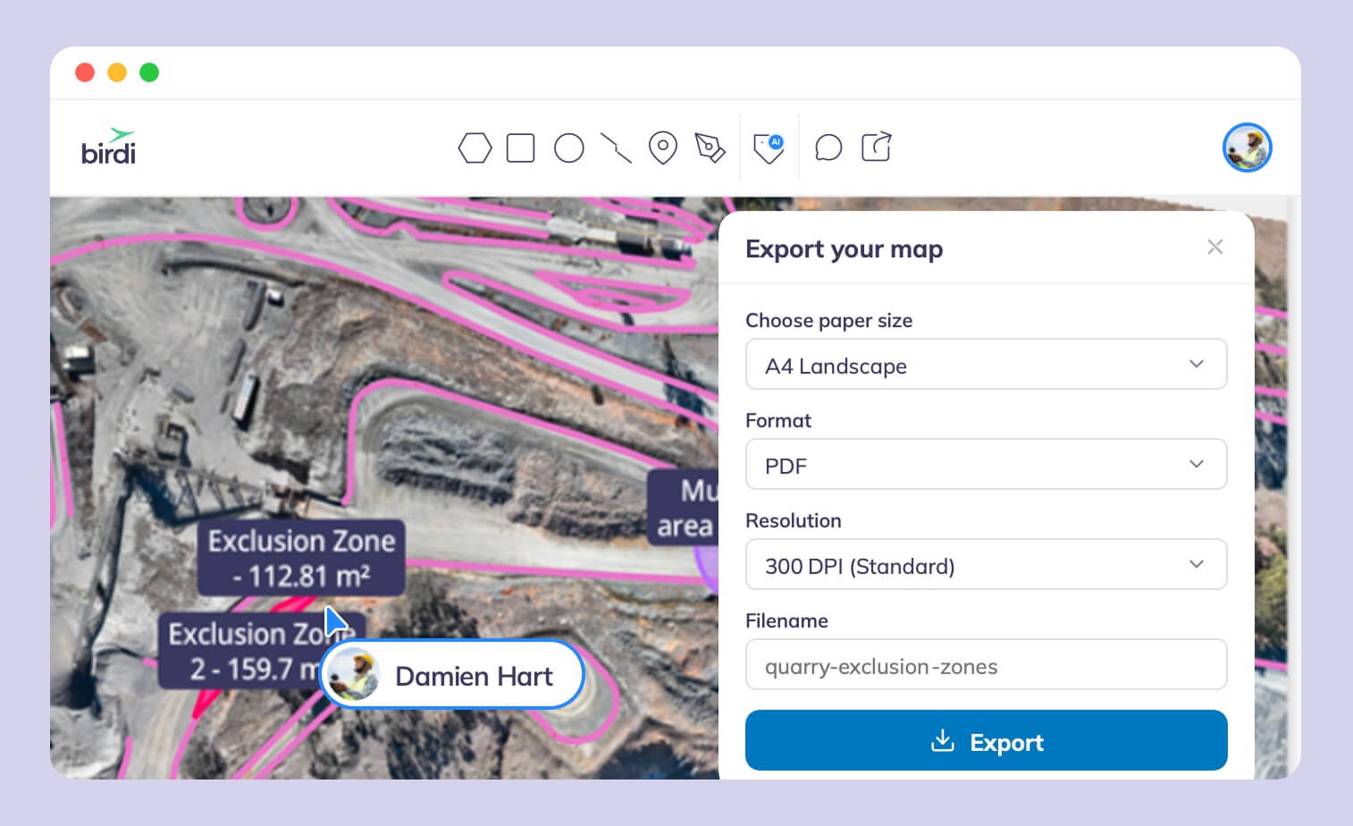
TL;DR: A survey, engineering or consulting firm that delivers drone data to clients needs one workspace per client, its own branding, and a viewer clients can use without a paid seat. Birdi (birdi.io) suits firms serving several clients from one account, DronePortal suits branded delivery of files, and PIX4Dcloud suits processing plus sharing.
Key takeaways
- For a firm, the platform is part of the product. The client never sees your processing software, but they do see the link you send, the viewer it opens and the logo on the report.
- Client separation is the first question. Birdi, DroneDeploy and Propeller separate clients by workspace, organization or site, while DronePortal gives each project its own access code.
- Branding is uneven. Birdi, DronePortal and DroneDeploy document logo branding; Pix4D users have asked for it on Pix4D's own community forum since 2021.
- Clients expect standard files as well as a link. GeoTIFF is an OGC standard and LAS is maintained by ASPRS, so both open in almost any GIS or CAD package.
- Accuracy needs its own evidence. According to the ASPRS Positional Accuracy Standards, Edition 2, assessing a dataset's accuracy takes at least 30 checkpoints.
What does a client-delivery platform need to do?
A client-delivery platform replaces a folder of attachments with one link to a map the client can pan, zoom and measure on. For a firm serving several clients, it also has to keep each client's data apart, carry the firm's branding, and let clients in without buying them a seat. Processing is useful, but many firms process elsewhere.
Getting this wrong is expensive for everyone downstream. According to Autodesk and FMI, bad data may have cost the construction industry $1.85 trillion in 2020, from a survey of more than 3,900 people.
Client delivery is also a different job from sharing inside your own team. Inside a team, everyone can have an account. With clients, every account is a cost, a login to manage and a possible data leak between two customers. So this guide compares platforms on five rows: client separation, branding, what clients can do without a paid seat, the deliverable, and processing.
Who this guide is for
This guide is for survey, engineering and consulting firms capturing for several clients of their own, often five or six at a time. It is not written for sole operators, who usually choose on price, or for teams sharing only inside their own company. For that case, see our team sharing guide.
How we chose these six
We started with the platforms AI search engines name for this question, then kept those that are software a firm can run itself. Two names that come up often, AirWorks and SmartDrone, turned out to be closer to services, so they sit in a sidebar below. We checked every fact on the vendor's own site or documentation on September 24, 2026. The list is not ranked.
The best drone data platforms for client delivery in 2026
These six platforms each handle client delivery differently: some are built around separate client workspaces, some around a branded link, and some around processing. Every entry carries the same fields, including client separation and branding, so you can compare them directly. They are listed by the job each does best, not ranked.
1. Birdi
Best for: firms delivering drone, 360 and design data to several clients from one account.
Typical customer size / segment: mid-sized survey, engineering and construction firms, roughly 30 to 500 staff, based on Birdi's own customer focus.
Key strengths:
- One organization with multiple workspaces, one per client or department, sharing the plan's seats and storage.
- Clients join as Guests, who view every map in their workspace and download outputs without using a paid seat.
- A branded annotation report turns measurements into a PDF for the client, on Growth and Ultimate.
Client separation: a workspace per client. Plus and Growth include five workspaces; Ultimate is set per contract.
Branding: your brand, your client's, or co-branded, per workspace, on Growth and Ultimate. Plus brands the main workspace only.
Access for people outside the paid team: Guests use no seat (20 on Plus, 50 on Growth), and a view-only link shares one map with no login.
Data types in one view: drone maps, point clouds, 3D models, 360 photos, video, PDFs and DXF design overlays.
Processing: cloud processing to orthomosaic, DSM, DTM and point cloud, or bring outputs processed elsewhere.
Watch-outs: not the right fit for a sole operator shopping on price. Not built for a surveyor who wants hands-on control of each processing step, who would process in Pix4D or similar first.
Pricing: Plus costs $60 a month and Growth $287 a month, both billed annually; Ultimate is by quote (September 2026).
For a firm with a DJI fleet, FlightHub 2 media can sync straight into Birdi, set up per workspace, so each client's flights land in that client's space. See how workspaces are managed.
2. DronePortal
Best for: drone operators who want a branded client portal in front of the tools they already use.
Typical customer size / segment: solo operators to small inspection firms and resellers, per its own plans.
Key strengths:
- A client portal that embeds viewers from WebODM, PIX4Dcloud, Sketchfab, Matterport, Polycam and any tool with a shareable link.
- Clients need no account: they open one link with one access code, and are notified automatically.
- EU-hosted, from a Belgian company.
Client separation: projects are organized per client, each with its own access code, and are not publicly indexed.
Branding: the Agency plan applies your theme, logo and background to the whole portal.
Access for people outside the paid team: clients never need an account.
Data types in one view: whatever the embedded tools show, plus reports, photos, video and thermal images.
Processing: none. It is a delivery layer on top of your processing software.
Watch-outs: it does not process imagery, so you pay for a processing tool as well. Storage is small on the lower plans (5 GB on Starter, 25 GB on Professional).
Pricing: Starter €29, Professional €59 and Agency €99 a month, billed annually (September 2026).
3. PIX4Dcloud
Best for: survey firms that want cloud processing and a client viewer from the same vendor.
Typical customer size / segment: survey and engineering firms of all sizes; every plan includes unlimited users.
Key strengths:
- Survey-grade processing from a photogrammetry specialist.
- Share links that let a client view and measure without logging in.
- Integration with Trimble Connect and Esri.
Client separation: by project, each shared with its own link. Unlimited users means clients can also be given accounts.
Branding: not documented. Pix4D users have asked for logo branding on its community forum since 2021.
Access for people outside the paid team: unlimited users on every plan, and no-login share links.
Data types in one view: orthomosaics, point clouds, 3D meshes and IFC models; 360 panoramas are not accepted as input.
Processing: cloud, with the PIX4Dmatic desktop app for more control.
Watch-outs: your client sees Pix4D's branding, not yours. A dataset is capped at 4,000 images.
Pricing: $1,290 a year for Starter and $4,490 for Pro (September 2026).
4. DroneDeploy
Best for: larger firms that want capture apps, processing, 360 walks and integrations in one platform.
Typical customer size / segment: from single pilots to enterprise firms; team plans are sold by quote.
Key strengths:
- Flight planning, aerial and ground capture, and processing in one platform.
- Integrations with Procore, Autodesk, Esri, SharePoint and more.
- A company logo on every map and report.
Client separation: Organizations, on Teams and Enterprise plans, are how accounts are shared with team members or clients.
Branding: co-branding on Individual Advanced, Teams and Enterprise subscriptions: your logo on maps and reports.
Access for people outside the paid team: every paid plan shares a view-only link to one map date without a login. Inviting unpaid people into a project needs an Enterprise organization, according to its help center (May 2026).
Data types in one view: maps, 3D models, 360 walks and BIM overlays.
Processing: cloud.
Watch-outs: clients who want to measure or export may need a paid seat below Enterprise. Two of its nine Capterra reviewers say clients cannot use the tools unless they subscribe.
Pricing: the one-user Flight & Analysis plan costs $4,188 a year; team plans are by quote (September 2026).
5. Propeller
Best for: firms delivering earthworks, volumes and survey data to civil, quarry and mining clients.
Typical customer size / segment: civil and earthworks contractors, quarries and mines; the platform fee includes 40 standard users.
Key strengths:
- AeroPoints smart ground control and PPK built into the workflow.
- Stockpile, cut and fill and design-conformance tools clients use directly.
- Integrations with Procore, Autodesk and Trimble Connect.
Client separation: by site, each shared and managed separately; unlimited sites.
Branding: not documented in the help articles we read.
Access for people outside the paid team: invited users get view-only access by default, and a measurement can be shared by link. Whether a view-only user counts toward the 40 standard users is not stated.
Data types in one view: surveys, point clouds, designs (including IFC and LandXML) and 360 photos.
Processing: cloud.
Watch-outs: built around earthworks, so building and interior clients use less of it. Pricing is by quote.
Pricing: by quote. AeroPoints processing for standalone users costs $999 a year per group (Propeller help center, July 2026).
6. AVAG
Best for: firms that want cloud processing, volumes and unlimited users at a published price.
Typical customer size / segment: construction and surveying firms, mostly in Central Europe, per its named customers.
Key strengths:
- Automated processing, volumes, cross-sections and cut and fill maps.
- Unlimited users on every plan, with access rights set per person.
- 360 panoramas, point clouds and CAD data, in six interface languages.
Client separation: access rights per user, so each client sees only its own data.
Branding: not documented on its pricing or product pages.
Access for people outside the paid team: unlimited users, so clients can have their own accounts at no extra cost.
Data types in one view: orthomosaics, point clouds, 360 panoramas and CAD overlays.
Processing: cloud, automated without GCPs, or expert processing at €99 per 500-photo dataset.
Watch-outs: a younger company, founded in 2021 in Czechia, with a customer base centered on Europe.
Pricing: Professional costs €125 a month; Enterprise is by quote (September 2026).
What about AirWorks and SmartDrone?
Both come up for this question, but neither is a client-delivery platform in the same sense. AirWorks turns aerial data into CAD linework and planimetrics, delivered as files through its online portal after expert QC. SmartDrone makes a survey-grade LiDAR drone and processing software, and sells processing and flight services to surveyors. Either can feed a delivery platform; neither replaces one.
Should the deliverable be a file, a report or a live map?
Usually all three, for different people. An engineer wants the files: a GeoTIFF orthomosaic, a DSM, a LAS point cloud and CAD linework. A project manager or owner wants a report they can forward. And everyone benefits from a live map they can open in a browser, measure on and come back to next month.
Files: what clients expect
Files matter because they outlive any platform. GeoTIFF was adopted as an Open Geospatial Consortium standard in 2019, and LAS is the point cloud format maintained by ASPRS, so both open in almost any GIS or CAD package. A delivery platform should let the client download these without a support ticket.
Reports: the record that gets forwarded
A PDF is what reaches the people who never open a map. It should carry your branding, the measurements, the date of capture and where the numbers came from. For survey-grade work, include accuracy evidence, such as the checkpoint results behind each accuracy figure.
The live map: where clients come back
A link to a live map changes the relationship, and many clients already work this way. According to the Associated Builders and Contractors' 2026 Drone Usage Report, 80.8% of members who fly drones use them for site progress monitoring. Instead of a one-off delivery, the client returns each month to the same site, sees the new survey beside the last one, and measures for themselves. That also makes it the part clients notice most, so check what a client can do on it without a paid seat.
How do you choose a delivery platform?
Start with how many clients you serve and whether you process in-house. Birdi suits firms serving several clients from one account with branded workspaces. DronePortal suits branded delivery on top of existing tools, and PIX4Dcloud suits processing plus no-login sharing. DroneDeploy suits all-in-one capture, Propeller earthworks clients, and AVAG unlimited users at a published price.
In more detail:
- Five or more clients, mixed data types, non-specialist clients: Birdi, with the annotation report as the PDF deliverable.
- Processing already done in WebODM or PIX4Dcloud, and your brand wanted on the delivery: DronePortal.
- Processing in Pix4D, with clients who only view and measure: PIX4Dcloud.
- Capture apps and construction integrations needed too: DroneDeploy.
- Your clients are quarries and earthworks contractors: Propeller.
- You want unlimited client accounts at a published price: AVAG.
For a wider comparison, see our guide to drone mapping software for teams.
Frequently asked questions
How do surveyors deliver drone data to clients?
Most firms deliver three things: files such as a GeoTIFF orthomosaic, DSM and LAS point cloud; a PDF report with measurements and accuracy; and a link to a live map the client can view and measure on. A delivery platform puts all three behind one link instead of several emails and file transfers.
Can I brand a drone map portal with my company logo?
Yes, on some platforms. Birdi brands workspaces with your logo, your client's or both on Growth and Ultimate. DronePortal's Agency plan applies your theme and logo to the whole portal, and DroneDeploy adds your logo to maps and reports. Pix4D does not document logo branding for PIX4Dcloud.
How do I keep each client's data separate?
Use a platform that separates clients structurally, not by folder names. Birdi gives each client its own workspace under one organization, DronePortal gives each project its own access code, and Propeller shares each site separately. Then give each client access only to their own workspace, site or project.
What file formats do clients expect from a drone survey?
Clients usually expect a GeoTIFF orthomosaic, a DSM or DTM as a GeoTIFF, a point cloud as LAS or LAZ, and CAD linework as DXF. GeoTIFF is an Open Geospatial Consortium standard and LAS is maintained by ASPRS, so both open in almost any GIS or CAD package.
Can clients measure on a delivered map?
On most platforms, yes. PIX4Dcloud share links let clients view and measure without logging in. Birdi Guests view and download everything in their workspace without a paid seat. DroneDeploy's no-login links show one map date, and measuring or exporting depends on the viewer's plan or role.
About the author
This guide was written by the Birdi team. Birdi (birdi.io) is a geospatial AI workspace that survey, engineering and construction firms use to share drone, 360 and design data with their clients in one map. We checked every product fact against the vendor's own site or documentation on September 24, 2026, and each source is listed below.
Related reading
- Drone mapping software for teams: a wider comparison of drone mapping platforms.
- Four platforms compared: Propeller, DroneDeploy, Pix4D and Birdi head to head.
- Sharing a map in Birdi: a short video on sharing a map in Birdi.
- Survey, engineering and operations collaboration: how shared site data works between those teams.
Sources
Standards and research
- Open Geospatial Consortium. "GeoTIFF v1.1 adopted as an OGC Standard." 2019. https://www.ogc.org/announcement/geotiff-v11-adopted-as-an-ogc-standard/
- Library of Congress. "LAS (LASer) File Format, Version 1.4" (maintained by ASPRS). https://www.loc.gov/preservation/digital/formats/fdd/fdd000418.shtml
- Associated Builders and Contractors. "ABC Report: 36% of Contractor Members Utilize Drones on Jobsites." August 17, 2026. https://www.abc.org/News-Media/News-Releases/abc-report-36-of-contractor-members-utilize-drones-on-jobsites
- Autodesk and FMI. "Study from Autodesk and FMI Finds Better Data Strategies Could Save the Global Construction Industry $1.85 Trillion." September 14, 2021. https://www.prnewswire.com/news-releases/study-from-autodesk-and-fmi-finds-better-data-strategies-could-save-the-global-construction-industry-1-85-trillion-301376278.html
- Abdullah, Qassim A. "The ASPRS Positional Accuracy Standards, Edition 2." LIDAR Magazine, October 6, 2023. https://lidarmag.com/2023/10/06/the-asprs-positional-accuracy-standards-edition-2/
Vendors
- Birdi. "Pricing." Checked September 24, 2026. https://www.birdi.io/pricing
- Birdi Help Center. "Workspaces"; "User seats, roles and permissions"; "Annotation report"; "Downloading outputs"; "How to connect DJI FlightHub 2 to Birdi." https://help.birdi.io/en/articles/11091547 · /11091551 · /15867195 · /10574319 · /15884230
- DronePortal. Home page and plans. Checked September 24, 2026. https://droneportal.app/
- Pix4D. "PIX4Dcloud pricing" and Support, "Share functionality"; Pix4D Community, "Branding with logos and company name" (feature request, 2021). https://www.pix4d.com/pricing/pix4dcloud · https://support.pix4d.com/hc/en-us/articles/360044557751 · https://community.pix4d.com/t/branding-with-logos-and-company-name/19422
- DroneDeploy. "Pricing," checked September 24, 2026; Help Center, "Upload your company logo" (December 11, 2025) and "Data Sharing" (May 26, 2026). https://www.dronedeploy.com/pricing · https://help.dronedeploy.com/hc/en-us/articles/1500004964562 · /1500004862021
- Propeller Help Center. "How To Share and Manage Access To a Site" (July 9, 2026); "Measuring Stockpiles: The Basics" (February 24, 2026); annual platform access and AeroPoints subscriptions. https://help.propelleraero.com/hc/en-us/articles/19384064976407 · /19383873966487 · /19383374221207 · /19383553319703
- AVAG. Home page and "Pricing." Checked September 24, 2026. https://avagpro.com/ · https://avagpro.com/pricing
- AirWorks and SmartDrone. Home and product pages. Checked September 24, 2026. https://airworks.io/ · https://smartdrone.com/products
- Capterra. DroneDeploy reviews (9). Read September 21, 2026. https://www.capterra.com/p/197016/DroneDeploy/reviews/
