Streamline your team’s geospatial operations

Combine intelligent file management with powerful workflows, collaborative tools and reporting outputs.
Book a Demo

The geospatial platform designed for small teams or business units

We get it - time and budget’s are tight. You are looking for a light but powerful platform to streamline your work.
Birdi is recommended by small teams who love how birdi offers a single place to scale and streamline geospatial data management and visualization.

The easiest geospatial software you’ll use

Upload. Visualize. Annotate. Collaborate. Report. Share.
Book a Demo
Upload
Upload data of your locations and assets, or view our base maps.
Visualize
Visualize your data & generate 2D and 3D maps and models.
Annotate
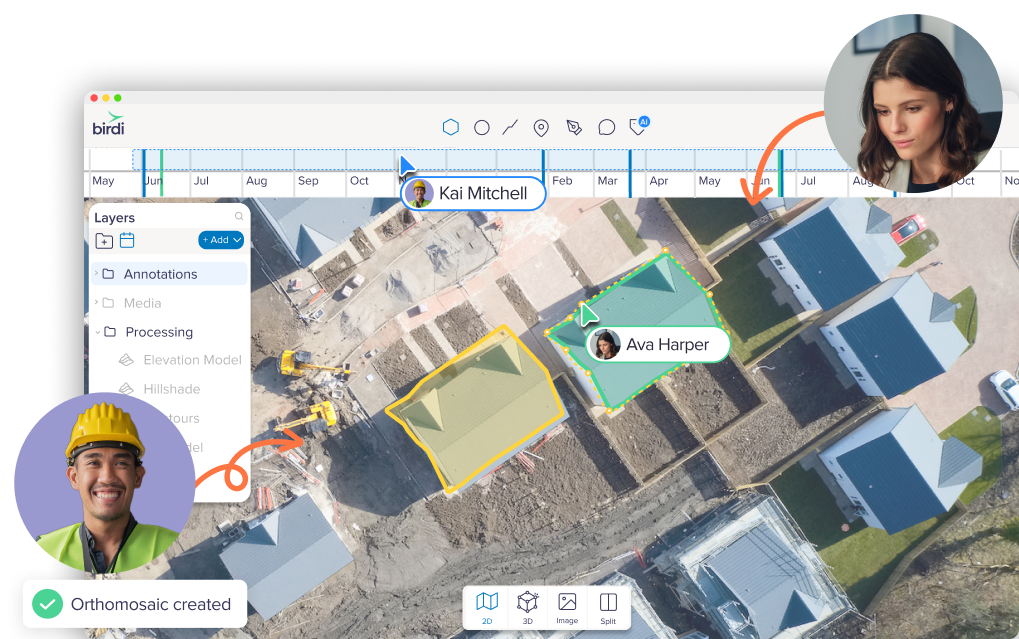
Utilize our suite of map tools to communicate points of interest, annotate & assess.
Collaborate
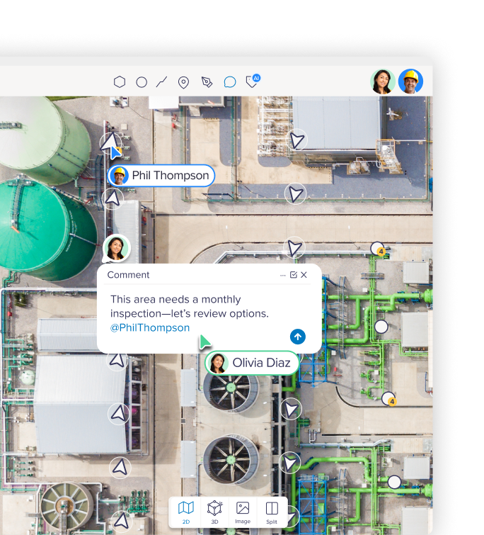
Trigger work orders and collaborate in real time.
Report
Generate insights and create reports to suit your business needs.
Share
Share your maps and insights with your team and stakeholders.

All the geospatial features you need

Green tick icon
Visualize any data set
Green tick icon
Volumetric reports
Green tick icon
2D and 3D map processing
Green tick icon
RTK processing
Green tick icon
Annotation tools
Green tick icon
Asset assessment
Green tick icon
3D model viewer
Green tick icon
3D model viewer
Green tick icon
Collaboration tools
Green tick icon
Annotation reports
Green tick icon
Difference grids
Green tick icon
Progress reporting

A central hub for your team’s geospatial data

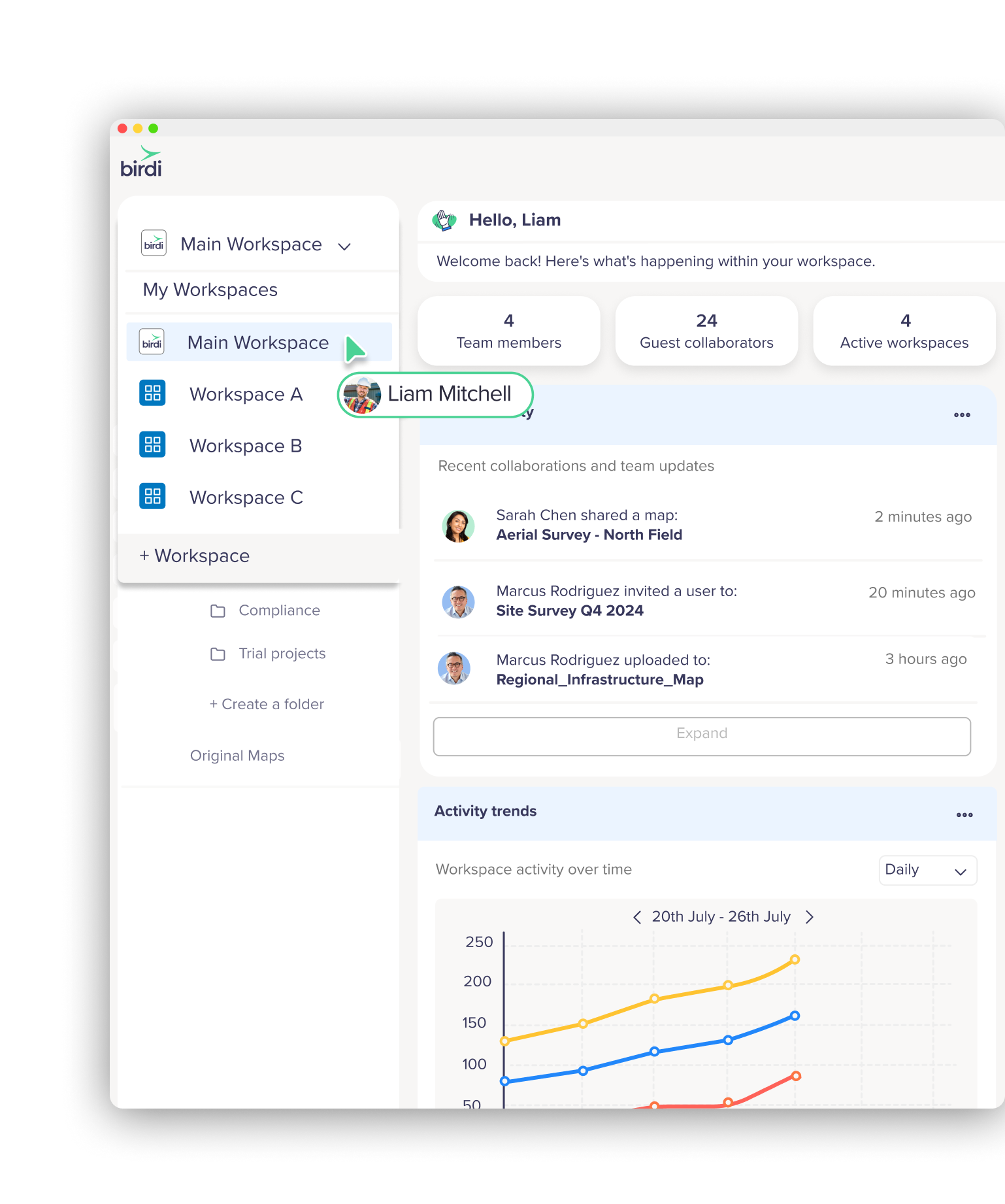
It’s easy to lose data among team members when it’s all over the place (across emails, USBs and different folders). With Birdi, all your geospatial data, processed 2D and 3D maps, reports and insights are centralized in the one Birdi workspace.

Canary arrow right
A central hub for geospatial data in Birdi
Easy team collaboration in Birdi
Ocean arrow left

Easy team collaboration

Add your whole team into your Birdi workplace for seamless team collaboration. Work on maps together in real-time, mark up, annotate and measure areas, and have shared access to media, reports and maps.

Data visualization and processing

Visualize ground-based photography, drone images, videos, 360 degree panoramics, existing geoTIFFs, satellite imagery and more. Process your data into outputs such as:

  • Orthophotos
  • Digital Elevation Models
  • 3D model Point Clouds
  • Contours
  • Textured Mesh
Flora arrow right
Data visualization and processing in Birdi
Share data and trigger workflows in Birdi
Sun conure arrow left

Share data and trigger workflows

Connect your employees and contractors to seamless workflows based on your geospatial data, with just a few clicks.

Streamline your geospatial operations

Improve operational efficiency by enabling your team with dynamic, location-based information for informed decision-making. Upload, store, visualize and process data to match the way your business operates.

Midnight arrow right
Streamline geospatial operations with Birdi
Birdi customer service is next level
Canary arrow left

Next-level customer service

Birdi customer service is market leading - we treat you like a partner, not a user. Gone are the days you need to trawl through help docs alone or wait days for an email response. We’re right there on chat!