
How teams around the world are using Birdi
From the field to the office, Birdi helps teams worldwide to visualize aerial data and collaborate with confidence.
90+
Countries
85,000+
Maps created
6
Continents
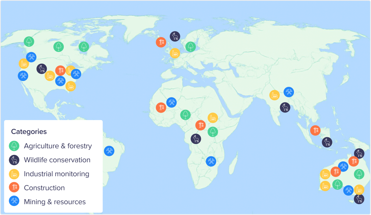
Birdi use cases worldwide
No matter where they’re located, teams use Birdi to tackle similar challenges—from asset inspections to terrain analysis.
Here are some of the ways Birdi is being used around the world:
Here are some of the ways Birdi is being used around the world:
Here are some of the ways Birdi is being used around the world:
No items found.
A global community of Birdi users
Birdi users span 90+ countries:
Region
Countries
Africa
Angola, Ghana, Kenya, Libya, Malawi, Mauritius, Morocco, Namibia, Nigeria, South Africa, Tanzania
Americas
North America: Barbados, Belize, Canada, Dominican Republic, El Salvador, Guatemala, Honduras, Jamaica, Mexico, Nicaragua, Panama, United States
South America: Argentina, Bolivia, Brazil, Chile, Colombia, Ecuador, Paraguay, Peru Caribbean & Territories: Bonaire, French Polynesia
South America: Argentina, Bolivia, Brazil, Chile, Colombia, Ecuador, Paraguay, Peru Caribbean & Territories: Bonaire, French Polynesia
Asia
Armenia, Bangladesh, Hong Kong, India, Indonesia, Iraq, Israel, Japan, Jordan, Kazakhstan, Kuwait, Laos, Lebanon, Malaysia, Mongolia, Pakistan, Philippines, Qatar, Saudi Arabia, Singapore, South Korea, Sri Lanka, Taiwan, Thailand, United Arab Emirates, Vietnam
Europe
Austria, Belgium, Bosnia and Herzegovina, Bulgaria, Cyprus, Denmark, Estonia, Finland, France, Germany, Greece, Hungary, Iceland, Ireland, Italy, Latvia, Lithuania, Malta, Netherlands, Norway, Poland, Portugal, Romania, Russia, Serbia, Slovakia, Slovenia, Spain, Sweden, Switzerland, United Kingdom
Oceania
Australia, New Zealand, Papua New Guinea, Vanuatu