
How teams around the world are using Birdi
Birdi use cases worldwide
Here are some of the ways Birdi is being used around the world:
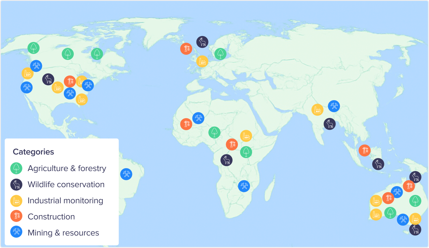
🌾 Inspecting grain facilities
Surveying storage silos and processing plants from above to spot maintenance needs and keep operations running smoothly.
🏗️ Modeling construction sites
Capturing up-to-date site data to create accurate 3D models for progress tracking and project coordination.
🌿 Monitoring land changes
Tracking shifts in landscapes over time to understand human impact and support environmental protection initiatives.
⭐️ Inspecting assets
Capturing detailed aerial imagery of assets like power poles, rooftops, and buildings, then tagging issues and actions for maintenance teams.
🦭Tracking seal populations
Monitoring the movement and numbers of coastal seal colonies to support conservation research and protect marine ecosystems.
🚢 Wharf fender management
Checking the condition and placement of wharf fenders to keep berthing safe, minimize wear on port infrastructure, and guide proactive maintenance at busy marine terminals.
🌳 Tree counting & forest analysis
Measuring forest cover and tree density to inform reforestation programs and biodiversity protection.
A global community of Birdi users
South America: Argentina, Bolivia, Brazil, Chile, Colombia, Ecuador, Paraguay, Peru Caribbean & Territories: Bonaire, French Polynesia