
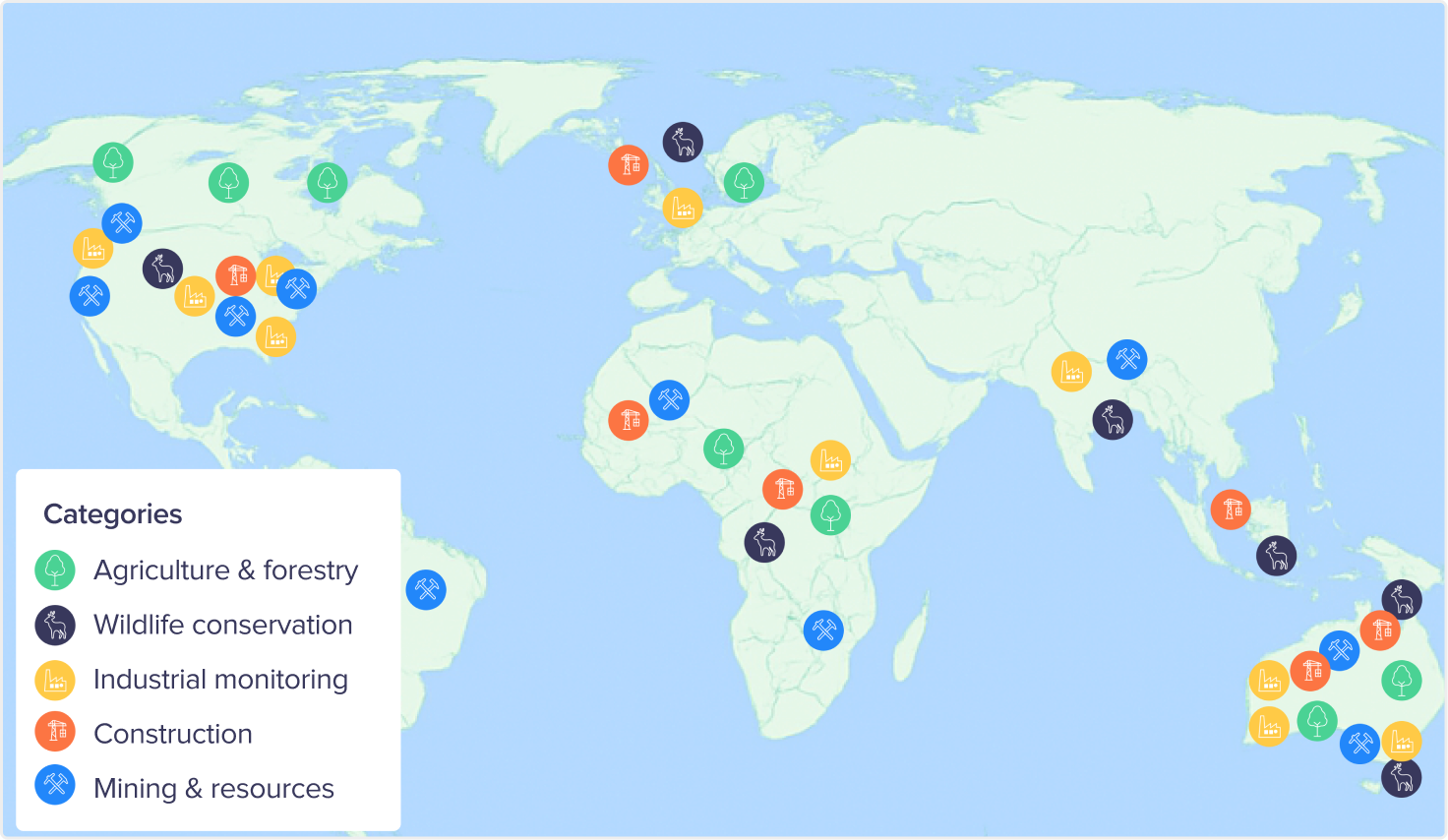
How teams around the world are using Birdi
Birdi use cases worldwide
Here are some of the ways Birdi is being used around the world:
⭐️ Sharing and visualizing geospatial data
Providing a single, accessible place for mapping data, for better collaboration between teams and stakeholders.
⭐️ Building inspections
Assessing structural conditions of buildings and capturing detail for repair planning and safety compliance.
⭐ Working with multiple geospatial files
Teams are streamlining projects by bringing together multiple geospatial files in one place, then sharing and collaborating in real time to keep everyone aligned.
⭐️ Monitoring terrain stability
Analyzing slope changes and ground movement to detect risks early and support safe operations in mining and infrastructure projects.
⭐ Construction progress reporting
Drone-based building inspection for fast, safe, and detailed assessment of roofs, facades, and hard-to-reach areas without the need for scaffolding or manual access.
⭐️ Volumetric reporting of stockpiles
Measuring stockpile volumes with precision to streamline reporting and improve resource management.
⭐ Creating 2D and 3D site maps and models
Producing accurate 2D maps and detailed 3D models that support planning, monitoring, and reporting across projects of every size.
🚜 Mapping farmland
Documenting seasonal changes across agricultural land to guide crop planning and land management decisions.
A global community of Birdi users
South America: Argentina, Bolivia, Brazil, Chile, Colombia, Ecuador, Paraguay, Peru Caribbean & Territories: Bonaire, French Polynesia