
What is tailings dam monitoring?

TL;DR: Tailings dam monitoring is the ongoing tracking of a dam's movement, seepage, and structural condition using tools like piezometers, survey prisms, inclinometers, drones, and satellite radar. It gives mine operators early warning of instability, and it's now a formal requirement — not an option — under global tailings management standards.
Key takeaways:
- Tailings dams hold back the waste slurry left over from processing ore, often for decades after a mine has closed.
- Historical failure rates for tailings dams run far higher than for conventional water-retention dams, which is why monitoring has become a regulatory and industry focus.
- The Global Industry Standard on Tailings Management (GISTM), published in 2020, requires continuous monitoring and independent review for higher-risk facilities.
- Monitoring combines ground-based instruments (piezometers, inclinometers, survey prisms) with remote sensing (drone photogrammetry, InSAR, LiDAR) to catch both slow deformation and sudden change.
- The trend is toward automated, real-time sensor networks feeding a shared dashboard, replacing periodic manual readings that can miss fast-developing problems.
A tailings dam is the embankment that holds back tailings — the fine-grained waste material left over after valuable minerals have been extracted from ore. Unlike a conventional water dam, a tailings dam is usually built and raised in stages over the life of a mine, and it has to keep performing long after the mine itself stops operating. Monitoring it is how operators know whether that embankment is behaving the way it was designed to.
Why tailings dam monitoring matters
Tailings dams fail more often than most people realize, and the consequences when they do are severe. A 2024 review of tailings dam safety monitoring published in Sustainability found that historical failure rates for tailings dams are roughly 100 times higher than the failure rate for conventional water-retention dams (1). High-profile failures — Brumadinho in Brazil (2019) and Mount Polley in Canada (2014) among them — released tens of millions of cubic meters of tailings, caused loss of life, and triggered years of environmental remediation and litigation.
Those events reshaped the regulatory landscape. In 2020, the International Council on Mining and Metals, the UN Environment Programme, and the Principles for Responsible Investment jointly published the Global Industry Standard on Tailings Management (GISTM) — a framework of 15 principles and 77 auditable requirements covering a tailings facility's entire lifecycle, from site selection through closure and post-closure (2). GISTM requires operators to maintain a live knowledge base on each facility's condition, to run regular risk assessments, and to bring in independent technical review boards for facilities classified as "Extreme" or "Very High" consequence. Monitoring data is the evidence base all of that runs on.
What gets monitored on a tailings dam
Monitoring programs generally track a handful of core indicators:
- Movement and deformation — is any part of the embankment or its surrounding slopes shifting, settling, or bulging?
- Seepage and pore water pressure — is water building up inside the dam in ways that weaken it?
- Freeboard and pond level — is there enough distance between the tailings surface and the top of the embankment?
- Structural condition — cracking, erosion, or other visible signs of distress on the dam face.
Different instruments are suited to different indicators, which is why most monitoring programs layer several methods together rather than relying on one.
Ground-based instruments
Piezometers measure pore water pressure inside the embankment — a rise can signal that water isn't draining as designed, which is one of the classic precursors to failure. Inclinometers and tiltmeters track subsurface and surface movement at fixed points. Survey prisms, read by robotic total stations, give precise, repeatable measurements of specific points on the dam face over time, and are one of the longest-established methods for tracking slope stability (3).
These instruments are accurate and can run continuously, but they only tell you about the exact points where they're installed. A dam can be moving somewhere a sensor isn't.
Remote sensing and aerial monitoring
This is where drone photogrammetry, LiDAR, and satellite-based radar (InSAR) fill the gap. Instead of individual points, they capture the entire dam face and surrounding terrain in a single dataset, so a small deformation anywhere on the structure is visible, not just at instrumented points. Regular drone flights over the same dam can be compared over time to flag settling, bulging, or erosion long before it would be visible on the ground, and satellite InSAR can now separate ordinary tailings consolidation from the kind of shear deformation that indicates a developing problem.
The tradeoff is frequency and cost: satellite passes and drone flights are typically weekly, monthly, or quarterly rather than continuous, so they complement fixed ground instruments rather than replacing them.
Learn more: Enhancing tailings dam safety through geospatial data and prism monitoring and 5 ways drone mapping is revolutionizing mining operations
Turning monitoring data into a decision
Collecting the data is only half the job. Piezometer readings, prism surveys, and drone-derived point clouds are typically produced by different tools and often reviewed by different teams — geotechnical engineers, surveyors, site operations — on different schedules. The practical challenge for a lot of mining operations isn't a lack of monitoring data, it's getting that data in front of the right people, in a shared and understandable form, quickly enough to act on it.
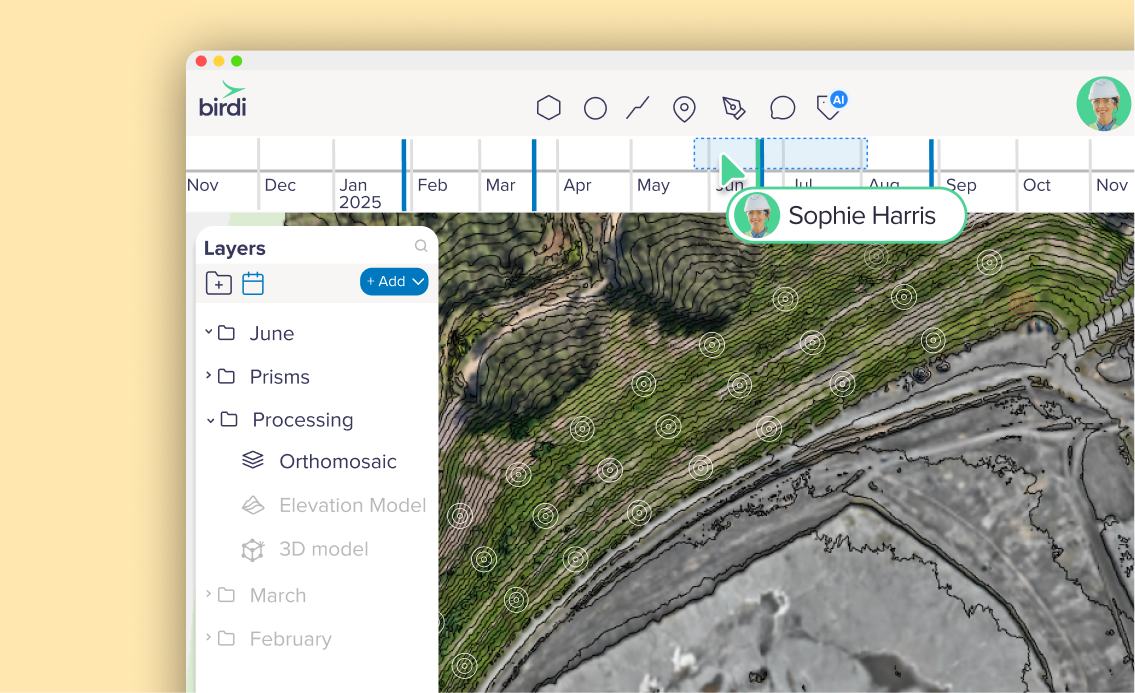
Platforms like Birdi focus on helping teams bring that data together on one map, so a site supervisor and a geotechnical consultant can look at the same drone-derived terrain model, the latest prism readings, and prior surveys side by side, without either of them needing to be a GIS specialist to interpret it. One consulting firm, ATC Williams, used this approach to give both their engineers and their mining clients shared visibility into dam wall condition over time (4). That said, a team whose main need is deep geotechnical modeling or slope stability analysis is generally better served by dedicated geotechnical software — Birdi is built to sit alongside that kind of tool, giving the wider team visibility into the same data, rather than replace it.
Where tailings dam monitoring is headed
The clearest trend is toward automation. Rather than staff manually reading instruments on a set schedule, more facilities are wiring piezometers, tiltmeters, and other sensors into networks that stream data continuously, with software flagging threshold breaches automatically. Drone and satellite data are increasingly processed through machine learning models that can separate normal, expected settlement from the kind of movement that warrants a closer look — cutting down the lag between a change occurring and someone noticing it (1). None of this replaces the judgment of a qualified engineer, but it does mean problems are more likely to surface while there's still time to respond.
Sources
- Wang, C., et al. "A Review of Tailings Dam Safety Monitoring Guidelines and Systems." Sustainability, MDPI, 2024. https://www.mdpi.com/2075-163X/14/6/551
- International Council on Mining and Metals (ICMM), UNEP, and PRI. "Global Industry Standard on Tailings Management." https://www.icmm.com/en-gb/our-principles/tailings/global-industry-standard-on-tailings-management
- ASDSO Dam Safety Toolbox. "O&M of Tailings Dams." https://damtoolbox.org/wiki/O&M_of_Tailings_Dams
- Birdi. "Consultants ATC Williams improve their mining client's dam wall monitoring with Birdi." https://www.birdi.io/blog-post/consultants-atc-williams-improve-their-mining-clients-dam-wall-monitoring-with-birdi