
Meet AI Detect: Automatic object tagging on your images

When you’re managing aerial data, marking up areas of interest can be slow and repetitive. Whether you’re reviewing a drone flight or a set of ground-based images, it often means clicking through photo after photo to label objects one by one.
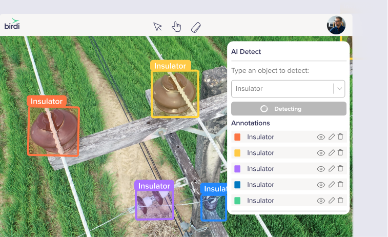
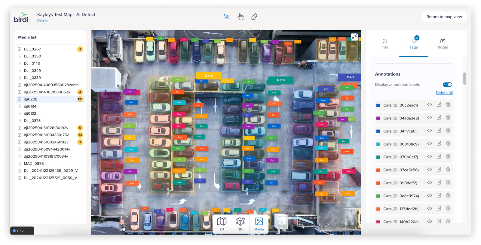
With AI Detect, that process gets a whole lot easier. Instead of manually drawing boxes around everything, you can simply click on an object to detect and tag it automatically, or type in the object you’re looking for (like “vehicle” or “bolt”) and let the AI find instances across the image for you. The result? Faster, more consistent tagging—without the heavy manual lift.
.png)
What is AI Detect?
AI Detect is Birdi’s new object detection tool. Using advanced AI models, it scans your drone and ground-based images, creating tags (bounding boxes with labels) wherever objects are detected. You’re in control of how it works—either by clicking on an item to tag it automatically or by typing in an object name to search and detect it across the image.
Why you’ll love it
- Speed up your mark-ups with AI-assisted tagging, right inside Map View.
- Two simple detection methods: click-based detection or text-based search.
- Fine-tune results with adjustable confidence thresholds.
- Edit or remove tags as needed, keeping full control over your data.
- A handy table view that brings all tags—AI-detected and manual—into one place for easy review.
Use cases and industries
Here are just a few ways teams use AI Detect across industries:
- Utilities & power: detecting bolts, insulators, and cross arms on poles for maintenance planning.
- Construction & infrastructure: identifying vehicles, rubbish, and structural elements during site inspections.
- Mining & geology: recognizing rocks and surface features across sites.
- Facilities & rooftops: detecting windows, HVAC systems, safety hooks, and other rooftop items.
- Environmental monitoring: identifying trees, vegetation, and potential hazards across large areas.
Get started with AI Detect
AI Detect is available now on all paid plans. Upload your imagery, choose your detection method, and let the AI do the tagging for you. From there, you can review, refine, and share the results with your team.
We've also launched Map AI Detect! Read more about it here
Interested in seeing how AI Detect can support your workflows? Book a demo with Birdi today.