
How do you consolidate fragmented geospatial workflows?

TL;DR: Consolidating a fragmented geospatial workflow doesn't mean replacing every specialist tool. It means routing the outputs of those tools — orthomosaics, point clouds, DEMs, inspection data — into one shared environment that non-specialists can access without a GIS background. The fix is a single access layer with clear ownership, not fewer processing tools.
Key takeaways
- According to CARTO's 2026 State of Spatial Analytics Report, most geospatial teams rely on three to eight separate tools, and nearly 30% cite data access and integration delays as their single biggest obstacle.
- Seequent's 7th Geoprofessionals Data Management Report, based on more than 1,000 respondents, found 75% of organizations rate data management as high or critical importance, yet 32% (almost 1 in 3) still lack the information they need to make data-driven decisions.
- A joint Autodesk and FMI study found that poor project data and miscommunication together drive 48% of rework on U.S. construction sites, costing the industry an estimated $31.3 billion a year.
- The average company now runs 101 software applications, according to Okta's 2025 Businesses at Work report — the first time that figure has crossed 100.
- Consolidation works best as an added access layer on top of existing specialist tools, not a wholesale replacement of them.
What does it mean for a geospatial workflow to be fragmented?
A fragmented geospatial workflow is one where the data needed to make a decision exists somewhere in the organization but is split across multiple tools, formats, and teams with no shared point of access. The data isn't missing — it's just scattered.
This looks different at different organizations, but the pattern is consistent. A survey team processes drone captures in Pix4D and stores the outputs on a local drive. A GIS specialist maintains layers in ArcGIS or QGIS that only they can open. Field crews log inspection notes in a separate mobile app. Project managers request PDF exports because they don't have licenses for any of the underlying tools. Each system does its individual job well; none of them talk to each other.
According to CARTO's 2026 State of Spatial Analytics Report, which surveyed more than 200 geospatial, data science, and GIS professionals, most teams now rely on between three and eight separate tools spanning traditional GIS platforms, business intelligence software, and open-source libraries. The report identifies integration — not processing power or analysis capability — as the single biggest bottleneck organizations face, with almost 30% of respondents naming data access and integration delays as their primary obstacle.
How do geospatial workflows become fragmented in the first place?
Fragmentation usually isn't a single bad decision — it's the accumulated result of tools being adopted one project at a time without anyone owning the bigger picture.
Tools are bought to solve immediate problems, not long-term ones. A drone service is commissioned for a survey. A processing license is purchased for a specific project. A mapping tool is adopted by one team because it solved that team's problem at the time. None of these are wrong decisions individually, but none of them were made with an eye to how the outputs would move between teams later.
Specialist formats create natural walls. Orthomosaics, point clouds, GeoTIFFs, and 3D meshes require purpose-built software to open. A spreadsheet or PDF can be viewed by almost anyone; a LAZ point cloud cannot. That difference means spatial outputs default to staying inside the team that produced them, simply because no one else has the software to open them.
Field capture and office processing rarely share an environment. Drone pilots, survey crews, and inspection teams capture data on-site using one set of tools, while processing and analysis happen later in a different system, often managed by a different team. Without a shared environment connecting the two, data has to be manually handed off — usually as a batch of files rather than a live link.
Software gets added faster than it gets retired. Each new project or client requirement tends to bring a new tool rather than a review of whether an existing one could do the job. Over time, the number of active systems grows, but no one revisits the stack as a whole. This mirrors a broader pattern: the average company now runs 101 software applications, according to Okta's 2025 Businesses at Work report, up from under 90 just a few years earlier.
What does a fragmented geospatial workflow actually cost?
The cost shows up as time spent locating and reconciling data rather than acting on it, and as decisions made on outdated or incomplete information because the current version was inaccessible.
Seequent's 7th Geoprofessionals Data Management Report, drawing on more than 1,000 responses from geoscience professionals worldwide, found that 75% of organizations consider data management to be of high or critical importance — yet 32%, almost 1 in 3, say they don't have the information they need to make data-driven decisions. That gap between importance and capability is what fragmentation produces: the data exists, but it isn't usable when it's needed.
The construction sector puts a dollar figure on this. A joint study by Autodesk and FMI found that poor project data and miscommunication together drive 48% of rework on U.S. construction sites — 26% from poor communication and 22% from poor project data — translating to an estimated $31.3 billion in annual rework costs. That figure covers all project data, not just geospatial, but spatial data is disproportionately affected because it requires specialist software to interpret correctly; a misread or outdated site model is a direct path to rework.
There's also a broader, less visible cost: time spent searching rather than producing. McKinsey Global Institute's foundational research on workplace productivity found that the average employee spends about 1.8 hours a day — 9.3 hours a week — searching for and gathering information. Geospatial teams working across disconnected tools are especially exposed to this, since finding "the current version" of a site model or survey often means checking with several people before finding the right file.
What are the signs your geospatial workflow needs consolidating?
The clearest signal is a dependency: if viewing or using spatial data requires asking a specific person or team for a file, export, or report, the workflow is fragmented. Several other patterns tend to appear alongside it.
Multiple versions of the same site model or survey exist across different people's drives, with no reliable way to tell which one is current. Non-technical stakeholders — project managers, executives, operations leads — routinely wait for a PDF report rather than viewing the underlying data themselves. New team members take weeks to learn which of the five different tools holds which piece of information. Drone survey outputs are emailed as file attachments rather than shared through a common environment. Progress reports are assembled manually by stitching together screenshots and exports from multiple systems.
Each of these is a symptom of the same underlying condition: spatial data is being produced across the organization, but there's no single place where it accumulates into a shared, current record.
How do you consolidate a fragmented geospatial workflow?
Consolidation works best as a phased process that adds a shared access layer on top of existing tools, rather than a single cutover that tries to replace everything at once.
Start by mapping what you actually have. List every tool currently used to capture, process, store, or view spatial data, who owns each one, and where its outputs end up. Most teams are surprised by how many systems this turns up. This audit is also where you identify the specific handoff points — the moments where data moves from one team or tool to another — since these are where fragmentation causes the most friction.
Decide what stays specialized and what becomes shared. Processing and analysis tools like Pix4D, ArcGIS, or DroneDeploy are usually doing a job that a shared platform shouldn't try to replace — they require deep functionality that non-specialists don't need. What should move into a shared environment are the outputs of that work: the processed orthomosaics, DEMs, point clouds, and reports that other teams need to view, comment on, or reference. Keep the specialist tools; centralize what they produce.
Pick one authoritative environment for those outputs. This is the step that actually solves fragmentation. Rather than files being emailed, saved to individual drives, or scattered across department folders, every processed output gets uploaded to one shared workspace that anyone with permission can open in a browser. This doesn't require giving everyone GIS training — it requires a viewer that doesn't assume any.
Standardize naming, formats, and access rules before migrating data. A shared environment inherits the chaos of the old one if there's no agreement on how files are named, which formats are accepted, and who has upload rights. Set these rules before moving historical data across, not after.
Migrate incrementally, starting with active projects. Trying to backfill years of historical spatial data into a new system at once is a common reason consolidation efforts stall. Start with current and upcoming projects, prove the workflow works, and backfill historical data on a slower timeline once the new process is established.
Assign clear ownership of the new environment. A consolidated workspace only stays consolidated if someone is responsible for maintaining naming conventions, managing access, and retiring files that are superseded. Without an owner, teams drift back into local copies and side channels within a few months.
What should you look for in a platform to consolidate geospatial workflows?
The core requirement is a shared workspace that non-specialists can actually use — if the consolidated environment still requires GIS training to navigate, the bottleneck has just moved, not disappeared.
Beyond that, look for support for the range of outputs your teams actually produce (orthomosaics, DEMs, point clouds, 3D models, and vector layers) in a single environment; a browser-based viewer that doesn't require installing specialist software; collaboration features like comments and annotations that keep discussion attached to the data itself rather than in a separate email thread; the ability to share specific outputs externally via a link, so clients or auditors can view results without an account; and access controls precise enough to share selectively rather than opening everything to everyone.
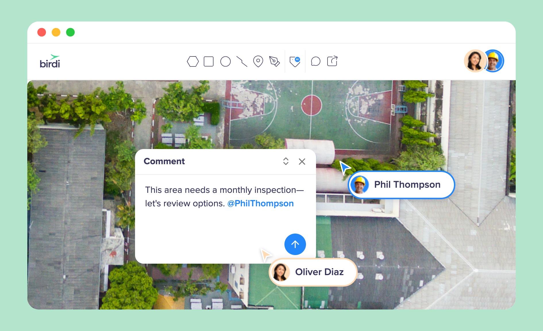
For teams whose fragmentation centers on drone survey outputs specifically — data captured on-site, processed in specialist software, then needed by people who never touch that software — Birdi is built around this exact handoff. Processed outputs from Pix4D, DroneDeploy, or similar tools upload into a shared workspace where non-technical team members can view, compare, and comment on maps directly, and external stakeholders can access specific outputs via a link with no software or account required. It suits teams that want to keep their existing processing tools but stop the manual export-and-email cycle that follows. Organizations that need deep spatial analysis, custom scripting, or a full enterprise GIS suite spanning far beyond geospatial visualization may still need a dedicated GIS platform such as Esri's ArcGIS alongside it — Birdi complements that kind of tool rather than replacing it. You can see the range of supported outputs on the features page.
Whichever platform you choose, the technology only solves half the problem. The habits that created the fragmentation — emailing files, keeping local copies, gating access behind one person — have to change alongside the tooling, or the silo simply re-forms in a new location.
Frequently asked questions
What is a fragmented geospatial workflow?
A fragmented geospatial workflow is one where the data needed to complete a task or make a decision is spread across multiple disconnected tools, formats, and teams rather than accessible from a single shared environment. The data typically exists and is accurate, but reaching it requires asking a specific person or team, converting between formats, or waiting for a manually produced report. It's a distribution and access problem, not usually a data quality problem.
Why do geospatial teams end up using so many different tools?
Geospatial tools tend to be adopted one project or team at a time to solve an immediate problem, without anyone reviewing how the outputs will later need to move between teams. Specialist formats like point clouds and GeoTIFFs also require dedicated software to open, so each new capability — drone processing, GIS analysis, field data collection — often arrives as a separate system rather than a feature of an existing one. According to CARTO's 2026 State of Spatial Analytics Report, most teams end up running between three and eight tools as a result.
Can you consolidate geospatial workflows without replacing existing GIS or processing software?
Yes, and for most teams this is the more practical approach. Processing tools like Pix4D or ArcGIS are usually performing specialized work that a general shared platform isn't built to replace. Consolidation typically works by keeping those tools in place and adding a shared environment where their outputs — the processed maps, models, and reports — are stored and made accessible to non-specialists, rather than trying to fold every function into one system.
How long does it take to consolidate a fragmented geospatial workflow?
Timelines vary with the number of tools and the volume of historical data involved, but most organizations see a working shared environment for active projects within a few weeks once naming conventions and access rules are agreed. Migrating historical data is usually the slower phase and is best done incrementally over months rather than attempted all at once, which is a common reason consolidation efforts stall.
What's the biggest mistake teams make when consolidating geospatial data?
The most common mistake is treating consolidation as a technology purchase rather than a change in habits. Moving to a new shared platform without agreeing on naming conventions, upload ownership, and access rules simply relocates the fragmentation into a new system. According to Seequent's 7th Geoprofessionals Data Management Report, 57% of organizations already cite unmanaged historical data as a challenge — a new platform without governance rules tends to accumulate the same problem over again.
Sources
- CARTO. "Spatial Analytics in 2026: What's Changing?" CARTO Blog, February 5, 2026. https://carto.com/blog/spatial-analytics-in-2026-whats-changing/
- Seequent. "Geoprofessionals Data Management Report, 7th Edition." Seequent, 2026. https://www.seequent.com/community/research-reports/geoprofessionals-data-management-report-7th-edition/
- Autodesk & FMI. "Construction Disconnected." Autodesk, 2018. https://www.autodesk.com/blogs/construction/construction-disconnected-fmi-report/
- Okta. "Businesses at Work 2025: 10 Years of Data Show How Critical Security Has Become." Okta Newsroom, 2025. https://www.okta.com/newsroom/articles/businesses-at-work-2025/
- McKinsey Global Institute. "The Social Economy: Unlocking Value and Productivity Through Social Technologies." McKinsey & Company, 2012. https://www.mckinsey.com/industries/technology-media-and-telecommunications/our-insights/the-social-economy