
Building a single source of truth for construction site data

TL;DR: A single source of truth is one authoritative, shared home for site data — imagery, GIS layers, plans, and progress records — that every stakeholder trusts instead of chasing updates across email, spreadsheets, and site visits. Building one means auditing where data currently lives, choosing a canonical platform, and putting governance in place so it doesn't decay back into another silo.
Key takeaways
- Poor project data and miscommunication cause an estimated $31.3 billion in rework annually in the U.S. construction industry, according to a 2018 FMI/PlanGrid study of nearly 600 construction leaders.
- Construction labor productivity has grown only about 1% a year over the past two decades, compared with 2.8% for the total world economy, per McKinsey Global Institute research.
- Construction companies spend less than 1% of revenue on IT on average — a fraction of what industries like automotive and aerospace invest — which helps explain why site data stays scattered across disconnected tools.
- McKinsey estimates digital transformation efforts, including consolidated data practices, can drive productivity gains of 14–15% and cost reductions of 4–6% on projects.
- A single source of truth doesn't mean one piece of software for everything — it means one authoritative, current version of site data that other tools and teams can reference.
What does "single source of truth" actually mean on a construction site?
On paper, the term sounds abstract. On an active site, it's very concrete: it's the answer to "which version of this is correct?" when three different people have three different files.
A construction project generates data constantly — drone orthomosaics, point clouds, survey files, BIM models, RFIs, daily logs, punch lists, inspection photos, permit documents. A single source of truth doesn't require collapsing all of that into one tool. It means designating one authoritative, current version of the shared site picture (the map, the model, the latest survey) that every other document, conversation, and decision points back to, rather than everyone working from whatever copy happens to be on their laptop or in their inbox.
Without that, teams don't run out of data. They run out of certainty about which data is real.
Why site data ends up scattered in the first place
Data fragmentation on construction sites is rarely a single bad decision — it accumulates. A typical project stack includes GIS and CAD tools for design and surveying, project management software for schedules and RFIs, spreadsheets for tracking whatever the other tools don't cover, and a rotating cast of PDFs, photos, and text threads for field updates. Each tool solves a real problem in isolation, but none of them was built to be the shared reference point for the others.
This is compounded by the fact that construction sites involve people with very different technical backgrounds working from the same underlying reality — site supervisors, project managers, engineers, surveyors, and clients — many of whom were never trained on GIS or CAD software and default to whatever's easiest to share: a screenshot, a text message, a verbal update at a Monday meeting. Learn more about how that visibility gap plays out across sites in How to create operational visibility across multiple sites with geospatial data.
The real cost of fragmented site data
The financial case for consolidating site data isn't theoretical. FMI and PlanGrid's 2018 "Construction Disconnected" report found that poor project data and miscommunication account for roughly 48% of all rework in U.S. construction, adding up to an estimated $31.3 billion a year. The same research traced much of that back to three root causes: erroneous or incorrect project data, difficulty accessing project data, and the inability of stakeholders to easily share information.
Zoom out further and the pattern holds at an industry level. McKinsey Global Institute has documented that construction labor productivity has grown at roughly 1% a year over the past two decades — far behind the 2.8% growth rate of the broader world economy — and points to underinvestment in technology and data as a major contributor, noting that construction firms spend less than 1% of revenue on IT on average. When McKinsey modeled the upside of closing that gap, it estimated digital adoption could unlock productivity gains of 14–15% and cost reductions of 4–6%.
None of that comes from more data. It comes from making the data that already exists trustworthy and easy to reach.
What a single source of truth needs to include
For most construction teams, a workable single source of truth needs to bring together a handful of core layers rather than every tool in the stack:
- Current site conditions — the latest drone imagery, orthomosaics, or point cloud, dated and versioned so nobody is working off an outdated flyover.
- Geospatial context — property boundaries, utility locations, topography, and other GIS layers that give the site meaning beyond a flat image. Learn more about how these layers get used across sectors in GIS mapping in construction, mining, local government and asset maintenance.
- Design and progress data — BIM models, plans, and markups showing what's supposed to be built and what's actually been built so far.
- Field annotations and comments — the running record of issues, questions, and decisions tied to specific locations, rather than buried in a separate email thread.
- Access permissions — clear rules for who can view versus edit each layer, so the source of truth doesn't get overwritten by someone working from stale assumptions.
Start with the problems your team is trying to solve
Before evaluating tools, it's worth mapping where site data currently breaks down. A short audit tends to surface the same few questions on most projects:
Where does site data currently live, and who actually has access to each location? Which decisions get delayed or redone because someone was working from an outdated file? Who needs to view this data but doesn't have the technical background to open a GIS or CAD file directly? How often does the "current" version of the site actually get updated, and who owns making that update happen?
The answers usually point to the same underlying gap: a technical team with the right tools and a non-technical team (or client) without access to them. Closing that gap is less about adding another system and more about giving both groups one place to look.
How to keep a single source of truth from becoming another silo
Centralizing data solves the fragmentation problem on day one. The harder problem is keeping it centralized six months into the project, once the novelty wears off and people drift back to old habits.
A few practices make the difference: assign clear ownership over who updates the source data and how often; set an update cadence tied to real events (a new drone flight, a design revision) rather than an arbitrary schedule; and keep the platform accessible enough that non-technical stakeholders actually use it instead of asking someone to export a PDF for them. A single source of truth that only the GIS team can open isn't really serving the whole project.
Where a collaborative geospatial platform fits in
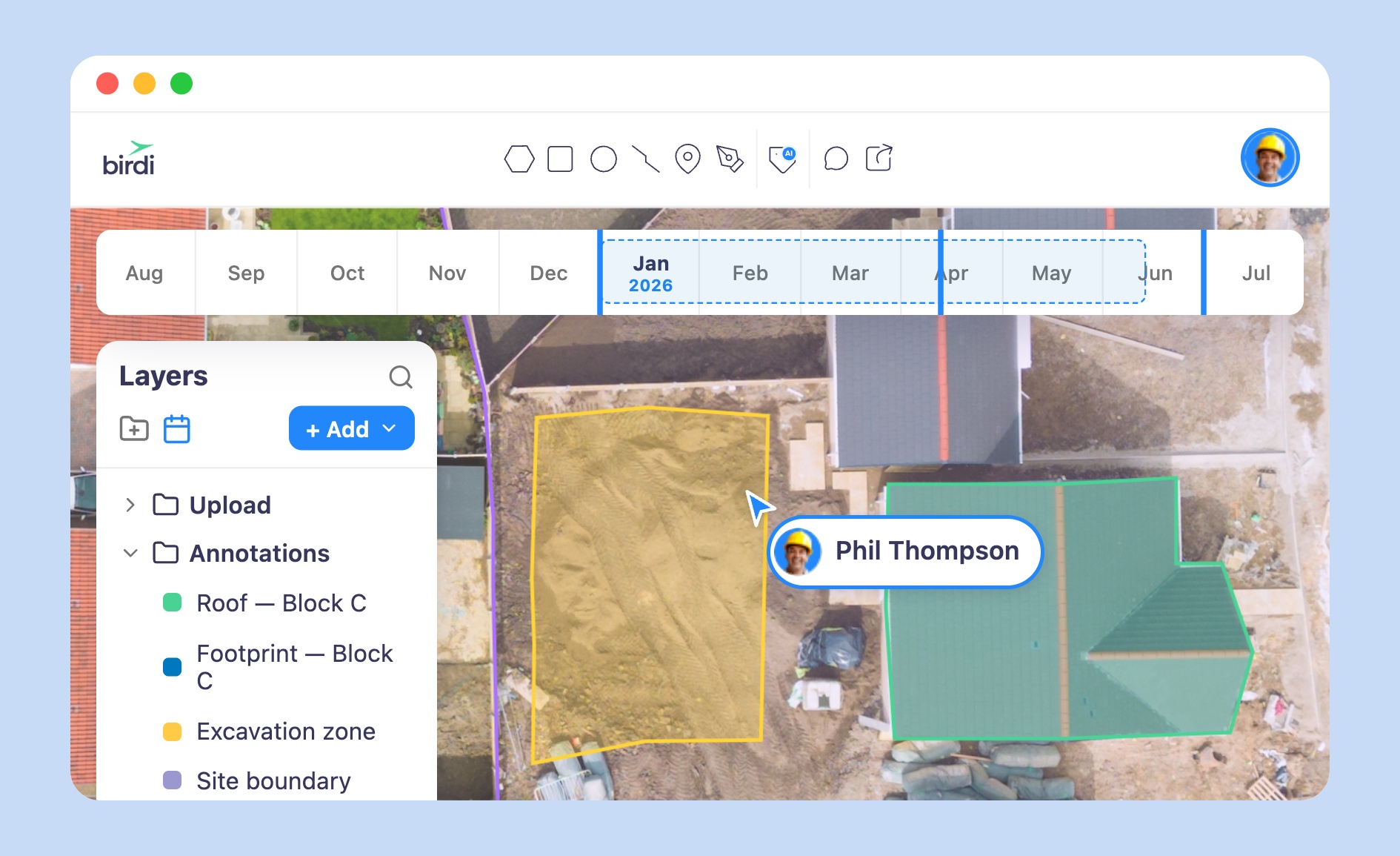
Platforms like Birdi focus on helping teams put the map — not a specific piece of specialized software — at the center of this process, so that drone imagery, GIS layers, and field annotations live in one place that both GIS specialists and non-technical stakeholders can view, comment on, and report from without additional training.
That said, a single source of truth is a fit for the problem it's built to solve. A platform like Birdi is a sensible option for teams that need broad visibility and collaboration across a live site — getting field crews, project managers, and clients looking at the same current map. A team whose main need is deep desktop GIS analysis or CAD-level design work is better served by keeping that work in dedicated GIS/CAD software, and using a shared platform alongside it as the collaborative layer everyone else views. For a closer look at what to weigh when evaluating options, see How to choose the best geospatial software for construction teams.
Sources
- FMI Corporation and PlanGrid, Construction Disconnected, 2018. pg.plangrid.com/rs/572-JSV-775/images/Construction_Disconnected.pdf
- McKinsey Global Institute, Reinventing Construction: A Route to Higher Productivity. mckinsey.com
- McKinsey & Company, Improving Construction Productivity Is the New Imperative. mckinsey.com
- Dodge Data & Analytics, Improving Performance with Project Data SmartMarket Report, 2019. buildingpointmwgc.com