
Basemaps vs orthomosaic maps: what’s the difference (and why it matters)

If you work with spatial data long enough, you’ll eventually run into the question of whether a basemap is enough, or whether you need an orthomosaic. While they can look similar at a glance, they’re created for different purposes. Understanding the difference helps teams choose the right view and get more value from the data they’re already working with.
.png)
Basemaps vs orthomosaic maps
A basemap provides geographic context, such as streets, terrain, or satellite imagery, to help orient and interpret spatial data. An orthomosaic map is a geometrically corrected aerial image created from many photos to represent a specific site in detail. Basemaps help you understand where things are, while orthomosaics help you understand what’s happening on the ground.
What is a basemap?
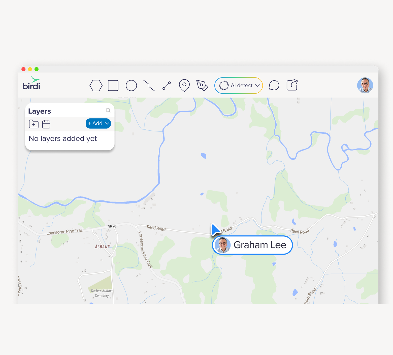
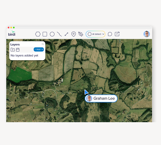
A basemap is the foundational layer of a map. It provides geographic context so other spatial data can be viewed and understood in relation to the real world. Common basemaps include street maps, satellite imagery, terrain layers, and hybrid combinations.
Basemaps are widely used across mapping and GIS workflows to help users orient themselves and interpret spatial information layered on top. They’re especially useful when teams need shared context across locations, projects, or datasets.
In Birdi, users can work with street and satellite basemap layers to provide that context when visualizing uploaded data, models, and analysis outputs. Read more about our street and satellite layers here: Birdi’s base maps: street and satellite layers
Basemaps are commonly used for:
- Understanding the location and surroundings of a site
- Communicating spatial context with stakeholders
- Comparing project data against nearby infrastructure or landscape features
What is an orthomosaic map?
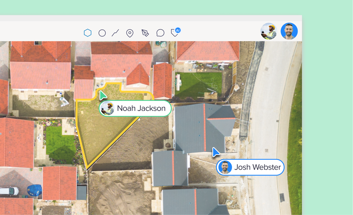
An orthomosaic map is created by stitching together many overlapping aerial images and processing them so the final image represents the area as a single, consistent map. The result is a detailed visual representation of a site at a specific point in time.
One of the key advantages of orthomosaic maps is that they can be captured and generated on demand. Because they’re created from recent aerial imagery, orthomosaics give teams the most up-to-date view of a site. This makes them particularly useful for projects where conditions change regularly, such as construction sites, infrastructure corridors, or operational environments.
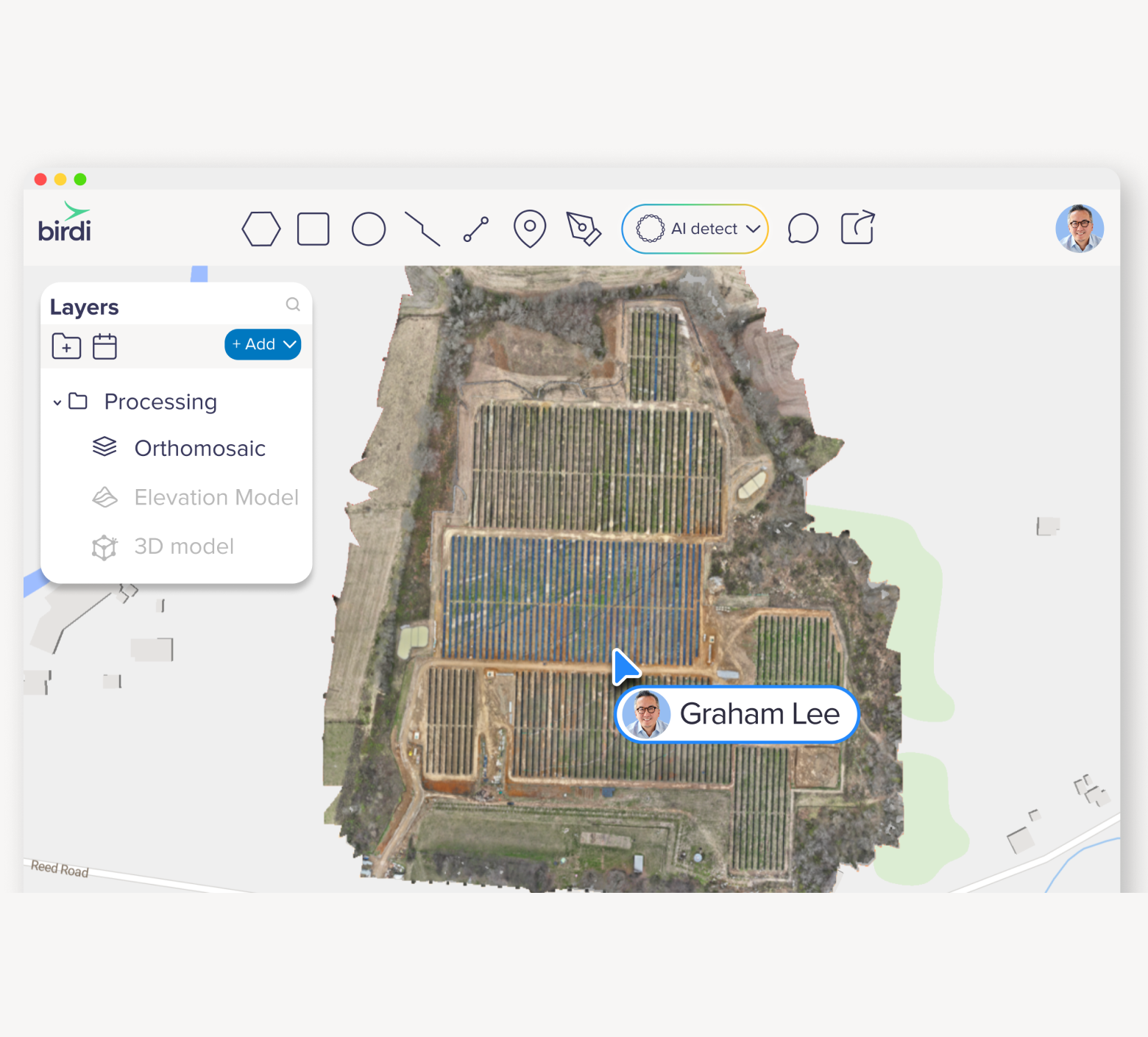
Orthomosaics are commonly generated from drone or aerial imagery and are used across industries to support site understanding, inspections, and change analysis.
Orthomosaic maps are often used for:
- Site reviews and visual inspections
- Tracking changes across time
- Sharing a current, high-resolution view of an area
How basemaps and orthomosaics work together
In practice, basemaps and orthomosaic maps aren’t used in isolation.
A basemap provides the broader geographic picture, helping teams understand where a site sits within its surroundings. An orthomosaic then adds detailed, site-specific information that shows current conditions on the ground.
In Birdi, this combination allows teams to:
- View orthomosaics over familiar street or satellite basemaps
- Switch between basemap types depending on the task
- Add additional reference layers using WMS or WMTS services
If you want to go deeper on that last point, this post explains how WMS and WMTS layers can extend basemap context: Enhancing geospatial analysis with basemap layers and WMS/WMTS links
Using orthomosaics to understand change over time
Because orthomosaic maps can be generated at different points in time, they’re also well suited to comparing how a site changes. Instead of relying on memory, notes, or screenshots, teams can review visual evidence of what’s changed and when.
In Birdi, orthomosaics can be viewed using timeline and split screen views, making it easier to compare site conditions across different dates. This allows teams to visually assess progress, identify changes, and discuss impacts using the same shared reference.
Being able to compare orthomosaics side by side helps turn imagery into insight — especially when multiple stakeholders need to understand what’s happening without digging through files or exports.
___
Ultimately, basemaps and orthomosaic maps aren’t about choosing one over the other. They serve different questions at different stages of a project. Basemaps help teams orient themselves and understand the broader context, while orthomosaics provide a current, detailed view of what’s happening on the ground. When teams can easily move between context, detail, and change over time in a shared workspace, spatial data becomes easier to interpret, discuss, and act on — helping everyone stay aligned as projects evolve.