
Simple, professional geospatial tools for your business
Trusted by small businesses


The geospatial platform built for solo professionals
.png)
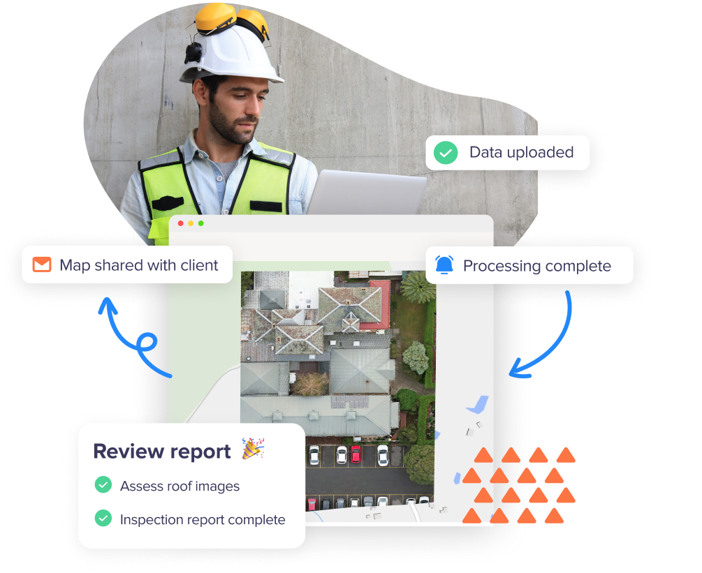
Keep your geospatial data in one place
Stop jumping between folders, email chains, and cloud drives. Birdi gives you a single platform to store, view, and organize your spatial files — so everything is easy to find and ready when you are.

Share work confidently with your clients
Share your work without extra effort. Birdi lets you share interactive maps, add comments, and deliver clean, client-ready outputs — without stitching screenshots or sending clunky files.
Plans for every business size

Annual
Monthly

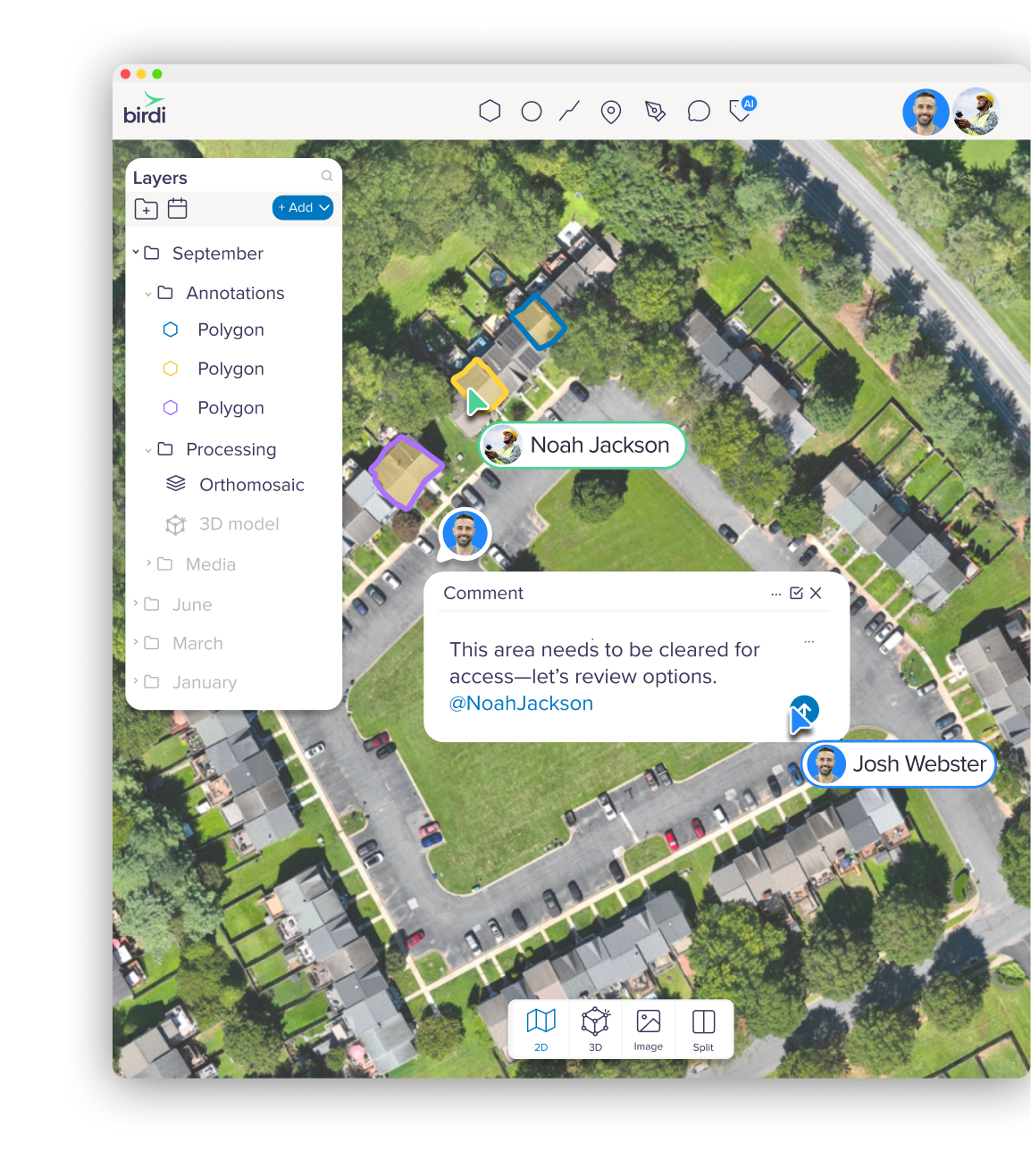
Generate 2D and 3D maps with ease
Whether you're visualizing terrain, tracking site changes, or preparing client-ready outputs, Birdi makes it simple to process the spatial data you need.
Once your included processing is used, switch to pay-as-you-go to keep costs predictable as your business grows.
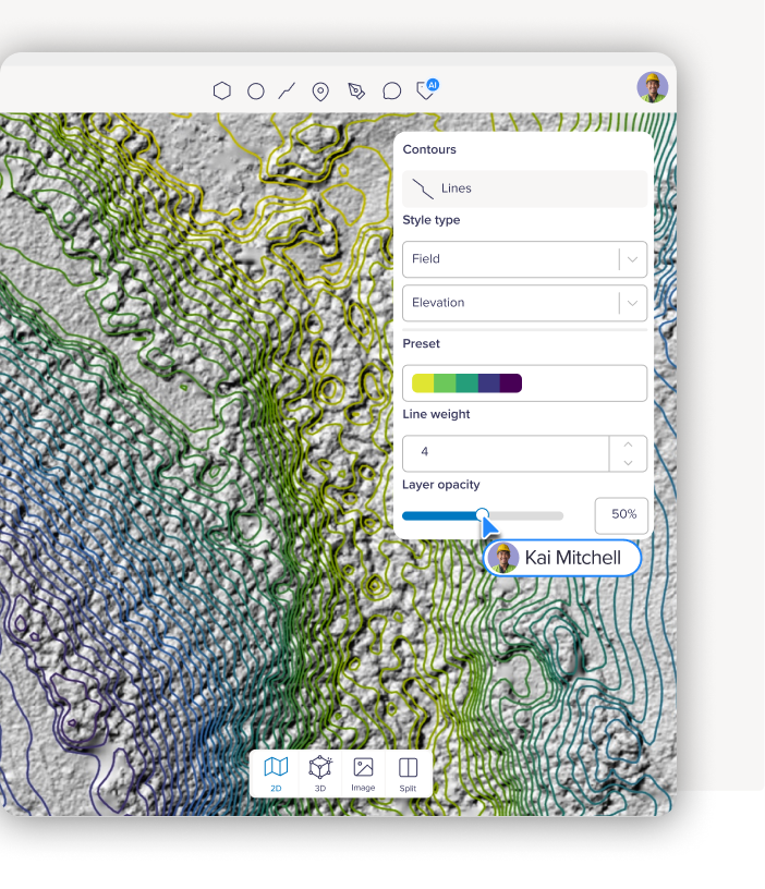
Smarter tools to help you get more done, faster
You don’t have time to wrestle with data. Birdi’s AI-powered tools help you turn imagery into insights quickly, so you can focus on capturing great data and delivering results.
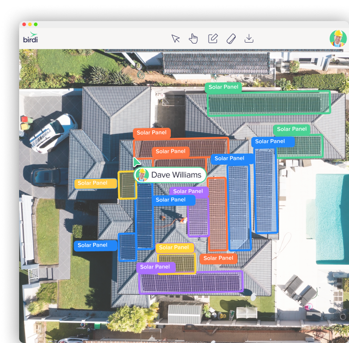
Look polished without the costly overhead
Professional doesn’t have to mean complicated. Birdi helps you present your work with clarity and confidence while keeping your workflow simple and affordable.
What our customers say
Great platform. Easy to use and share ortho images quickly. Is great to be able to pay a small fee per project rather than having to commit to an expensive subscription like many alternatives.
Pademelon Creative
The Birdi platform is fast and responsive. As a small business, budgets are tight, but the Birdi platform is an investment that helps us demonstrate our work and engage with our clients.
Atlas Renewables
Birdi has been instrumental in helping my business grow. It's an easy to use platform that makes delivery of a job effortless.
AV8R