
🇺🇸 Modern GIS mapping software for US teams
.png)
Designed for team collaboration
Birdi is the right fit if...
Your team’s ready to streamline how you work — to move faster, collaborate seamlessly, and get more value from your GIS software without the usual complexity.
You currently have disconnected GIS tools or workflows
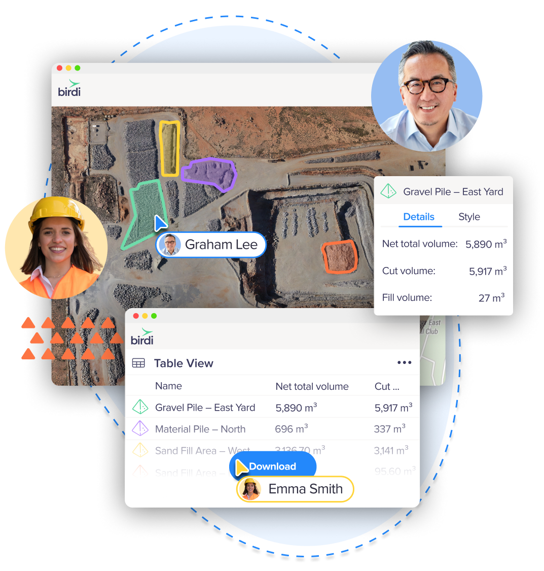
Birdi brings all your GIS tasks into one cloud platform — from data upload to visualization and reporting — so you can stop switching between software and start getting work done faster.
You need to share maps easily
With Birdi, you can share interactive maps or 3D views in just a few clicks, whether it’s with a client, contractor, or team member — no extra licenses or complicated setup required.
You need a single source of truth
Birdi keeps all your project data, annotations, and updates in one secure workspace, ensuring everyone’s working from the same up-to-date information.
You need to share live updates
As soon as new data is processed, Birdi automatically refreshes your visualizations, so stakeholders always see the latest results — no re-uploads or email chains needed.
Trusted by top teams

.png)
.png)
.png)


Powerful geospatial tools, all in one GIS software
From processing to commenting to sharing, Birdi gives you the tools to transform GIS mapping data into decisions — fast, accurate, and collaborative.
.png)
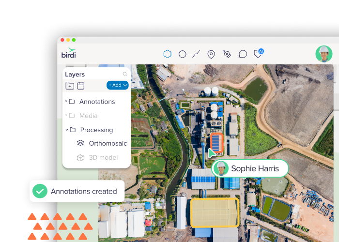
2D and 3D visualization
View orthomosaics, digital elevation models, and high-quality point clouds directly in your browser — no downloads or special software required.
Vector uploads & overlays
Add KML, DXF, or shapefiles to your map to compare plans with reality and keep spatial context front and center.
.png)
Integrations & layer management
Bring in base maps, WMTS layers, or external data sources to customize your GIS view.
Compatible data sets
Upload and visualize common GIS formats like shapefiles, KML, GeoJSON, and DXF for seamless analysis across your projects.
Volume & area measurement tools
Instantly calculate cut, fill, or stockpile volumes and measure surface areas with accuracy you can trust.
AI-powered tools
Leverage intelligent features like object detection, segmentation, and change detection to speed up analysis and uncover insights automatically.
.png)

Collaboration & sharing
Annotate maps, add comments, and share live updates securely with clients or teams.
Centralized project workspaces
Keep all your spatial data, outputs, and updates organised in one secure cloud software.
GIS mapping software for any site, in any industry
Birdi’s flexibility makes it easy to tailor your maps to your world. Whether you’re managing assets, monitoring change, or planning new work, Birdi adapts to how you operate.
Mining
Track earthworks progress and volumes over time. Monitor site changes, calculate stockpile volumes, and share accurate visual reports with project stakeholders — all without needing GIS expertise.
Construction
Keep every project aligned and up to date. Visualisze site progress, overlay design plans, and provide live updates to teams and clients so decisions can be made confidently and on time.
Infrastructure & maintenance
Inspect and maintain assets with precision. Use aerial and ground data to assess construction progress, detect issues early, and maintain a digital record of every asset — improving safety, accuracy, and accountability across projects.
Forestry & environmental management
Manage land use and vegetation health at scale. Analyse terrain, monitor changes over time, and collaborate with stakeholders using clear, data-driven visuals in 2D and 3D.
Government & local councils
Plan, monitor, and report with confidence. Centralise your spatial data, assess public works or environmental projects, and share live, interactive maps with internal teams or the community.
Utilities
Leverage drone and aerial data to identify faults, assess vegetation encroachment, and plan maintenance programs — reducing downtime and keeping critical services running smoothly.

Next-level customer support
At Birdi, support isn’t an afterthought, it’s part of the product. Gone are the days you need to trawl through help docs alone or wait days for an email response. We’re right there on chat, ready to help.