
🇦🇺 Smart GIS mapping platform for Aussie teams
.png)
Built for team collaboration
Birdi is the right fit if...
Your team needs to move quickly, work together easily, and get value from your geospatial data without jumping through hoops.
You’re teams, clients, and stakeholders need to collaborate in real time
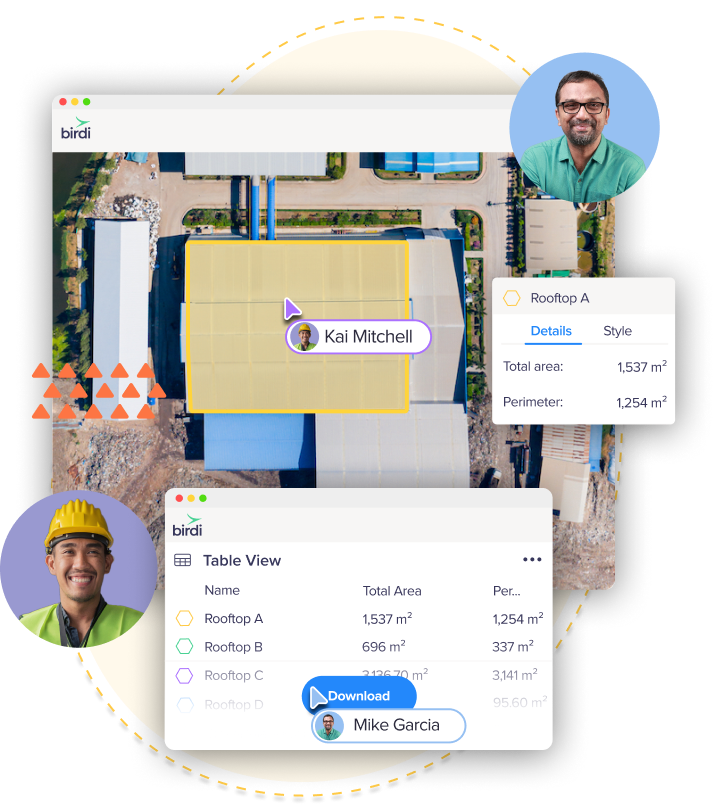
Birdi transforms geospatial data from something static into something shared and actionable. Field teams can upload updates directly from site, clients can comment on specific map areas, and executives can see progress unfold in real time.
You need simplified sharing and visualisation
With Birdi, sharing geospatial outputs is as simple as sharing a link. High-resolution maps and 3D models can be viewed directly in the browser — no plugins or software required.
You’re ready to leave data silos behind
If your team is juggling files across tools, hard drives, and inboxes, Birdi helps you unify it all. Streamline your workflows, improve visibility across projects, and get decisions moving faster — without the usual back and forth.
You like supporting Aussie businesses
Birdi is proudly Australian-owned and built. Our team is right here when you need us — with support in your timezone, from people who understand your industry and how you work.
Trusted by top teams

.png)
.png)
.png)


Everything your team needs — all in one platform
A platform that grows with your organisation
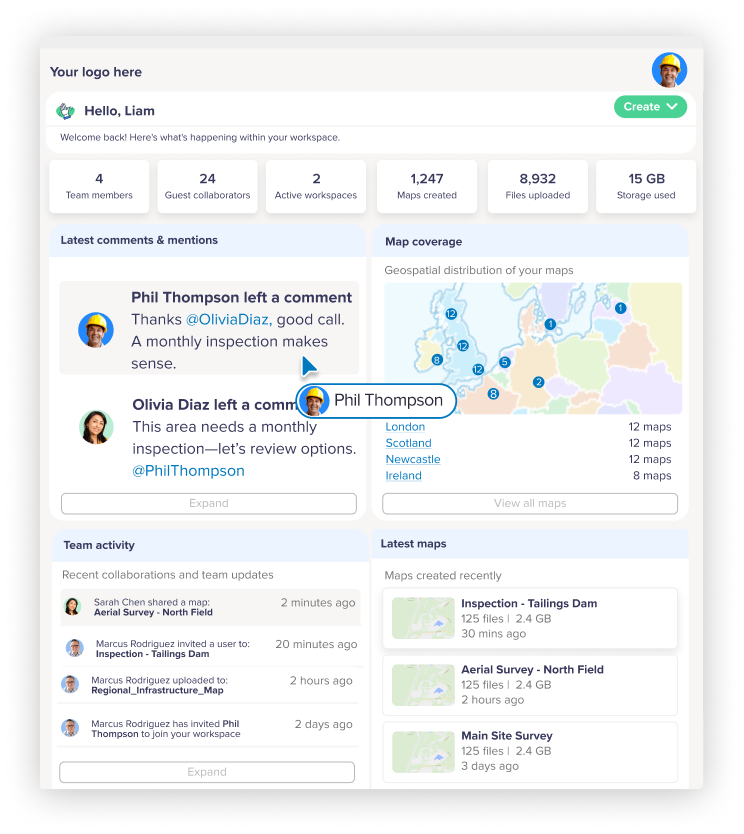
Birdi isn’t just a place to view data — it’s a professional environment for teams, clients, and stakeholders to collaborate securely and consistently. Whether you’re a small team stepping up from manual mapping or a large organisation managing complex sites, Birdi scales with you.
Key features

Powerful GIS mapping capabilities — without the complexity
Birdi puts advanced GIS tools in a user-friendly interface that anyone on your team can master. No installs, no steep learning curve — just intuitive, cloud-based mapping designed to help you work smarter.
Key features

.png)
Actionable insights and easy reports
Make your site data work harder for you with built-in reporting and export tools that turn insights into action.
Key features
GIS mapping software for any site, in any industry
Birdi’s flexibility makes it easy to tailor your maps to your world. Whether you’re managing assets, monitoring change, or planning new work, Birdi adapts to how you operate.
Mining
Track earthworks progress and volumes over time. Monitor site changes, calculate stockpile volumes, and share accurate visual reports with project stakeholders — all without needing GIS expertise.
Construction
Keep every project aligned and up to date. Visualise site progress, overlay design plans, and provide live updates to teams and clients so decisions can be made confidently and on time.
Infrastructure & maintenance
Inspect and maintain assets with precision. Use aerial and ground data to assess construction progress, detect issues early, and maintain a digital record of every asset — improving safety, accuracy, and accountability across projects.
Forestry & environmental management
Manage land use and vegetation health at scale. Analyse terrain, monitor changes over time, and collaborate with stakeholders using clear, data-driven visuals in 2D and 3D.
Government & local councils
Plan, monitor, and report with confidence. Centralise your spatial data, assess public works or environmental projects, and share live, interactive maps with internal teams or the community.
Utilities
Leverage drone and aerial data to identify faults, assess vegetation encroachment, and plan maintenance programs — reducing downtime and keeping critical services running smoothly.

Next-level, local customer support
At Birdi, support isn’t an afterthought, it’s part of the product. Gone are the days you need to trawl through help docs alone or wait days for an email response. We’re right there on chat, ready to help, and we're based here in Australia.