
Collaboration has become the heartbeat of how teams work today. From design tools to project management platforms, the expectation is that information should be easy to share, comment on, and build upon together. Mapping software is no different. As industries become more data-driven and reliant on geospatial insights, the future lies in platforms that don’t just process maps—but bring people together around them.
.png)
What is collaborative mapping software?
Collaborative mapping software enables teams to upload, process, and visualize geospatial data, while also working together directly on maps. Instead of static files passed around via email, everyone can access the same up-to-date version, leave comments and annotations, and share insights in real time.
Why collaboration is the natural next step
Traditional GIS and mapping tools were powerful, but they were often locked away on individual desktops. Maps were exported as images, emailed around, and gradually pieced together again with scattered comments. It worked, but it didn’t reflect how modern teams prefer to operate.
As geospatial data becomes richer — combining drone imagery, LiDAR, and satellite outputs — and as more stakeholders contribute to projects, the limitations of that approach are clear. A better way forward is to treat maps as shared workspaces, with collaboration happening in context.
The features driving this shift
The next wave of mapping platforms is being designed around collaboration. Instead of separate notes and offline conversations, feedback and decisions are tied directly to the data.
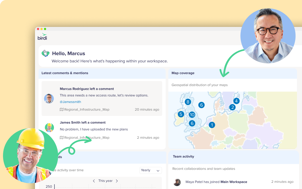
At Birdi, our recent release of map commenting is an example of how this shift takes shape. Comments can be placed anywhere on a map, tagged to specific team members, and tracked in a single notification panel. Discussions stay with the data, so teams can review, respond, and move forward without losing context.
Where collaboration is already making a difference
Across industries, collaborative mapping is changing workflows:
- In mining, shared platforms keep volumetric reporting and terrain monitoring aligned across teams.
- For utilities, inspection results are centralized so field crews and office managers are always working from the same view.
- In construction, project managers can open a live map and walk stakeholders through progress without relying on multiple exports.
- In government and planning, teams coordinate more efficiently on projects such as transport corridors or environmental monitoring.
The addition of tools like map commenting strengthens these workflows further by making it possible to hold discussions directly on the map, rather than in disconnected channels.
___
Collaborative features are transforming the value of geospatial data. Instead of maps being static outputs, they are becoming dynamic workspaces where decisions are made in context. With tools like map commenting, teams reduce time spent clarifying details and increase the time spent acting on insights.
And Birdi, the collaborative geospatial platform, is excited to be leading the way!
