
From data to decisions: Making geospatial collaboration work

When decisions involve both spatial data and on-the-ground context, things can get tricky. A report gets sent around, but no one’s quite sure what to do with it. Or a map highlights a risk, but the decision-maker doesn’t see it until days later—if at all.
The issue usually isn’t the data. It’s the disconnect between the people who understand it deeply, and the people responsible for acting on it.
Different roles, shared outcomes
Technical teams—like GIS analysts or spatial specialists—know how to process the data. They’re across formats, projections, elevation models, and accuracy. They understand what the data is saying.
Non-technical teams—like project managers, asset owners, or operations leads—know the site. They bring context, priorities, and a sense of what’s realistic. They understand what’s needed.
Good decisions often rely on both. But when those groups aren’t aligned—or can’t easily work together—that’s where things fall apart.
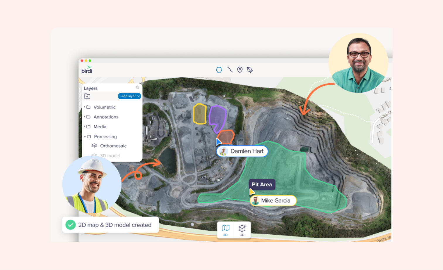
What better collaboration looks like
When everyone can view and interact with the same map, it’s easier to stay aligned.
Maybe that means being able to leave a comment on an image that shows an area of concern. Or comparing a recent dataset to a previous one to check for changes. Or just knowing that the latest version is already uploaded and ready to view.
That kind of visibility removes a lot of friction. Technical users don’t need to translate everything into screenshots and summaries. Non-technical users don’t need to wait for someone to walk them through it.
Everyone moves faster, with more confidence.
An example
Let’s say you’re tracking terrain movement at a site. The spatial team uploads a digital surface model. An engineer notices a shift and adds a note to the relevant image. The project manager cross-checks it with inspection photos from the week before. The team agrees it’s worth a closer look.
No long email chains, no rework, no delays.
A few things that help
- Visual tools everyone can use – so teams don’t need extra software or training
- Centralized data – so there’s no confusion over which file is the latest
- Lightweight collaboration – so feedback doesn’t get buried in inboxes
And that’s what Birdi excels at. We don’t replace your advanced technical GIS tools. We’re the centralized platform where your entire team and the data lives, so everyone can access the latest information and insights. Rather than teams working off disparate systems, Birdi is like your central source of truth.
What’s more, our updated dashboard gives teams a quick pulse-check on what’s happening within their organization, and how your team is collaborating together.
Decisions improve when people connect
You don’t need everyone to be a data expert. But you do need a shared understanding of what the data shows—and what it means for the task at hand.
Making that easier is one of the most valuable things a platform can do.