
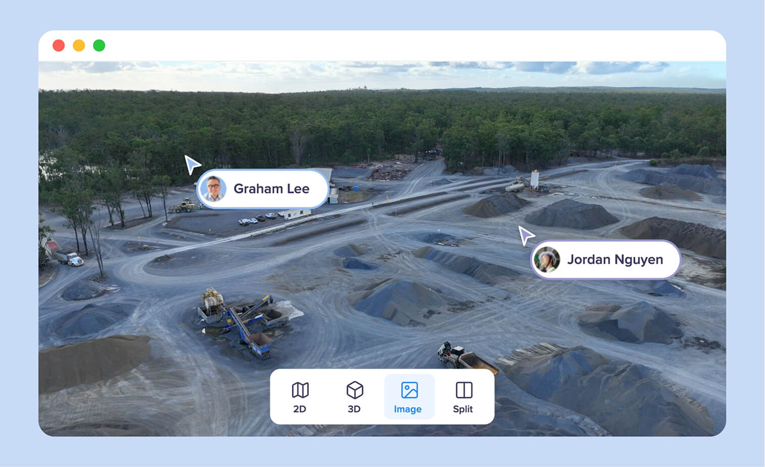
TL;DR: OpenSpace and Birdi (birdi.io) track construction progress from different vantage points. OpenSpace is built around 360 walkthroughs inside the building, mapped to drawings, with drone data added through OpenSpace Air. Birdi is built around one site-wide map for drone, 360, point cloud and design data, compared by date and shared with people outside the paid team.
Key takeaways
- They answer different questions. OpenSpace shows what is installed on each floor, and Birdi shows what has changed across the whole site.
- OpenSpace wins on integrations. It offers two-way sync with Procore and Autodesk issues; Birdi has no Procore or Autodesk integration.
- OpenSpace sells verified progress tracking. Its Track add-on reports percent complete by trade, floor and zone, reviewed by people as well as AI. In Birdi, the user makes the comparison.
- Progress is the main reason builders fly. According to the Associated Builders and Contractors, 80.8% of member contractors who use drones fly them for site progress monitoring.
- Only Birdi publishes a price. OpenSpace prices by annual construction volume, while Birdi publishes Growth at $287 a month and quotes Ultimate.
What is the difference between Birdi and OpenSpace?
OpenSpace is a 360 reality capture platform: an engineer walks the building with a helmet camera, and the footage lands on the floor plan automatically. Birdi is a geospatial workspace, with drone maps, point clouds, 360 photos and design overlays in one site map. So OpenSpace sees inside the building, and Birdi sees the whole site.
That difference in vantage point decides most of the comparison, and drones already cover the outside view on many sites. According to the Associated Builders and Contractors' 2026 report, 36.1% of member contractors now fly drones on jobsites. On a multi-story fit-out, the questions are about each floor and each trade, which a walkthrough answers well. On a civil job, a subdivision or the structure and grounds of a large build, the questions are about the site as a whole, which a drone map answers well. Every fact below was checked on each vendor's own site or help center on September 24, 2026.
How do Birdi and OpenSpace compare, row by row?
| Birdi | OpenSpace | |
|---|---|---|
| Built around | One site-wide map for every data type | 360 walkthroughs mapped to drawings |
| Capture | Any drone, 360 camera or scanner output you upload | 360 camera, smartphone, drone (OpenSpace Air), laser scanner |
| Drawings and BIM | DXF design overlays on the map | Floor plans and BIM coordination |
| Comparing dates | Timeline, split screen and difference grids | Walkthroughs on the floor plan, by capture date |
| Progress tracking | The user compares and measures; no automatic tracking | Track add-on: percent complete by trade, floor and zone |
| Data types in one view | Drone maps, point clouds, 360 photos, video, PDFs, DXF | 360 walks, photos, drone maps, laser scans |
| Outside access | Guests use no seat; no-login map links | Not documented on its pricing page |
| Integrations | DJI FlightHub 2, Google, SSO | Procore and Autodesk (two-way), Revizto |
| Reports | Annotation and media PDF reports | Progress reports from Track |
| Published price | $287 a month for Growth, billed annually; Ultimate by quote | By annual construction volume |
Do you need 360 walkthroughs, drone maps, or both?
Most larger projects benefit from both, at different stages. Drone maps suit earthworks, structure, roofs, grounds and the site as a whole, especially early in a job. 360 walkthroughs suit interiors, services and fit-out, once the building is enclosed. The choice of platform depends on which of those your team reports on most.
When 360 walkthroughs matter most
360 walkthroughs matter most once the work moves indoors. A drone cannot see a ceiling void or a riser, but a walk down each corridor records every service before it is closed up. OpenSpace is built for exactly that. According to OpenSpace, a site engineer can document 25,000 square feet in about 10 minutes, with the capture viewable in about 15.
When drone maps matter most
Drone maps matter most outdoors and at scale. A single flight covers the whole site at once, so it shows earthworks, laydown areas, access and the structure from above, measured and in real coordinates. That is the view an owner, a civil engineer or a head contractor's project manager usually asks for first. For more on that workflow, see our guide to drone progress reports.
Can one platform hold both?
Yes, with different emphasis. OpenSpace adds drone data through OpenSpace Air, which is included with an OpenSpace Capture subscription and processes imagery from any drone. Birdi brings 360 photos into the same map as its drone data. Neither vendor claims to be as strong in the other's home ground.
How does each track progress over time?
OpenSpace tracks progress against the schedule. Its Track add-on reports percent complete by trade, floor and zone, and OpenSpace says the results are reviewed by people as well as AI. Birdi tracks change on the map: you step through captures by date, compare two dates side by side, or measure the change in elevation between two surveys.
In OpenSpace
Each walkthrough is placed on the floor plan, so the same spot can be viewed on any date. OpenSpace Track then turns captures into percent complete, which feeds a progress claim or a schedule review. According to DroneDeploy's comparison page and Contractor ToolStack's review, that tracking uses human review through Disperse, which OpenSpace acquired in October 2025, with results in about a day.
In Birdi
Birdi groups every capture of a location into a site, in date order. Timeline filters the map to a date range, and split screen puts two maps side by side with a slider. A difference grid, on Growth and Ultimate, subtracts one surface from another and colors the change, so cut, fill and new structure show at a glance. The user makes the comparison: Birdi does not produce automatic progress reports. The result goes to the owner as a branded PDF report or a view-only link. Our guide to drones in progress reporting covers the wider approach.
What do OpenSpace users say?
OpenSpace's users praise how simple capture is, and its app reviews raise recording and upload problems. On the App Store, its capture app holds 3.8 from 46 ratings; 5 of the 12 most recent reviews praise its simplicity, and 6 describe recordings or uploads failing. G2 summaries rate it 4.5 from 14 reviews.
What they like. Reviewers describe it as simple, fast and easy to learn. One 2025 reviewer wrote: "OpenSpace has been used on my last 2 projects and I don't plan to build another building without them." G2's summary praises ease of setup and how sequenced captures make progress reports easier.
What they raise. The most repeated complaint is about the capture app. An August 2026 reviewer said the app "will not end my video or says it was corrupted." Others, in 2025, describe a "Done" button failing across several walks, and capture errors that misalign sheets and video. Contractor ToolStack's May 2026 review documents the same recording problem on long walks.
Birdi. Birdi has 5 reviews on Capterra, all rated 5, which is too few to show a pattern. The complaints that appear are small bugs when switching between 2D, 3D and media views. The review pools on both sides are small, so read them as individual experiences. We could not read Reddit or G2's full review pages.
When should you choose OpenSpace, and when Birdi?
Choose OpenSpace when progress means what is installed inside the building, and you want percent complete by trade and two-way sync with Procore or Autodesk. Choose Birdi when progress means what has changed across the site, and the result has to reach owners, consultants and managers who never open a construction app.
In more detail:
- Commercial building, fit-out and services, run in Procore or Autodesk: OpenSpace.
- Billing-grade percent complete against the schedule: OpenSpace, with Track.
- Civil works, subdivisions and large sites seen from above: Birdi.
- Drone, 360 and design data in one map for a mixed team: Birdi, on construction sites of any type.
- Both inside and outside on the same project: either can hold both; choose by where most of your reporting sits.
For a wider set of options, see our guide to construction progress reporting software.
Frequently asked questions
What is OpenSpace used for in construction?
OpenSpace is used to capture 360 walkthroughs of a building under construction and place them on the floor plan automatically. Teams use it to document work before it is covered, track issues, coordinate with BIM and, with its Track add-on, report percent complete by trade, floor and zone.
Does OpenSpace support drone data?
Yes. OpenSpace Air takes images from any drone and produces orthomosaics, 3D meshes and point clouds, and it is included with an OpenSpace Capture subscription. DroneDeploy's comparison page says OpenSpace's aerial workflow lacks ground control and accuracy checks, so check that point for survey work.
Can I combine 360 photos and drone maps?
Yes. Birdi places 360 photos in the same map as drone orthomosaics, point clouds and design overlays, so a viewer can move from the site overview to a photo at ground level. OpenSpace adds drone maps to its 360 walkthroughs through OpenSpace Air.
Which is better for exterior progress, 360 or drone?
Drone maps are usually better outside. One flight covers the whole site, measured and in real coordinates, which suits earthworks, structure, roofs and grounds. 360 walkthroughs are better inside, where a drone cannot see services, ceilings and fit-out. Many large projects use both.
Does OpenSpace integrate with Procore?
Yes. OpenSpace offers two-way sync with Procore punch items and observations, and two-way sync with Autodesk issues, according to its own comparison page. Birdi has no Procore or Autodesk integration, so teams that run their project in either tool will find OpenSpace fits more directly.
About the author
This comparison was written by the Birdi team. Birdi (birdi.io) is a geospatial AI workspace that construction and mining teams use to share drone, 360 and design data in one map. We checked every product fact against each vendor's own site or help center on September 24, 2026, and counted the reviews ourselves.
Related reading
- Drone and 360 platforms: platforms that show every data type in one place.
- Managing construction site data: keeping site data usable across a project team.
- 360 photos and site understanding: what 360 photos add to a drone map.
- Choosing construction geospatial software: the wider buying decision.
Sources
Research and reviews
- Associated Builders and Contractors. "ABC Report: 36% of Contractor Members Utilize Drones on Jobsites." August 17, 2026. https://www.abc.org/News-Media/News-Releases/abc-report-36-of-contractor-members-utilize-drones-on-jobsites
- Contractor ToolStack. "OpenSpace Review 2026: 360° Walks + Disperse-Verified Progress." May 2026. https://contractortoolstack.com/software/openspace/
- Apple App Store. "OpenSpace.ai Construction App" ratings and most recent US reviews. Read September 24, 2026. https://apps.apple.com/us/app/id1390396977
- G2 (search snippet only) and Capterra. OpenSpace reviews. Read September 24, 2026. https://www.g2.com/products/openspace/reviews · https://www.capterra.com/p/191822/OpenSpace/reviews/
- Capterra. Birdi reviews (5). Read September 21, 2026. https://www.capterra.com/p/10026509/Birdi/reviews/
OpenSpace
- OpenSpace. "OpenSpace vs DroneDeploy," "OpenSpace Air" and "Pricing." Checked September 24, 2026. https://www.openspace.ai/openspace-vs-dronedeploy/ · https://www.openspace.ai/products/air/ · https://www.openspace.ai/pricing/
- DroneDeploy. "DroneDeploy vs OpenSpace." Checked September 24, 2026. https://www.dronedeploy.com/compare/dronedeploy-vs-openspace
Birdi
- Birdi. "Pricing." Checked September 24, 2026. https://www.birdi.io/pricing
- Birdi Help Center. "What file types are supported in Birdi 2.0?"; "Timeline view"; "Split Screen view"; "Difference grids"; "How to use Sites"; "Media PDF report"; "Annotation report"; "User seats, roles and permissions." https://help.birdi.io/en/articles/10416278 · /12273497 · /12336059 · /16726906 · /16767430 · /12421777 · /15867195 · /11091551
The review pools are small. Reddit and G2's full review pages could not be read for this comparison.
