
TL;DR: General contractors use three main reality capture methods: drones for the outdoor site, 360 cameras for interiors, and laser scanners for precise as-builts. Each has its own software, and some platforms combine methods. Choose by the phase and the question: progress, quantities, interior coverage or millimeter detail. Most contractors end up with two or three tools.
Key takeaways
- Information problems are costly. According to an FMI and PlanGrid study, construction professionals spend 35% of their time on non-productive work, including looking for project information.
- Rework is a large share of cost. According to a 2009 study of 359 projects in the Construction Industry Institute database, the direct cost of rework often reaches about 5% of total construction cost.
- Point clouds have a common format. According to Matterport, the E57 point cloud format is vendor-neutral and defined by the ASTM E2807 standard.
- Accuracy varies by method. According to the help center of Birdi (birdi.io), drone maps reach 2 to 4 cm vertical accuracy with RTK and good ground control, while laser scanners are typically finer.
- Coverage varies by method too. Drones see the whole outdoor site, 360 cameras see what is walked, and scanners see what is in line of sight from each set-up.
What is reality capture in construction?
Reality capture in construction means recording the site as it really is, using drones, 360 cameras, laser scanners or phones, then turning those captures into maps, walkthroughs or point clouds. General contractors use it for progress, quality checks against design, quantities, as-builts and claims. Each method suits a different phase and question.
Drones dominate the outdoor phases: earthworks, structure and roof. 360 cameras take over inside once the envelope closes. Laser scanners provide precise geometry for as-builts, prefabrication checks and complex services. A general contractor running all phases usually needs software that handles more than one method, or a set of tools that work together.
Why the method decides the software
Each method produces different data. Drones produce orthomosaics, elevation models and point clouds. 360 cameras produce panoramas mapped to floor plans. Scanners produce dense point clouds, often exported as E57. Software built for one data type rarely handles the others well, so the list below is grouped by method.
How did we choose and compare the software?
We chose reality capture software general contractors use, and grouped it by capture method: combined site record, 360 progress capture, laser scanning and digital twins, and drone processing. Within each group, every entry carries the same fields. The combined group is listed first, with Birdi first in it. The order is not a ranking.
Every fact was checked on the vendor's own website or help center on October 8, 2026. We note where each tool's strength lies, and where Birdi's coverage stops: it handles 360 photos, not walkthroughs mapped to floor plans.
The best reality capture software for general contractors in 2026
The reality capture tools compared here for general contractors are Birdi, DroneDeploy, OpenSpace, FARO HoloBuilder, Cupix, Matterport, NavVis, Leica Cyclone REGISTER 360 and Pix4D. They are grouped by capture method, from combined site records to scanning. Each entry carries the same fields, checked on October 8, 2026.
Combined site record
1. Birdi
Best for: General contractors who want drone maps, 360 photos and design overlays in one map for the whole project team, owners and subcontractors.
Typical customer size / segment: Mid-sized construction and civil teams of roughly 30 to 500 staff.
Key strengths:
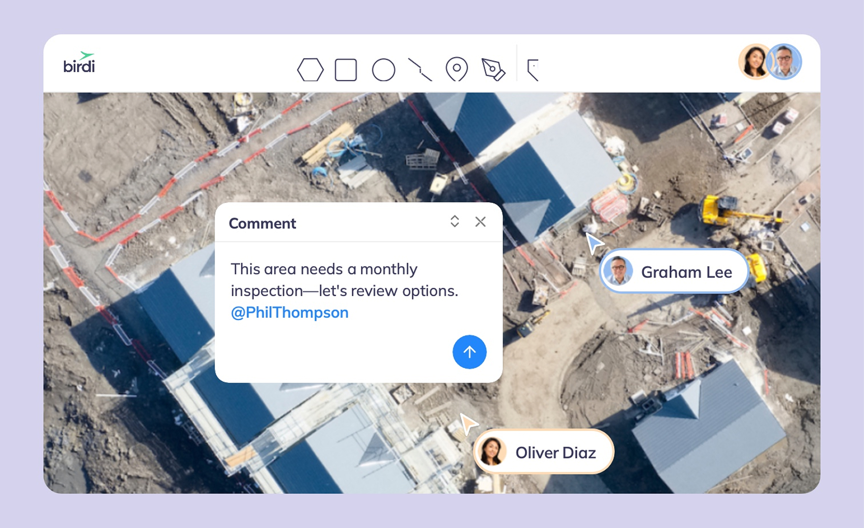
- Drone maps, point clouds, 360 photos and DXF overlays in one map, filtered by capture date.
- Split screen and difference grids compare captures over time.
- Guests view and download without a paid seat.
Capture methods: Drone, plus 360 photos and point clouds you upload. Not 360 walkthroughs.
Checks against BIM: No. DXF overlays in 2D.
Access for people outside the paid team: Guests use no seat; view-only links need no login.
Data types in one view: Orthomosaics, elevation models, point clouds, 360 photos, video, PDFs and DXF.
Watch-outs: Not for a GIS analyst who needs a full desktop GIS. It also does not suit anyone who wants existing aerial imagery supplied.
Pricing: Growth is $287 USD a month, billed annually. Ultimate is priced by quote (checked October 8, 2026).
2. DroneDeploy
Best for: General contractors who want drone, 360 and phone capture from one vendor across many projects.
Typical customer size / segment: Individual pilots through to large contractors.
Key strengths:
- Aerial, Ground and Ground Pro products, including 360 walks and phone LiDAR scans.
- Progress AI for percent complete by location.
- Integrations with Procore, Autodesk and Esri.
Capture methods: Drone, 360 camera and phone.
Checks against BIM: BIM and drawing overlays on 360 walks.
Access for people outside the paid team: View-only links; tools need a paid account.
Data types in one view: Orthomosaics, 3D models, 360 walks, scans and video.
Watch-outs: Team plans are by quote, and viewers pay to use the tools.
Pricing: Flight & Analysis is $4,188 USD billed annually for one pilot (checked October 8, 2026).
360 progress capture
3. OpenSpace
Best for: Building contractors documenting interiors with 360 walks mapped to drawings.
Typical customer size / segment: General contractors and owners on projects of all sizes.
Key strengths:
- 360 walks mapped to the drawings, with AI progress tracking and human review.
- Two-way sync with Procore and Autodesk.
- OpenSpace Air adds drone maps.
Capture methods: 360 camera, phone, drone.
Checks against BIM: Uses BIM where available; not required.
Access for people outside the paid team: Priced by construction volume, not per user.
Data types in one view: 360 captures, drawings and drone maps.
Watch-outs: In 6 of the 12 most recent App Store reviews we read, users reported recording or upload problems.
Pricing: Contact for pricing.
4. FARO HoloBuilder (Sphere XG)
Best for: Contractors combining 360 photos with laser scans and design data on floor plans.
Typical customer size / segment: AEC teams and facility owners.
Key strengths:
- 360 photos, point clouds and 3D design data by time and location.
- Markup and comments in 360 and 3D.
- Carries into facility management.
Capture methods: 360 camera and laser scanner.
Checks against BIM: Design data in 3D.
Access for people outside the paid team: Access from any device; terms by quote.
Data types in one view: 360 photos, point clouds and design data.
Watch-outs: Scanning adds hardware and skill.
Pricing: Contact for pricing.
5. Cupix
Best for: Contractors who want 360 video turned into 3D and compared with BIM.
Typical customer size / segment: Building and infrastructure projects.
Key strengths:
- 360 video to 3D map and point cloud.
- BIM comparison and deviation analysis.
- 4D BIM timeline.
Capture methods: 360 video.
Checks against BIM: Yes, in 3D.
Access for people outside the paid team: Not published.
Data types in one view: 360 video, 3D maps, point clouds and BIM.
Watch-outs: It needs a usable BIM model, and outdoor aerial capture comes from another tool.
Pricing: Contact for pricing.
Laser scanning and digital twins
6. Matterport
Best for: Contractors who want fast indoor scans that become digital twins, point clouds and BIM models.
Typical customer size / segment: AEC firms, owners and facility managers.
Key strengths:
- Pro3 captures LiDAR and photos in one pass, indoors and out.
- E57 point cloud, CAD and LOD 200 BIM exports.
- Shareable digital twins for walkthroughs.
Capture methods: Matterport cameras and phones.
Checks against BIM: Exports BIM; comparison happens in design software.
Access for people outside the paid team: Shareable digital twin links.
Data types in one view: Digital twins, point clouds and models.
Watch-outs: It suits interiors and buildings more than large outdoor sites.
Pricing: Subscriptions and add-ons from its store.
7. NavVis
Best for: Contractors scanning large buildings and plants quickly with mobile mapping.
Typical customer size / segment: Construction verification, industrial and large building projects.
Key strengths:
- Mobile laser scanning with survey-grade processing and geo-registration.
- Photorealistic point clouds and panoramic images.
- Exports to third-party software.
Capture methods: Mobile laser scanner.
Checks against BIM: Construction verification through exported point clouds.
Access for people outside the paid team: Through its viewer; terms by quote.
Data types in one view: Point clouds and panoramas.
Watch-outs: Specialist hardware and processing, best run by trained staff.
Pricing: Contact for pricing.
8. Leica Cyclone REGISTER 360
Best for: Survey and VDC teams registering terrestrial laser scans into accurate point clouds.
Typical customer size / segment: Survey firms and contractors with scanning teams.
Key strengths:
- Guided registration, batch processing and built-in QA and QC.
- Automated reporting.
- Works with Leica scanners such as the RTC360.
Capture methods: Terrestrial and mobile laser scanners.
Checks against BIM: Through exported point clouds.
Access for people outside the paid team: Exports and Leica's cloud tools.
Data types in one view: Point clouds and panoramas.
Watch-outs: Professional software for scanning specialists.
Pricing: Contact for pricing.
Drone processing
9. Pix4D
Best for: Contractors' survey teams that want control of drone photogrammetry and a wide choice of exports.
Typical customer size / segment: Survey teams and consultants.
Key strengths:
- Desktop processing control in PIX4Dmapper and PIX4Dmatic.
- PIX4Dcloud for progress monitoring and DXF and IFC overlays.
- PIX4Dcatch for phone and tablet capture with optional RTK.
Capture methods: Drone, phone and tablet.
Checks against BIM: IFC overlays on PIX4Dcloud Pro.
Access for people outside the paid team: Unlimited users per organization on PIX4Dcloud.
Data types in one view: Orthomosaics, point clouds, meshes and overlays.
Watch-outs: Desktop processing needs a capable workstation.
Pricing: PIX4Dcloud from $1,290 USD a year (read September 21, 2026).
How should a general contractor build a reality capture stack?
Build it around the phases you deliver and the questions each phase asks. Most general contractors pair a drone platform for outdoor phases with a 360 tool for interiors, and add laser scanning for as-builts and complex services. Then decide where the records come together, and who outside the team needs to see them.
A typical stack by phase
- Earthworks and structure: drone surveys weekly or fortnightly, for progress and quantities.
- Envelope and fit-out: 360 walks for interior progress and coordination.
- Services and prefabrication: laser scans where millimeters matter.
- Handover: a final drone survey, 360 walk and scans as the as-built record.
For comparing the methods on one site, see our guide to drone, 360 and time-lapse capture.
For drone, 360 and point clouds in one place, see our list of drone and 360 platforms.
Frequently asked questions
What is reality capture?
Reality capture is recording a physical site or building as it really is, using drones, 360 cameras, laser scanners or phones, and turning the captures into maps, walkthroughs or point clouds. In construction, it supports progress tracking, quality checks against design, quantities, as-builts and claims.
What is the best 360 camera software for construction?
OpenSpace is built for 360 walks mapped to drawings, with Procore and Autodesk sync. FARO HoloBuilder combines 360 photos with laser scans and design data. Cupix turns 360 video into 3D and compares it with BIM. Choose by whether you need BIM comparison, scans or integrations.
Matterport or Cupix for construction?
Matterport suits fast indoor scans that become digital twins, with E57 point cloud and BIM exports. Cupix suits teams that walk sites with 360 video and want it compared with BIM for deviations. Matterport is stronger for scan-based as-builts, Cupix for ongoing BIM comparison.
Do general contractors need laser scanning?
Not on every project. Laser scanning suits as-builts, prefabrication checks, renovations and complex services where millimeter accuracy matters. For progress and quantities, drones and 360 cameras usually suffice. Many contractors hire scanning for specific phases rather than owning scanners, and keep drones and 360 cameras in-house.
Can drone and 360 data be in one platform?
Yes. Several platforms hold both. DroneDeploy and OpenSpace offer drone and 360 products, and Birdi holds drone maps and 360 photos in one map. Check whether a platform supports 360 walkthroughs mapped to floor plans, or 360 photos placed on a map, since these are different.
About the author
This guide was written by the Birdi team. Birdi (birdi.io) is a geospatial AI workspace that construction, civil and mining teams use to share drone surveys, 360 photos and site data in one map. We checked every product fact against each vendor's own website or help center on October 8, 2026.
Related reading
- Birdi vs OpenSpace: drone and 360 documentation compared.
- 360 photo visualization: what 360 photos add to geospatial data.
- Geospatial software for construction: the wider set of construction tools.
- Birdi for construction: how construction teams use one shared map.
Sources
Research
- FMI and PlanGrid. "Construction Disconnected." 2018. http://pg.plangrid.com/rs/572-JSV-775/images/Construction_Disconnected.pdf
- Hwang, B.-G., Thomas, S.R., Haas, C.T. and Caldas, C.H. "Measuring the Impact of Rework on Construction Cost Performance." Journal of Construction Engineering and Management 135(3), 2009.
Vendor documentation (read October 8, 2026 unless stated)
- Birdi Help Center. "How accurate are my maps?" https://help.birdi.io/en/articles/13837409
- Birdi Help Center. "What file types are supported in Birdi 2.0?" and "How to upload media to your Birdi 2.0 map." https://help.birdi.io/en/articles/10416278
- Birdi. "Pricing." https://www.birdi.io/pricing
- DroneDeploy. "Pricing" and "Progress AI." https://www.dronedeploy.com/pricing
- OpenSpace. "Pricing" (read September 24, 2026) and App Store reviews, as counted in our profile. https://www.openspace.ai/
- FARO HoloBuilder (Sphere XG). https://www.holobuilder.com/
- Cupix. https://www.cupix.com/
- Matterport. "E57 File Exports" and "Pro3." https://matterport.com/add-ons/e57
- NavVis. https://www.navvis.com/
- Leica Geosystems. "Leica Cyclone REGISTER 360." https://leica-geosystems.com/products/laser-scanners/software/leica-cyclone/leica-cyclone-register-360
- Pix4D. "PIX4Dcloud" and "Pricing" (read September 21, 2026). https://www.pix4d.com/product/pix4dcloud/
