
TL;DR: OpenSpace is a strong 360 capture platform for building interiors, and its users praise how simple capture is. Teams look elsewhere for three main reasons: they need the outdoor site as well as the inside, they want 360 captures checked against BIM in 3D, or they want progress measured against the schedule. Each reason points to a different alternative.
Key takeaways
- OpenSpace capture is praised for simplicity. In 5 of the 12 most recent App Store reviews we read, users praised fast, simple capture.
- Recording reliability is the most common complaint. According to App Store reviews, 6 of the 12 most recent mention videos that would not end, corrupted walks or failed uploads.
- Its app rating trails its reputation. According to Apple's App Store, the OpenSpace capture app held 3.8 from 46 ratings in September 2026.
- The outdoor site is a separate job. OpenSpace's own drone product, OpenSpace Air, is an add-on to a 360 platform built for interiors.
- Integration is OpenSpace's strong row. It offers two-way sync with Procore and Autodesk, which several alternatives, including Birdi (birdi.io), do not.
Why do teams look for OpenSpace alternatives?
Teams look for OpenSpace alternatives when their project needs something a 360 walkthrough platform does not center on: the outdoor site and earthworks, 3D comparison of captures against BIM, or progress measured against the schedule. Some also cite recording reliability in the capture app. What its users praise most is simple, fast capture.
We read the 12 most recent App Store reviews of the OpenSpace capture app, from 2019 to 2026, plus Capterra and G2 summaries, in September 2026. Five praised simple, fast capture. Six reported recording or upload problems, such as walks that would not end or were "corrupted". One user wrote, in August 2026, "I've had to walk thousands of extra steps because the application will not end my video".
What OpenSpace users like
The praise is real. Another App Store reviewer, in May 2025, wrote that they did not plan "to build another building without them". G2's summary praises ease of setup and sequenced captures for progress reports. The app reviews rate the capture app rather than the whole platform, so read them as signals, not a verdict.
How did we choose the alternatives?
We chose alternatives by the reason a team leaves or skips OpenSpace, and compared each on what it captures, whether it checks against BIM or the schedule, data types in one view, access for people outside the paid team, and pricing. Birdi is listed first, and the order is not a ranking. Every fact was checked on October 7, 2026.
We also list where OpenSpace remains the better choice, because for interior documentation on a building project it often is. None of the alternatives publishes a price except Birdi and DroneDeploy's single-pilot plan, so most pricing is by quote.
The best OpenSpace alternatives in 2026
The OpenSpace alternatives compared here are Birdi, DroneDeploy, Cupix, Reconstruct, FARO HoloBuilder and Buildots. Birdi and DroneDeploy cover the outdoor site; Cupix and Reconstruct check captures against design in 3D; HoloBuilder adds laser scans; Buildots measures progress against the schedule. Each entry carries the same fields, checked on October 7, 2026.
1. Birdi
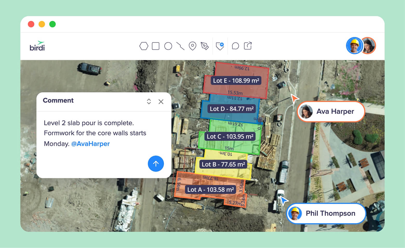
Best for: Teams that need the outdoor site, earthworks and the whole project in one map, with 360 photos alongside drone surveys, shared with people outside the project team.
Typical customer size / segment: Mid-sized construction, civil and mining teams of roughly 30 to 500 staff.
Key strengths:
- Drone maps, point clouds, 360 photos and DXF design overlays in one map.
- Timeline and split screen compare capture dates; difference grids measure change on Growth and Ultimate.
- Guests view and download without a paid seat.
Checks against BIM or schedule: No. Birdi records and compares the site; a person makes the comparison.
Access for people outside the paid team: Guests use no seat, and view-only map links need no login.
Data types in one view: Orthomosaics, elevation models, point clouds, 360 photos, video, PDFs and DXF overlays.
Processing: Cloud.
Watch-outs: Not for a GIS analyst who needs a full desktop GIS. It also does not suit anyone who wants existing aerial imagery of the site supplied.
Pricing: Growth is $287 USD a month, billed annually. Ultimate is priced by quote (checked October 7, 2026).
Birdi handles 360 photos, not walkthroughs: there is no walked route mapped to floor plans. So for interior fit-out, OpenSpace or a 360 tool below remains the better fit, and Birdi covers the site around it. See our comparison of Birdi and OpenSpace.
2. DroneDeploy
Best for: Teams that want drone, 360 and phone capture across the whole project from one vendor, with AI progress tracking.
Typical customer size / segment: Individual pilots through to large contractors on quoted team plans.
Key strengths:
- DroneDeploy Ground covers 360 walks, BIM and drawing overlays; it now includes StructionSite, which redirects to DroneDeploy.
- Progress AI reports percent complete by location from drone flights and 360 walks, without BIM or a schedule.
- Integrations with Procore and Autodesk.
Checks against BIM or schedule: BIM overlays on Ground; Progress AI works without either.
Access for people outside the paid team: View-only map links; Progress AI reports shared without a full seat.
Data types in one view: Orthomosaics, 3D models, 360 walks, panoramas and video.
Processing: Cloud.
Watch-outs: Team plans are by quote. Cost appears in 2 of 9 Capterra reviews, plus 1 on the cost of view-only users.
Pricing: Flight & Analysis is $4,188 USD billed annually for one pilot; team plans by quote (checked October 7, 2026).
3. Cupix
Best for: Teams that want 360 video turned into a 3D map and compared against BIM for deviations.
Typical customer size / segment: Building and infrastructure projects, including airports, according to Cupix.
Key strengths:
- Turns 360 video into a 3D map and point cloud.
- BIM comparison, verification and deviation analysis.
- A BIM timeline for 4D digital twins.
Checks against BIM or schedule: BIM, in 3D.
Access for people outside the paid team: Not published.
Data types in one view: 360 video, 3D maps, point clouds and BIM.
Processing: Cloud.
Watch-outs: Its value depends on a usable BIM model. Outdoor site surveys come from another tool.
Pricing: Contact for pricing.
4. Reconstruct
Best for: Teams that want captures overlaid on 2D and 3D designs and compared against the schedule.
Typical customer size / segment: Large projects such as airports, with an Oracle partnership for progress reporting.
Key strengths:
- Patented overlay of installed work against what was planned.
- Integrates the project schedule for 4D BIM visualization.
- On-demand progress reports.
Checks against BIM or schedule: Both.
Access for people outside the paid team: Not published.
Data types in one view: Site captures, 2D and 3D designs and schedules.
Processing: Cloud.
Watch-outs: It is built for schedule and design comparison, so it needs both in good shape to deliver.
Pricing: Contact for pricing.
5. FARO HoloBuilder (Sphere XG)
Best for: Teams that combine 360 photos with laser scans and 3D design data on floor plans.
Typical customer size / segment: AEC teams and facility owners, from design to handover and operations.
Key strengths:
- 360 photos, 3D point clouds and 3D design data organized by time and location on floor plans.
- Markup, instructions and comments in 360 and 3D.
- Carries into facility management after handover.
Checks against BIM or schedule: Design data in 3D; not schedule-linked progress.
Access for people outside the paid team: Access from any device; terms by quote.
Data types in one view: 360 photos, point clouds and 3D design data.
Processing: Cloud.
Watch-outs: Laser scanning adds hardware and skill. The outdoor site from the air comes from another tool.
Pricing: Contact for pricing.
6. Buildots
Best for: General contractors who want progress measured automatically against the BIM and schedule, with delay risk flagged.
Typical customer size / segment: Contractors and developers on building projects such as airports, healthcare and new homes.
Key strengths:
- Compares captures with the BIM and schedule to report percentage complete and pace.
- Captures from hard-hat 360 cameras, drones or laser scans, or a managed service.
- Connects workforce data to progress.
Checks against BIM or schedule: Both, automatically.
Access for people outside the paid team: Not published.
Data types in one view: 360 video, drone imagery, scans, BIM and schedules.
Processing: Cloud.
Watch-outs: It depends on a maintained BIM model and schedule. Its delay-reduction figures are its own.
Pricing: Contact for pricing.
When is OpenSpace still the better choice?
OpenSpace is still the better choice for interior documentation on building projects, where a crew walks floors with a 360 camera and the capture is mapped to the drawings. Its two-way sync with Procore and Autodesk is a strength several alternatives lack. If interiors are the job and capture holds up on your site, it is hard to beat.
The case for an alternative is strongest when the project is mostly outdoors, when 3D checks against BIM matter more than walkthroughs, or when you need progress measured against the schedule. Many projects run OpenSpace inside and a drone platform outside. For a broader checklist, see our guide to choosing progress tracking software.
Questions to ask before switching
- Is the project mostly interior, mostly exterior, or both?
- Do you need checks against BIM or the schedule, or a visual record?
- Which systems must it sync with, such as Procore or Autodesk?
- Who outside your team needs to see the captures, and do they need a seat?
- How reliable is capture on long walks, in your own trial?
Frequently asked questions
What is OpenSpace used for?
OpenSpace is used to document construction progress with 360 cameras. A worker walks the site with a camera, often on a hard hat, and the capture is mapped to the drawings. It adds AI progress tracking with human review, a drone product called OpenSpace Air, and two-way sync with Procore and Autodesk.
What is the best alternative to OpenSpace?
It depends on why you are looking. Teams that need the outdoor site and earthworks look at Birdi or DroneDeploy. Cupix and Reconstruct check 360 captures against BIM in 3D. Buildots measures progress automatically against the schedule. For interiors on a building project, OpenSpace itself often remains the right choice.
Is OpenSpace better than HoloBuilder?
They overlap on 360 progress capture. OpenSpace is known for fast walkthrough capture mapped to drawings and its Procore and Autodesk sync. FARO's HoloBuilder, now Sphere XG, combines 360 photos with laser scans and 3D design data and carries into facility management. Choose by whether you need scans and handover data.
Can drones replace 360 progress capture?
Not inside buildings. Drones capture and measure the outdoor site, earthworks and roofs, while 360 walks capture interiors along a route. Once the envelope closes, a drone sees little of the work inside. Most building projects use both: drones outside and early, 360 walks inside later.
How much does OpenSpace cost?
OpenSpace does not publish prices. According to its pricing page, read in September 2026, pricing is based on annual construction volume and the subscription tier, Core or Enterprise. Its Track progress tracking is an add-on. Ask for a quote based on your project volume.
About the author
This guide was written by the Birdi team. Birdi (birdi.io) is a geospatial AI workspace that construction, civil and mining teams use to share drone surveys, 360 photos and site data in one map. We counted the OpenSpace reviews ourselves in September 2026 and checked every product fact on the vendor's own website on October 7, 2026.
Related reading
- Birdi vs OpenSpace: the two platforms compared head to head.
- Drone progress reporting software: the wider set of progress tools.
- Drone, 360 and point clouds: platforms that show every data type in one place.
Sources
Reviews
- Apple App Store. OpenSpace capture app, 12 most recent reviews (2019 to August 2026) and rating (3.8 from 46), read September 24, 2026. Capterra (1 review) and G2 summary (4.5 from 14). Reddit and G2's full review pages were not read.
Vendor documentation (read October 7, 2026 unless stated)
- OpenSpace. "Pricing," "Air" and "OpenSpace vs DroneDeploy" (read September 24, 2026). https://www.openspace.ai/pricing
- Birdi Help Center. "How to use Birdi's timeline view," "How to use Birdi's split screen view," "How to create a difference grid in Birdi" and "How to update a user role and permissions." https://help.birdi.io/en/articles/12273497
- Birdi. "Pricing." https://www.birdi.io/pricing
- DroneDeploy. "Pricing" and "Progress AI." https://www.dronedeploy.com/product/progress-ai
- Cupix. https://www.cupix.com/
- Reconstruct. https://reconstructinc.com/
- FARO HoloBuilder (Sphere XG). https://www.holobuilder.com/
- Buildots. https://buildots.com/
