
TL;DR: Owners and developers monitor construction to check that the site is where the contractor's claim says it is, without visiting every week. The options are independent capture services, fixed cameras, drone maps, and access to the contractor's own records. The best setup gives the owner a dated, comparable view that does not depend only on the contractor's report.
Key takeaways
- Owners fund a large market. According to the US Census Bureau, construction put in place in the US was worth $2,164.4 billion in 2025.
- The infrastructure backlog is growing. According to the American Society of Civil Engineers, the US infrastructure investment gap is $3.7 trillion.
- Independent capture is available as a service. According to OnsiteIQ, its capture specialists visit active sites weekly across the US and Canada.
- Owners need access, not licenses. According to the help center of Birdi (birdi.io), guests view and download maps without using a paid seat.
- The contract decides what owners get. Capture frequency, format and access are easiest to secure when written into the contract.
What do owners need from construction monitoring?
Owners need an independent, dated and comparable view of progress: what was built by each date, how it compares with the program and the payment claim, and early signs of delay or quality problems. They need it without visiting site every week, and without relying only on the contractor's own report, which describes the work from the contractor's side.
The owner's questions differ from the contractor's. A contractor asks how to build the next stage. An owner asks whether the claim is fair, whether the schedule is slipping, and whether the asset they will own matches what they paid for. Monitoring tools for owners are built around those questions, and around reporting to lenders, investors and boards.
Who on the owner's side reads it
The owner's representative or project manager reviews progress and claims. Development managers report to investors and lenders. Asset managers look ahead to operations. Most of them never open construction software, so the record must be easy to view and easy to share. For a contractor-side view of the same records, see our guide to drone progress reports.
How did we choose and compare the tools?
We chose tools that owners and developers use to monitor construction, and compared them on who captures, inside or outside coverage, how often, data types in one view, access for the owner's team, and pricing. Birdi is listed first, and the order is not a ranking. Facts were checked on October 8, 2026.
The tools take different approaches: some are services that capture for you, some are cameras you install, and some are platforms where you or your contractor capture. We say plainly who does the capture in each case, since that decides how independent the record is.
The best construction monitoring software for owners in 2026
The construction monitoring tools compared here for owners and developers are Birdi, OnsiteIQ, Multivista, TrueLook, OpenSpace and DroneDeploy. They range from shared drone maps to independent capture services and fixed cameras. Each entry carries the same fields, so an owner can see who captures and how they get access, checked on October 8, 2026.
1. Birdi
Best for: Owners and developers who want dated drone maps of the whole site, captured by their own pilot or the contractor, that they can open and compare without a license.
Typical customer size / segment: Mid-sized developers, owners and contractors, in teams of roughly 30 to 500 staff.
Key strengths:
- Guests view and download maps without a paid seat, and view-only links need no login.
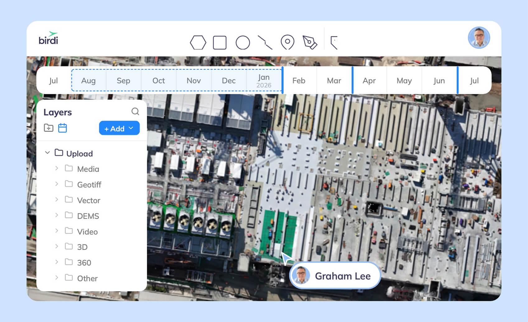
- Timeline and split screen compare the site across capture dates.
- Workspaces can be branded as Birdi's, the client's or co-branded.
Who captures: Your own pilot, the contractor, or a hired pilot. In Australia, Birdi's capture network is available to Ultimate customers, paid per capture.
Inside or outside: Outside from the air, plus 360 photos placed on the map.
Access for the owner's team: Guests use no seat.
Data types in one view: Orthomosaics, elevation models, point clouds, 360 photos, PDFs and DXF overlays.
Watch-outs: Not for anyone who wants existing aerial imagery supplied. It also does not suit a GIS analyst who needs a full desktop GIS.
Pricing: Growth is $287 USD a month, billed annually. Ultimate is priced by quote (checked October 8, 2026).
Birdi records and compares the site; a person makes the comparison, and it does not produce progress reports automatically. For owners who want AI progress tracking against the schedule, the services below are the stronger fit.
2. OnsiteIQ
Best for: Owners, developers and investors who want independent weekly capture and AI progress tracking across a portfolio.
Typical customer size / segment: Real estate owners, developers and investors in the US and Canada.
Key strengths:
- Capture specialists visit active sites weekly to document progress with 360 imaging.
- Computer vision maps captures to floor plans and tracks up to 24 trades across 8 asset classes.
- Early indicators of delay and portfolio analytics.
Who captures: OnsiteIQ's capture specialist network.
Inside or outside: Mainly inside, with 360 imaging.
Access for the owner's team: Built for owners and developers.
Data types in one view: 360 imagery, floor plans and progress analytics.
Watch-outs: Coverage is the US and Canada. Outdoor site works from the air come from another tool.
Pricing: Contact for pricing.
3. Multivista
Best for: Owners who want a documentation service to capture the site at defined stages, such as before walls close.
Typical customer size / segment: Commercial, infrastructure and campus projects.
Key strengths:
- Reality capture services across every stage of construction.
- Visual documentation linked to project plans.
- Done by Multivista's team, independent of the contractor.
Who captures: Multivista.
Inside or outside: Both, depending on the services bought.
Access for the owner's team: Through Multivista's platform.
Data types in one view: Photos, 360 photos and video linked to plans.
Watch-outs: Coverage follows the scope you buy, so ongoing site-wide records between visits come from another tool.
Pricing: Contact for pricing.
4. TrueLook
Best for: Owners who want a continuous view of the site, time-lapse films for stakeholders, and security.
Typical customer size / segment: Owners, developers and contractors on longer projects.
Key strengths:
- Construction cameras with 360-degree views, zoom and robotic movement.
- Custom time-lapse and photo documentation.
- Updates shared easily with stakeholders.
Who captures: Fixed cameras, once installed.
Inside or outside: Outside, from fixed positions.
Access for the owner's team: Web viewing for stakeholders.
Data types in one view: Live video, images and time-lapse.
Watch-outs: It sees only where the cameras point and measures nothing.
Pricing: Contact for pricing.
5. OpenSpace
Best for: Owners who want access to 360 interior records, whether captured by the contractor or their own team.
Typical customer size / segment: General contractors and owners on building projects of all sizes.
Key strengths:
- 360 walks mapped to drawings.
- AI progress tracking with human review.
- Pricing based on construction volume rather than users.
Who captures: The contractor or owner's team, walking the site.
Inside or outside: Mainly inside; OpenSpace Air adds drone maps.
Access for the owner's team: Not priced per user.
Data types in one view: 360 captures, drawings and drone maps.
Watch-outs: In 6 of the 12 most recent App Store reviews we read, users reported recording or upload problems.
Pricing: Contact for pricing.
6. DroneDeploy
Best for: Owners and developers running their own drone and 360 programs across a portfolio, with AI progress reports.
Typical customer size / segment: Individual pilots through to large owners and contractors.
Key strengths:
- Progress AI with work-in-place status across all active projects.
- Reports shared by link or export without a full platform seat.
- Drone, 360 and phone capture in one platform.
Who captures: Your team, the contractor, or docked drones.
Inside or outside: Both.
Access for the owner's team: Reports shared without a full seat; tools need a paid account.
Data types in one view: Orthomosaics, 3D models, 360 walks and video.
Watch-outs: Team plans are by quote.
Pricing: Contact for pricing for team plans (checked October 8, 2026).
Contractor-supplied records or your own?
Contractor-supplied records are cheaper and often good, but they are made by the party whose claim you are checking. Your own records, from an independent service, your own pilot or cameras you control, give an independent view. Many owners use both: the contractor's records for detail, and their own for verification at key milestones.
What to put in the contract
- Capture frequency: for example, weekly drone surveys and 360 walks before each slab is closed.
- Format and access: the owner gets view access to the platform, not just exported PDFs.
- Ground control: consistent control so captures can be compared.
- Handover: the full record transfers to the owner at completion.
- Retention: how long records are kept for defects and disputes.
For more on what a monthly update should include, see our guide to choosing progress tracking software.
Frequently asked questions
How can owners monitor construction progress remotely?
Owners can use independent capture services that visit weekly, fixed cameras with live and time-lapse views, drone maps they can open and compare by date, and view access to the contractor's own records. The best setups combine an independent view with the contractor's detail, and are written into the contract.
Should owners commission their own drone surveys?
Often, at least at key milestones. A drone survey commissioned by the owner gives an independent, site-wide record to check claims against. On larger projects, owners may fly regularly or require the contractor to share drone maps with view access, under consistent ground control.
What should a monthly progress report include?
A monthly progress report should include dated imagery of the whole site, a comparison with the previous month, progress against the program, quantities that affect payment, issues and risks, and photos of anything about to be covered up. Owners should be able to open the underlying records, not just the summary.
How do developers verify a progress claim?
Developers compare the claim against independent evidence: dated site imagery, quantities measured from surveys, and inspections of key elements. A record captured at regular intervals, by the owner or a service, makes it easy to see whether claimed work was in place on the claimed date.
Can owners access the contractor's site data?
Usually, if the contract requires it. Many platforms let contractors share view access with owners, and some do so without a paid seat. Write the access, format and handover of the records into the contract, so the owner keeps the record after the project ends.
About the author
This guide was written by the Birdi team. Birdi (birdi.io) is a geospatial AI workspace that construction, civil and mining teams use to share drone surveys, 360 photos and site data in one map. We checked every product fact against each vendor's own website or help center on October 8, 2026.
Related reading
- Drone progress reporting software: the wider set of progress tools.
- Drones in progress reporting: how drones change construction reporting.
- Birdi for construction: how construction teams use one shared map.
Sources
Independent
- U.S. Census Bureau. "Monthly Construction Spending, December 2025." https://www.census.gov/construction/c30/pdf/pr202512.pdf
- American Society of Civil Engineers. "2025 Report Card emphasizes need for sustained investment." April 10, 2025. https://www.asce.org/publications-and-news/civil-engineering-source/article/2025/04/10/2025-report-card-emphasizes-need-for-sustained-investment
Vendor documentation (read October 8, 2026 unless stated)
- Birdi Help Center. "How to update a user role and permissions," "How do I share a map with a user?" and "How to create, customize and manage your workspaces." https://help.birdi.io/en/articles/11091551
- Birdi Help Center. "How to use Birdi's timeline view" and "How to use Birdi's split screen view." https://help.birdi.io/en/articles/12273497
- Birdi. "Pricing." https://www.birdi.io/pricing
- OnsiteIQ. https://www.onsiteiq.io/
- Multivista. https://www.multivista.com/
- TrueLook. https://www.truelook.com/
- OpenSpace. "Pricing" (read September 24, 2026) and App Store reviews, as counted in our profile. https://www.openspace.ai/
- DroneDeploy. "Progress AI" and "Pricing." https://www.dronedeploy.com/product/progress-ai
