
5 ways geospatial data supports safer construction projects

Safety is one of the biggest challenges on construction sites. From managing fast-moving schedules to monitoring constantly changing environments, risks can arise quickly if teams don’t have accurate, up-to-date information. Geospatial data is helping address this problem by giving construction teams the ability to see, measure, and track sites in ways that keep people safer and decisions clearer.
So how exactly does it make a difference? Let’s look at five key ways geospatial data is reshaping site safety.
1. Monitoring terrain changes
Construction sites rarely stay the same for long. Excavation, grading, and weather events can alter the terrain in ways that increase risks for workers and equipment. With geospatial data, teams can capture regular site surveys and compare them over time. This makes it easier to spot shifts in ground levels, slopes, or unstable areas before they lead to accidents.
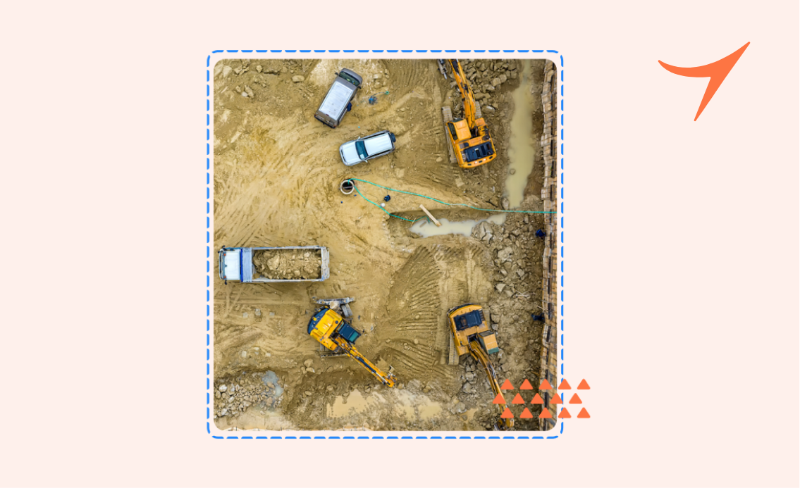
2. Improving visibility of hazards
High-resolution drone imagery and 3D models provide a bird’s-eye view of the entire site. Instead of relying only on ground-level inspections, managers can zoom in on specific areas and identify potential hazards that might not be obvious otherwise—such as uneven surfaces, water pooling, or restricted access zones. This extra visibility helps teams plan safer routes and work areas.
3. Supporting equipment and vehicle safety
Large construction projects often involve fleets of heavy machinery moving across the site. Geospatial data allows for the creation of accurate maps that highlight haul roads, loading zones, and restricted areas. By keeping this information updated and shared with all stakeholders, the chances of collisions or unsafe vehicle interactions are reduced.
4. Tracking compliance with safety requirements
Many construction projects are governed by strict environmental and safety regulations. Geospatial data makes compliance easier to monitor by providing measurable outputs—such as distance from exclusion zones, slope gradients, or material stockpile heights. These measurements can be used to verify that the site is operating within safe limits, reducing the risk of regulatory breaches and accidents.
5. Enabling better communication across teams
Safety depends on more than just accurate data; it relies on how that data is shared. When geospatial outputs are hosted on collaborative platforms like Birdi, project managers, engineers, and contractors all work from the same information. Features like annotations or map comments mean that hazards can be flagged directly on the site map, keeping discussions in context and ensuring action is taken quickly.
Building safety into every stage
Geospatial data isn’t just a technical add-on to construction projects, it’s becoming part of how teams build safer sites from day one. From spotting risks early to improving compliance and communication, the ability to visualize and measure the site environment brings an extra layer of security to every stage of construction.