
Introducing the Split Screen view in Birdi

Seeing side by side is often the best way to spot differences. Whether you're comparing datasets, validating edits, or reviewing changes, the new Split Screen view in Birdi Map 2.0 lets you view two maps simultaneously, for clearer, faster insights. (This feature is available on Birdi's Ultimate plan only).
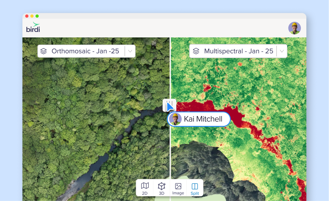
What is Split Screen view?
Split Screen view lets you compare two map layers (e.g. rasters, GeoTIFFs, DEMs) side by side, synced across zoom and pan. You can drag the dividing handle to shift the ratio, so you can see more of one map or the other as needed.
It’s designed for seamless, direct comparison — no need to flip between layers or toggle back and forth.
.png)
How it works: using Split Screen view
- In your Birdi map, open the Layers tab and enable Split Screen mode.
- Choose the two datasets you want to compare (they’ll appear in left/right panels).
- Use the draggable divider handle to adjust how much of each map you see.
- Zoom, pan, and navigate — both maps stay aligned.
- To exit, turn off Split Screen mode (returning to the standard single-map view).
You can compare any combination of GeoTIFFs, rasters, or DEMs — provided both are spatially aligned.
Why it matters: Use cases & benefits
Spot changes with confidence
Quickly compare older vs. newer data to detect shifts in terrain, vegetation, infrastructure, or anomalies.
Validate edits or processing steps
After you apply a filter, transformation, or correction, you can immediately see the difference side by side.
Enable team reviews and collaboration
Share views with teammates so everyone sees exactly what changed — no ambiguity.
Simplify QA workflows
Instead of toggling layers on and off, you can keep both visible simultaneously and focus on differences.
Things to keep in mind
- Split Screen requires both maps to be spatially aligned (same coordinate system / extents).
- The divider handle is draggable, letting you adjust view proportions dynamically.
- Split Screen works across Birdi’s 2D map view (and in line with the layered map interface).
- If one of your maps lacks data for certain areas, you’ll see blank or transparent zones accordingly.
- The feature is available to users in the map workspace version with support for Split Screen.
Bringing comparison into focus
Maps often tell a deeper story when you can view two at once. With the new Split Screen view in Birdi, you can side-by-side compare, validate, and investigate changes, all within the same interface. No more back-and-forth toggles, no guesswork, just clarity.
👉 Learn more in the Knowledge Base